Kurinjimala Sanctuary trek

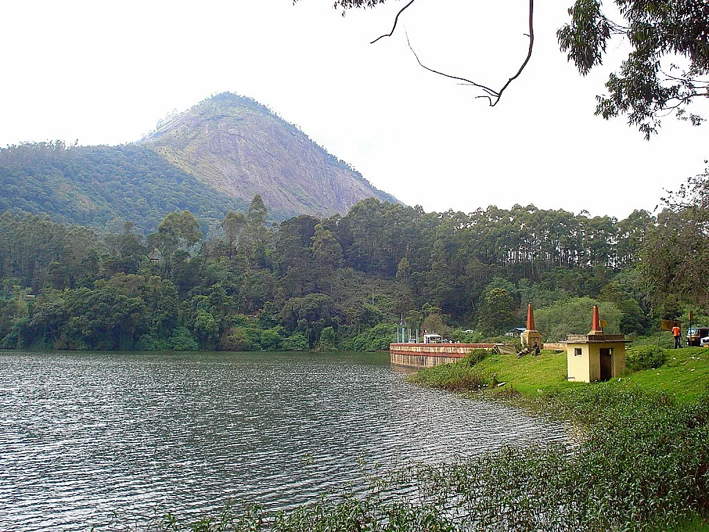
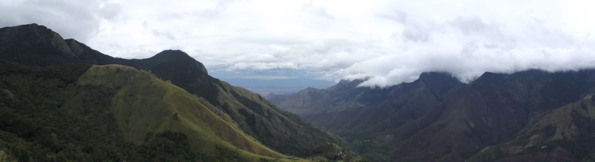
Kurinjimala is the 32 km² sanctuary above Kottakamboor and Vattavada, notified on 6 October 2006 to protect one plant — Strobilanthes kunthiana, the neelakurinji — and routinely described as the only sanctuary of its kind in south India, created for a single flowering species. It is 45.8 km and about an hour and twenty-five minutes from Munnar by road, up past Mattupetty, Kundala and Top Station.

Kurinjimala Sanctuary trek, Munnar
Practical guide

Plan Kurinjimala Sanctuary trek

Who's going?Tailor Kurinjimala Sanctuary trek to your trip
Typetrek
AreaMunnar
DistrictIdukki
Best timeSeptember–October for the flower
Time neededA full day from Munnar
Places to visit27Listed businesses125

The thing to understand before you drive out is that this is not a park with a gate. There is no ticket window, no visitor centre and no trekking counter anywhere on the boundary. The Forest Department publishes two walks and two stays for Kurinjimala in its own brochure and nothing about any of them on any booking system, so the practical first step is a telephone call to the Wildlife Warden's office in Munnar on 04865 231587 rather than a drive. Two farming villages live inside the boundary, the land either side of the track is somebody's, and the road above Koviloor is graded earth.

The story

A sanctuary notified for one plant, in the year that plant is flowering across the high range — and it is on none of the lists of places the Forest Department has opened to see it. What Kurinjimala does have is a brochure of its own, two walks and two stays in it, two office numbers, and no booking system; two farming villages living inside its boundary and sending their vegetables out to Tamil Nadu on pack ponies; a boundary the state is still surveying with drones twenty years after it was drawn; and a size that the most-copied source in English gets wrong by a factor of a hundred.

The story of Kurinjimala Sanctuary trek

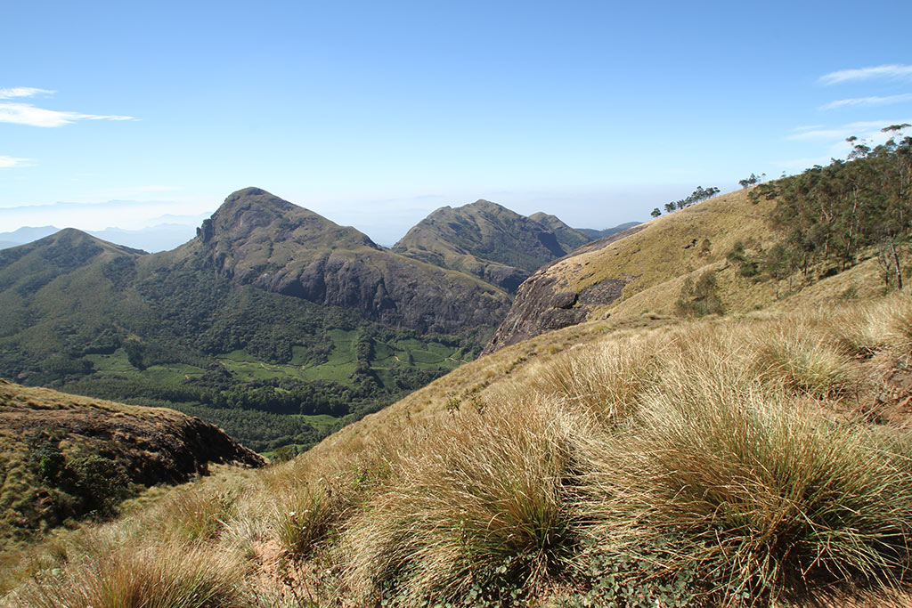
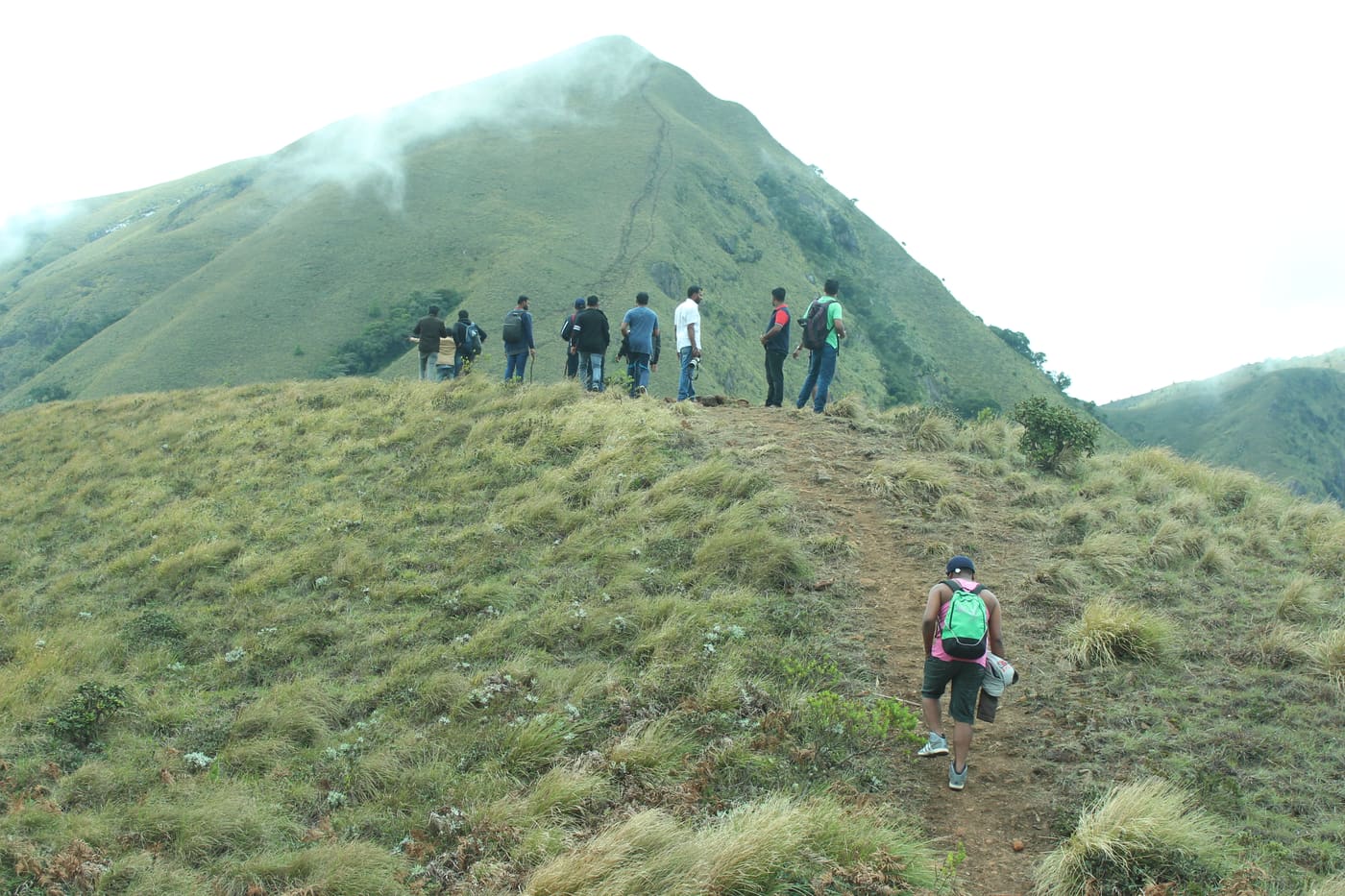
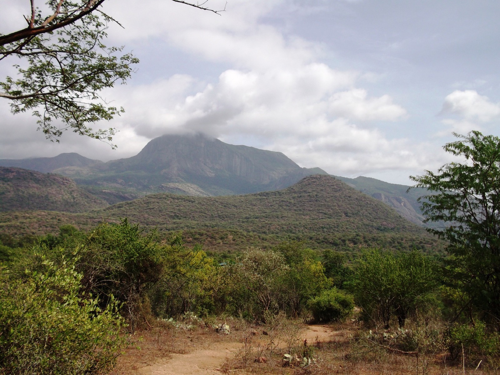
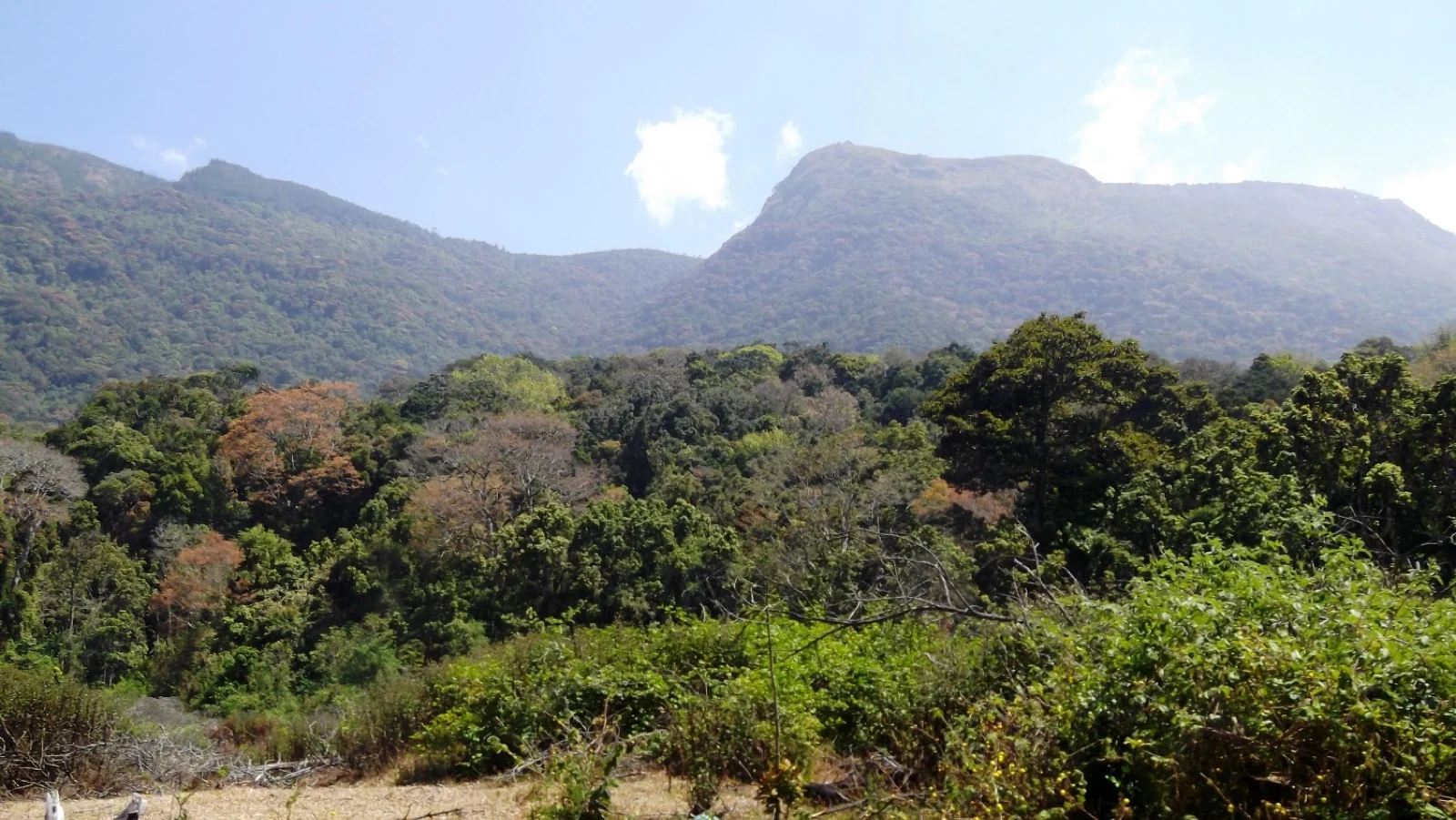
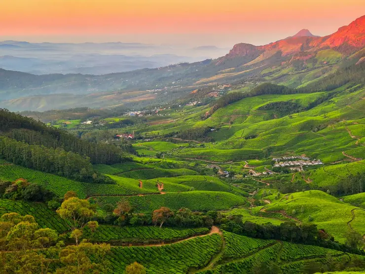
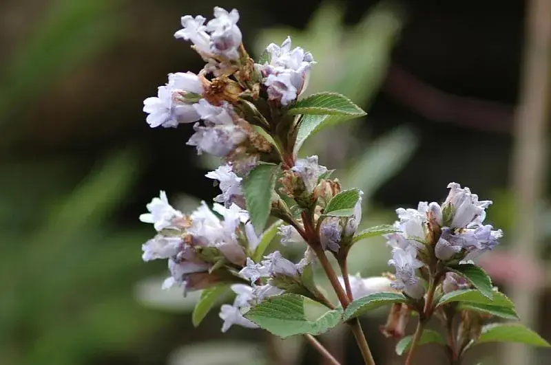
Kurinjimala Sanctuary is the piece of the Western Ghats that Kerala protected for a flower. The government notified it on 6 October 2006, and the forest minister of the day, Benoy Viswam, announced it the following day from the stage of the Neelakurinji Fest at Munnar. It covers about 32 square kilometres of the high ground above Kottakamboor and Vattavada villages, in Devikulam taluk of Idukki district, and it is routinely described as the only sanctuary of its kind in south India, brought into existence for a single flowering plant. The 2006 bloom that produced it drew something close to a million people to Munnar, which is the pressure the notification was a response to. That plant is Strobilanthes kunthiana, the neelakurinji, which flowers gregariously once in about twelve years and then dies back to seed.

That is the ordinary encyclopedia paragraph, and everything interesting about this place is in what it leaves out. Kurinjimala is not a park you drive into. There is no ticket window, no visitor centre, no gate with a barrier and a register. The Forest Department's own published brochure for the sanctuary — a two-page PDF that still sits on forest.kerala.gov.in and was last replaced there in March 2025 — lists exactly four eco-tourism facilities: a nature trail to the Kurinji land, a trek to cliffy rocks, a stay at Kadavari, and a stay at Narco point. It gives two numbers to ring about them: the Forest Information Centre at the Wildlife Warden's Office in Munnar, on 04865 231587, and the Office of the Assistant Wildlife Warden of the Shola National Parks Range at Top Station, Yellappetty. It does not give a price, a season, a duration, a meeting point or a booking link for any of the four, and none of them appears on the department's own reservation site at booking.munnarwildlife.com, which sells log houses at Pampadum Shola and Anamudi Shola and nothing at all here.

So the answer to the question this page exists to answer — is there a trek at Kurinjimala? — is yes, on the department's own document, and no, on every system a visitor can actually use. That is not a hedge. It is the honest shape of the place, and it is why the practical advice on this page is a telephone number rather than a departure time. If you want to walk in Kurinjimala, the walk you are asking about is the one in that brochure, and the people who can tell you whether it is running this month are the Munnar Wildlife Warden's office and the range office at Top Station.

The timing makes that gap strange, because 2026 is a kurinji year in these hills. Through August the Malayalam press has carried the bloom moving across the high range — Nallathanni, Munnar town, Mattupetty, the Devikulam Gap Road, Chokramudi — and the department has responded by opening ticketed viewing. A Kurinji Garden on the Chokramudi slopes opened on 24 August 2026, ₹200 for adults and a lower rate for under-18s, 07:00 to 16:00, with the entrance beside the Devikulam range office on the Kochi–Dhanushkodi highway. Meesapulimala is being prepared by the Kerala Forest Development Corporation at ₹1,200 a head with a cap of 750 visitors a day, to open once the bloom is general. Idalimet, Sevenmala and Kundumala appear on the same lists. Kurinjimala does not. As of 25 August 2026 we could find no announcement, in English or in Malayalam, that the sanctuary named for the plant has been opened for the season in which the plant is flowering.

There is a second twist, and the Malayalam press got to it first. On 30 July 2026 Manorama published a piece with a blunt headline — do not set off for Munnar yet; what you are seeing in the reels is not neelakurinji, it is what people here call mettukurinji. The violet carpets going round Instagram, the argument runs, are a different plant in the same broad group. Roughly forty species are called kurinji; Strobilanthes kunthiana is the one that matters, the one with the twelve-year clock and the one this sanctuary was drawn for, and Kerala Tourism's own line is that its full flowering falls in September and October. It is a small correction with a large consequence for anyone planning a trip: a violet hillside in a photograph is not evidence that the twelve-year bloom has started. The plant that carries the name mettukurinji in the botanical literature is Strobilanthes sessilis, also called topli karvy — same family, purple to lavender flowers, a seven-year cycle rather than twelve, and, as Down To Earth put it in 2024, identical to neelakurinji to the naked eye. One caution on that identification, which we would rather flag than smooth over: the published range for S. sessilis is the northern Western Ghats above about 800 m, not the Munnar high range, so "mettukurinji" as used in Idukki may be a local name attached to a different Strobilanthes. What is not in doubt is the point the report was making — that a violet slope near Munnar in July is not the twelve-year event.

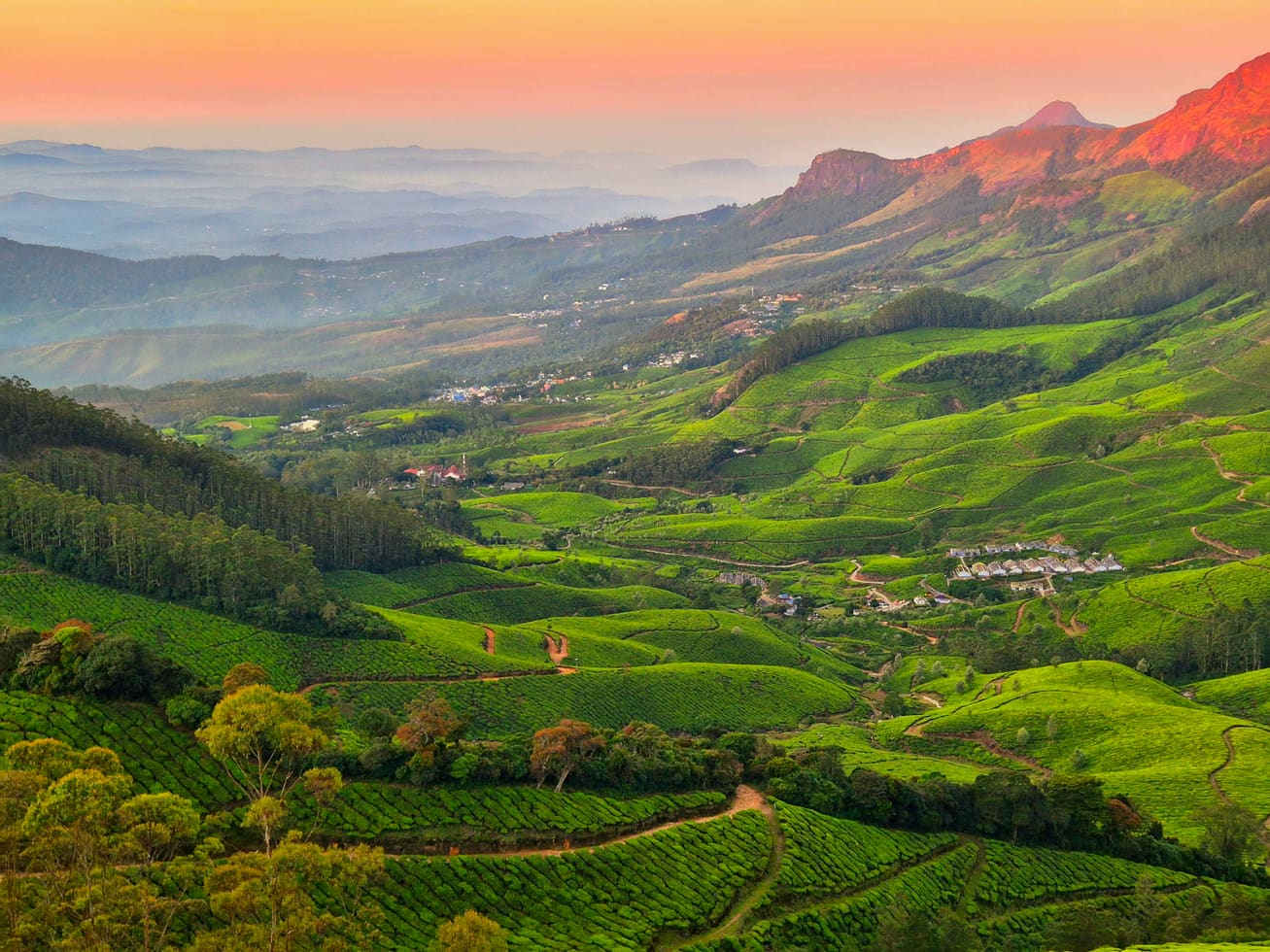
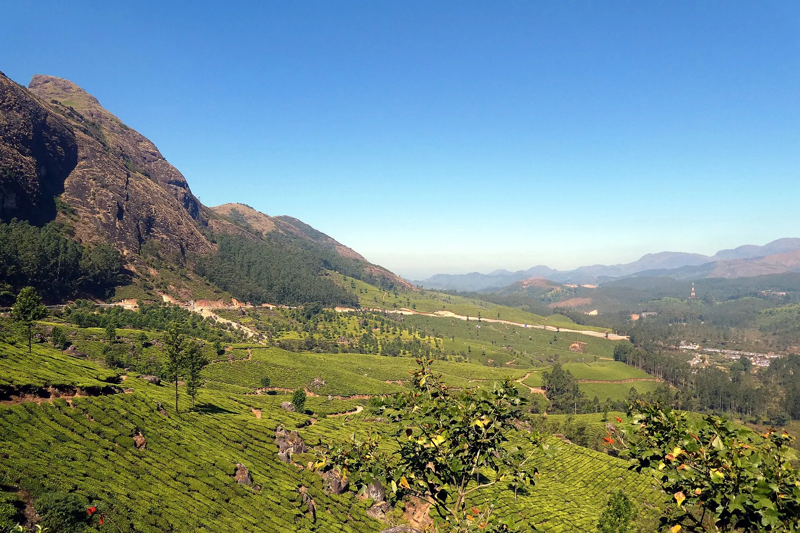
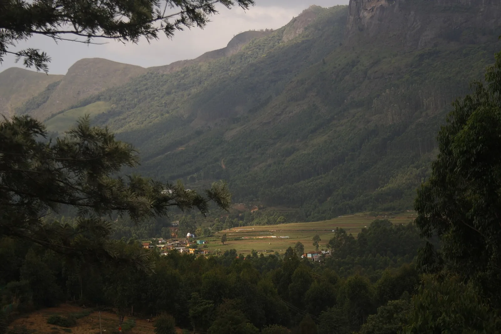
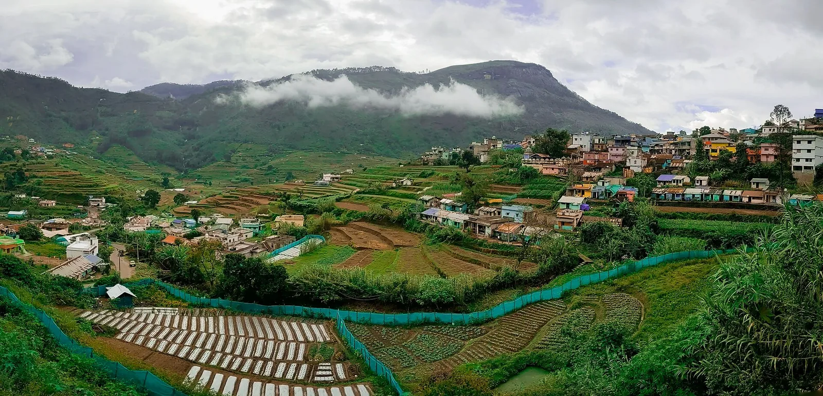
The people who live with all of this are two villages of vegetable farmers. Kottakamboor and Vattavada sit at around two thousand metres, which gives Kerala the only temperate growing season it has, and the fields here carry beans, potato, carrot, beetroot, cabbage, garlic and radish rather than anything you would recognise as a Kerala crop. Kadavari, the settlement the department's brochure names as one of its two stays, is inside the sanctuary — three and a half kilometres beyond Kottakamboor by a mapped path, seven and a half from Koviloor, and about five kilometres from Kilavarai on the Tamil Nadu side. Its produce goes east rather than west. Farmers load it onto pack animals and walk it over to the Tamil Nadu market, and there is a photograph of exactly that on Wikimedia Commons: two loaded ponies and a man in a lungi on a forest track, uploaded by a contributor from the valley. The English record calls them horses and the Malayalam caption calls them mules. Either way it is a freight system, not a picture postcard, and it is the single clearest illustration of what a protected area drawn around inhabited farmland actually means.

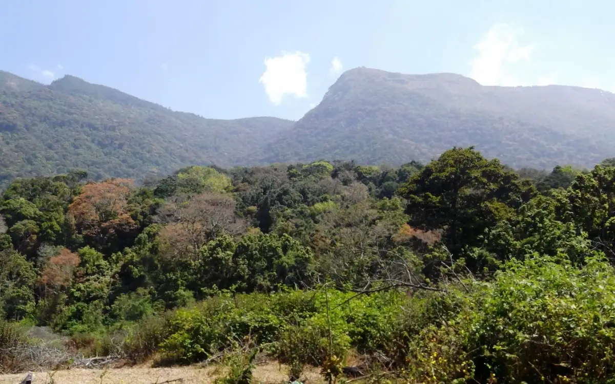
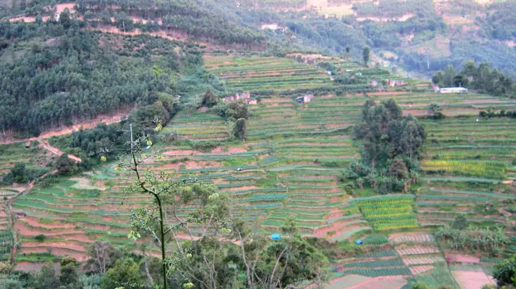
That tension is the sanctuary's real history. Private land with legal title was excluded from the notified area from the beginning — the department's brochure says so in as many words — but the boundary between the titled and the protected has never been settled on the ground. The state cabinet has since appointed a settlement officer of IAS rank to hear claims and fix the line, ordered the ground surveyed by drone to separate titled land from forest, and instructed the Idukki collector to draw up a plan to clear the acacia and eucalyptus plantations across Vattavada, Kottakamboor, Kanthalloor, Marayur and Keezhanthur. If you want to understand why a photograph filed on Commons as "Kurunjhimala Sanctuary" shows a hillside of planted eucalyptus over a cut-over slope, that is the reason. Much of this ground is not shola and grassland at all; it is somebody's plantation, or was.

The brochure is also candid about something almost nothing else in print mentions. The sanctuary, it says, covers Kambakkallu and Kadavari, "formerly infamous for the cultivation of Ganja and narcotic trafficking", and records that after the area was handed to the department and raided repeatedly the illicit activity was curbed. One of the four eco-tourism facilities the same page advertises is a stay at Narco point. It is not every wildlife sanctuary that offers you a night at the old drug post. The other piece of that geography is the road: the old Kodaikanal–Munnar road runs straight through this country, and the section east of Kadavari carries a plain instruction on OpenStreetMap — access no, this road is closed for public. Locally it is the Escape Road. You can drive to Kadavari. You cannot drive on to Kodaikanal.

One last thing to fix before you read anything else about this place. English Wikipedia says Kurinjimala protects "approximately 32 hectares" of core habitat, and dozens of travel sites have copied it. The Kerala Forest Department's own brochure says 32 square kilometres, twice, and every Malayalam source says 32 ചതുരശ്ര കി.മി. Thirty-two hectares is a third of a square kilometre. The real figure is a hundred times larger, and the mistake is a useful thermometer: on this sanctuary, the aggregator text that fills the first page of search results is not merely thin, it is wrong on the first number it prints.

Legend & myth

Kurinji is one of the oldest landscape words in south India, and it belongs to poetry before it belongs to botany. Classical Tamil poetics divides the country into five tinai, five landscapes each with its own mood, season, deity and flowers, and kurinji is the mountain one — the land of hill slopes and secret meetings, whose god is Murugan and whose emblem is the blue flower that gives the region its name. A sanctuary called Kurinjimala is therefore not named for a shrub in the way a place is named for a tree. It carries a two-thousand-year-old idea of what mountains are for.

The best-known piece of kurinji lore is that the hill communities counted age in flowerings. Because the plant blooms once in about twelve years, a person who had seen four blooms was about fifty; the practice is attributed most often to the Muthuvan and Paliyan communities of these ranges, and it is repeated widely enough that it is worth saying plainly that it is reported tradition rather than a documented census method. It is also, as arithmetic, entirely sound — which is more than can be said for most folklore about calendars.

The flower has a temple of its own, though not on this side of the state line. At Kodaikanal, sixty road kilometres east of Kadavari as the old closed road used to run, the Kurinjiyandavar temple is dedicated to Murugan in his aspect as lord of the kurinji hills, and it is where the plant's association with the god is most visibly kept. English Wikipedia adds a further claim about this ground — that silambam, the Tamil stick-fighting art, took its name from these hills, silam for hill and the bamboo the staves were cut from. We have not been able to trace that to a source we would print as fact, and it is set down here as the claim it is.

Read the full history of Kurinjimala Sanctuary trek 883 more words

History

The campaign that produced this sanctuary was about the 2006 bloom. Neelakurinji flowered across the Munnar hills that year, the flowering drew national attention to how much of its habitat had been converted to plantation and vegetable land, and the state moved during the season itself: the notification is dated 6 October 2006 and the announcement was made from the Neelakurinji Fest at Munnar on 7 October by the forest minister Benoy Viswam. The stated purpose in the notification is the long-term protection of the biodiversity of the area, and of Strobilanthes kunthiana and its habitat in particular.

What was notified was not empty ground. Kottakamboor and Vattavada are old settlements with titled holdings, and the sanctuary was drawn across a landscape where cultivation, plantation and shola grassland interleave at the scale of a single hillside. Private land with legal title was excluded on paper from the start. Fixing where that exclusion actually runs has taken the better part of two decades and is not finished: the cabinet has appointed an IAS settlement officer to consider claims and settle boundaries, ordered a drone survey to demarcate titled land from forest, and directed that markers be set once the survey is in.

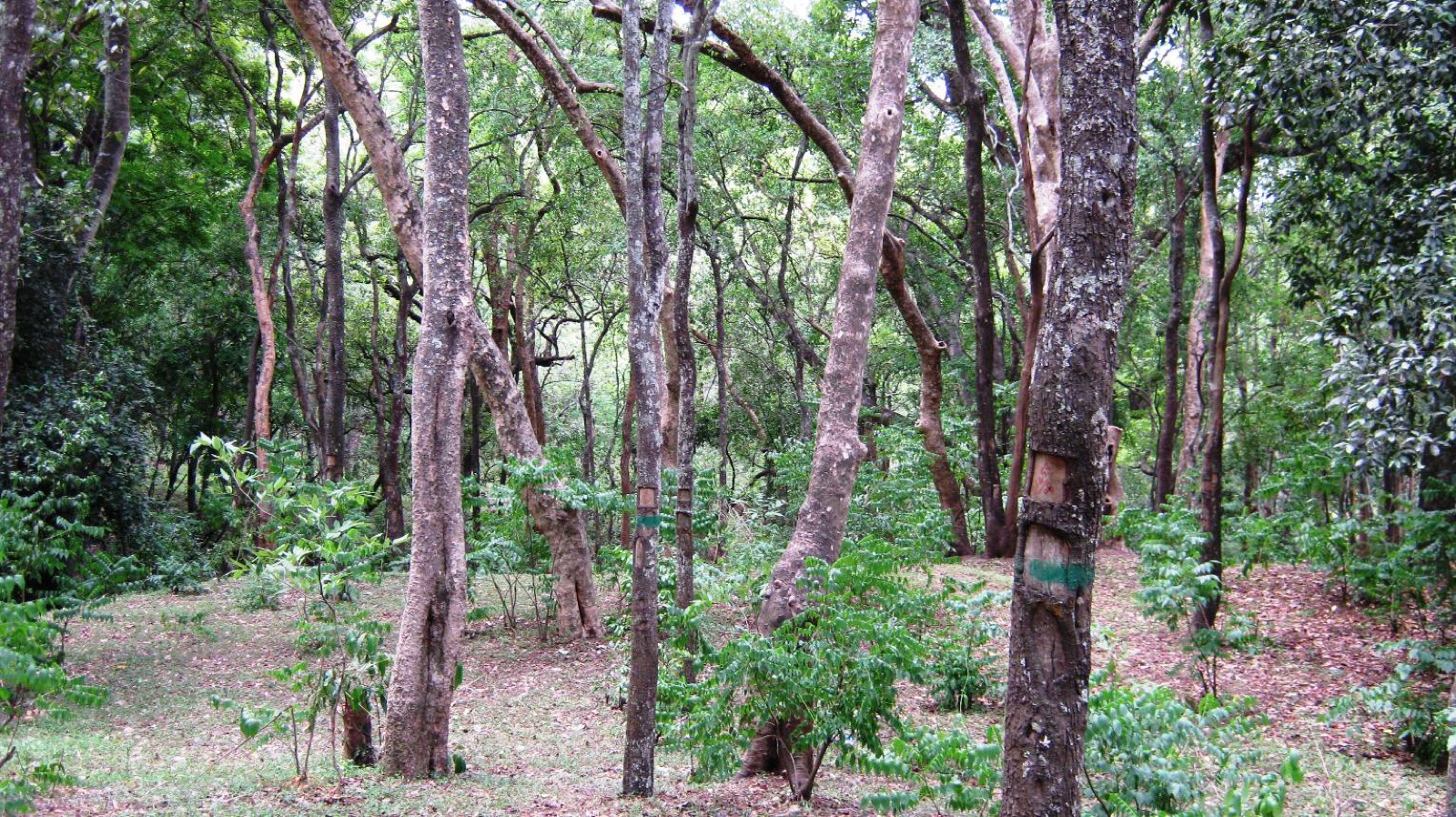
Alongside the boundary work runs a plantation problem. Acacia and eucalyptus were planted across this high country in the twentieth century, and they are the opposite of what a kurinji sanctuary needs: they shade out the shola-grassland mosaic the plant depends on and they drink. The Idukki collector was asked to prepare a plan to clear them from Vattavada, Kottakambur, Kanthalloor, Marayur and Keezhanthur. Photographs from inside the sanctuary show how far that has to go — the ground around the department's own entrance board is planted eucalyptus.

There is a law-and-order chapter too, and the department writes it into its own brochure rather than leaving it to journalism. Kambakkallu and Kadavari, both inside the sanctuary, were, in the brochure's phrase, formerly infamous for the cultivation of ganja and for narcotic trafficking. Handing the area to the Forest Department and running frequent raids is credited with curbing it. The department's own naming has kept the memory: one of the four facilities it lists for visitors is a stay at Narco point.

The bloom arithmetic is where the published record gets confusing, and it is worth setting out because two Roampedia pages touch it. The standard line is that neelakurinji flowered in 2006 and again in 2018, which puts the next event in 2030. Yet the Idukki hills are blue in 2026 and the Forest Department has opened ticketed viewing for it. Both things are true, because the plant does not run on one clock. Different populations flower on different cohorts, so a hillside here and a hillside forty kilometres away can be twelve years out of step with each other. What that means practically is that "the twelve-year bloom" is a statement about a plant, not a statement about a date on which the whole range turns blue.

The most recent chapter is the one being written now. Through July and August 2026 the bloom has moved across the high range and the state has responded by opening and pricing access at specific, controllable points: the Kurinji Garden at Chokramudi from 24 August, Meesapulimala under the Forest Development Corporation with a daily cap, and viewing along the Devikulam road. In parallel the Devikulam and Munnar panchayats agreed in May to keep large tourist buses out of Mattupetty, Kundala, Top Station, Rajamala and Vattavada and to regulate other private vehicles by e-pass, with fines for heavy vehicles running to Marayoor and Vattavada. That scheme was meant to start in the first week of August; as of 22 August 2026 Onmanorama reported it was still not in force, because the administration had not fixed standard fares for the local jeeps and autorickshaws that were supposed to replace the buses. Anyone driving to Kottakamboor this season should assume it can change with little notice.

Why visit

The only protected area in the country created for a single flowering plant — and one of the very few you can stand at the edge of, read the board, and understand the whole argument about Indian conservation in one glance.

Two working villages inside a wildlife sanctuary, farming potato and carrot at two thousand metres and moving the harvest out to Tamil Nadu on pack ponies, which is a piece of living Kerala that exists nowhere else.

Kadavari: a settlement inside the boundary, three and a half kilometres beyond the last public road-head, five from the state line, and named by the Forest Department's own brochure as a place it can put you up.

The old Kodaikanal–Munnar road, the Escape Road, which comes through this country and stops — mapped as closed to the public east of Kadavari, and one of the most evocative dead ends in the Western Ghats.

A landscape at the exact altitude band the neelakurinji occupies, in a year when the high range is flowering, with none of the crowd management that has arrived at Chokramudi and Meesapulimala.

The honest version of a much-copied place: a sanctuary whose published size is wrong by a factor of a hundred in the source most people read, and whose trekking programme exists in a government brochure and nowhere else.

What to expect

Highlights

  • A wildlife sanctuary created for a single flower — 32 km² notified in 2006 for Strobilanthes kunthiana, which flowers gregariously once in about twelve years.
  • Kadavari, a farming settlement inside the boundary 3.5 km beyond the last public road-head, and one of the two stays the Forest Department lists for this sanctuary.
  • Pack ponies carrying the harvest out to Tamil Nadu — beans, potato, carrot and cabbage grown at 2,000 m and sold across the state line rather than down the ghat.
  • The old Kodaikanal–Munnar road, the Escape Road, which runs through this country and is mapped closed to the public east of Kadavari.
  • The corridor value nobody photographs: Kurinjimala physically links Chinnar, Anamudi Shola, Pampadum Shola and the proposed Palani Hills National Park.
  • A sanctuary whose most-copied English source gets its size wrong by a factor of a hundred — 32 hectares in print against the department's own 32 square kilometres.
Getting there

How to visit

  • Ring first, and treat the call as the booking. 04865 231587 reaches the Forest Information Centre at the Wildlife Warden's Office, Munnar; the Office of the Assistant Wildlife Warden, Shola National Parks Range, at Top Station is the other number the department's brochure gives. Nothing at Kurinjimala can be booked online.
  • Drive to Kottakamboor, 45.8 km from Munnar via Mattupetty, Kundala, Top Station, Vattavada and Koviloor. Allow an hour and twenty-five minutes; this is a mountain road and slower than its length.
  • ⚠ There is no counter, no gate and no register at the boundary. If you walk in, nobody knows you are there — which is a safety point on ground with elephants and gaur on it, not a formality.
  • Take the road surface seriously. Above Koviloor it is graded earth, and the last stretch towards Kadavari is a single-vehicle track cut through felled plantation. A low car will not enjoy it and may not manage it.
  • Come in September or October for the flower and December to February for the walking. Avoid June to August, which is the south-west monsoon on an exposed 2,000 m ridge.
  • ⚠ Do not treat the violet hillsides in this summer's social media as evidence. Manorama reported in July 2026 that the plant in the viral photographs is mettukurinji, not the twelve-year neelakurinji — see the visitor notes below.

Distance by road

  • Kochi107 km
  • Madurai172 km
  • Thiruvananthapuram226 km
  • Coimbatore252 km
  • Kozhikode276 km

Road km to Idukki; ghat roads and traffic vary — allow extra.

Timing

Best time

September–October for the flower; December to February for the weather. Kerala Tourism puts full neelakurinji flowering in September and October, and the 2026 bloom across the high range is expected to peak through September. For walking rather than flowers, the settled cold weather from December to February is the best of the year up here. June to August is the south-west monsoon at 2,000 m and is the season to stay away.

Weather in Kurinjimala Sanctuary trekSeasonal guide

Live forecast loads in your browser.

Today at Kurinjimala Sanctuary trek
Sunrise6:09 am
Sunset6:08 pm
Golden hour best light5:08 pm–6:08 pm
Blue hour after sunset6:08 pm–6:33 pm
Sun sets toward compass bearingW · 264°
Moon tonight🌘 Waning crescent · 11%
Retreating monsoon. October and November still see spells of rain from the retreating monsoon, though it is usually lighter than mid-year. Conditions are generally good but worth checking.

Sun and moon are calculated for this location and shown in IST. Photography windows are the hour around sunrise and sunset; the sunset bearing is degrees clockwise from true north. Moon phase is accurate to about half a day.

Visitor notes

  • 🔴 The size of this sanctuary is misprinted in the source most people read. English Wikipedia says Kurinjimala protects "approximately 32 hectares" of core habitat, and a large number of travel sites have copied it. The Kerala Forest Department's own brochure prints 32 Sq. Km twice, the sanctuary's own Management Plan 2012–22 gives approximately 32 square kilometres, and every Malayalam source says 32 ചതുരശ്ര കി.മി. Thirty-two hectares is a third of a square kilometre; the notified area is a hundred times that. Separately, the boundary traced on OpenStreetMap measures about 24.8 km², but that trace is derived from a georeferenced raster rather than from the notification, so it is an outline and not a survey.
  • 🔴 Whether a public trek is running here is genuinely unresolved, and this page will not pretend otherwise. The department's published brochure for Kurinjimala lists four eco-tourism facilities — a nature trail to the Kurinji land, a trek to cliffy rocks, a stay at Kadavari, a stay at Narco point — with two office numbers and no price, season, duration or meeting point. None of the four appears on booking.munnarwildlife.com, which sells log houses at Pampadum Shola and Anamudi Shola and nothing at all here. Aggregator pages that promise "trekking and rappelling" at Kurinjimala are copying each other, not the department.
  • ⚠ In the year the neelakurinji is flowering, the sanctuary named for it is not on the list of places you may go to see it. Through August 2026 the Forest Department opened ticketed viewing at Chokramudi (from 24 August, ₹200 for adults, 07:00–16:00) and is preparing Meesapulimala through the Forest Development Corporation at ₹1,200 a head with a cap of 750 visitors a day; the Malayalam listings of viewing sites name Nallathanni, Munnar town, Mattupetty, the Devikulam Gap Road, Chokramudi, Idalimet, Sevenmala and Kundumala. As of 25 August 2026 we could find no announcement, in English or Malayalam, that Kurinjimala has been opened. Ask the Wildlife Warden's office before you assume.
  • 🔴 What is in this year's viral photographs may not be neelakurinji at all. Manorama, 30 July 2026: do not set off for Munnar yet, because what the reels are showing is what people here call mettukurinji, a different plant of the same broad group. About forty species are called kurinji; Strobilanthes kunthiana is the one with the twelve-year clock and the one this sanctuary was drawn for. Kerala Tourism's own line is that its full flowering falls in September and October. The plant that carries the name mettukurinji in the literature is Strobilanthes sessilis, a seven-year species that Down To Earth describes as identical to neelakurinji to the naked eye — though its published range is the northern Western Ghats rather than this one, so treat the local usage as a name rather than a determination.
  • The bloom arithmetic looks contradictory and is not. The standard sequence is 2006, 2018, 2030, and yet these hills are blue in 2026 with the department selling tickets for it. Both are true because different populations of the plant run on different cohorts, so hillsides forty kilometres apart can be years out of step. "Once in twelve years" describes an individual population, not a date on which the whole range turns.
  • ⚠ Vehicle rules on this road were agreed and then not brought in, and could arrive at any point this season. In May 2026 the Devikulam and Munnar panchayats decided to keep large tourist buses out of Mattupetty, Kundala, Top Station, Rajamala and Vattavada, to regulate other private vehicles by e-pass, and to fine heavy vehicles parked at tourist spots on the Marayoor and Vattavada runs. It was to start in the first week of August; Onmanorama reported on 22 August 2026 that it was still not in force because standard fares for the replacement jeeps and autorickshaws had not been fixed. Check before you drive rather than at a barrier.
  • This is inhabited, titled and contested land, and that is the sanctuary's central fact rather than a footnote. Kottakamboor and Vattavada are farming villages; private holdings with legal title were excluded from the notified area from the start; and where that exclusion runs on the ground is still being settled twenty years later, by an IAS settlement officer hearing claims and a drone survey to separate titled land from forest. The instruction to clear the acacia and eucalyptus plantations across Vattavada, Kottakamboor, Kanthalloor, Marayur and Keezhanthur belongs to the same process.
  • Kadavari is the settlement to know about. It sits inside the sanctuary at about 2,000 m, 3.5 km beyond Kottakamboor by a mapped path, 7.5 km from Koviloor and roughly 5 km from Kilavarai in Tamil Nadu, and its harvest goes east on pack animals rather than west by lorry. English sources call them horses; the Malayalam caption on the photograph of them calls them mules. The Forest Department's brochure names Kadavari as one of its two stays here.
  • The old Kodaikanal–Munnar road comes through and stops. OpenStreetMap carries the section east of Kadavari with access=no and the description "This road is closed for public"; locally it is the Escape Road. You can drive to Kadavari from the Kerala side. You cannot go on to Kodaikanal, and the 55 km often quoted between Kadavari and Kodaikanal is a distance on a map rather than a route.
  • The department is unusually frank about this ground's other history. Its own brochure records that the sanctuary covers Kambakkallu and Kadavari, "formerly infamous for the cultivation of Ganja and narcotic trafficking", and that repeated raids after the area was handed over curbed it. One of the four facilities the same brochure lists is a stay at Narco point.
  • Two offices administer this, and it is worth knowing which is which. The Munnar Wildlife Division runs the sanctuary — its name is on the entrance board — and the Forest Information Centre at the Wildlife Warden's Office in Munnar takes enquiries on 04865 231587. The Assistant Wildlife Warden of the Shola National Parks Range is the local office, at Top Station and Yellappetty; the nearest departmental building on the ground is the forest office and nature camp on the Vattavada road at 10.137124 / 77.254548, about 8 km south of the sanctuary, which is a Pampadum Shola facility rather than a Kurinjimala one.
  • ⚠ Be careful which pin you follow. A centre-of-area marker for “Kurinjimala Sanctuary” at 10.228781, 77.267605 is surrounded by woodland and a stream, with no road, building or gate within 320 m. It is not a visitor entrance, and following it can take you 55 km from Munnar to an unreachable point. This page uses Kottakamboor junction instead.
Safety

Good to know

  • There is no counter, no register and nobody who knows you are on this ground. Tell your accommodation where you are going and when you expect to be back, because that is the only search-and-rescue trigger that exists here.
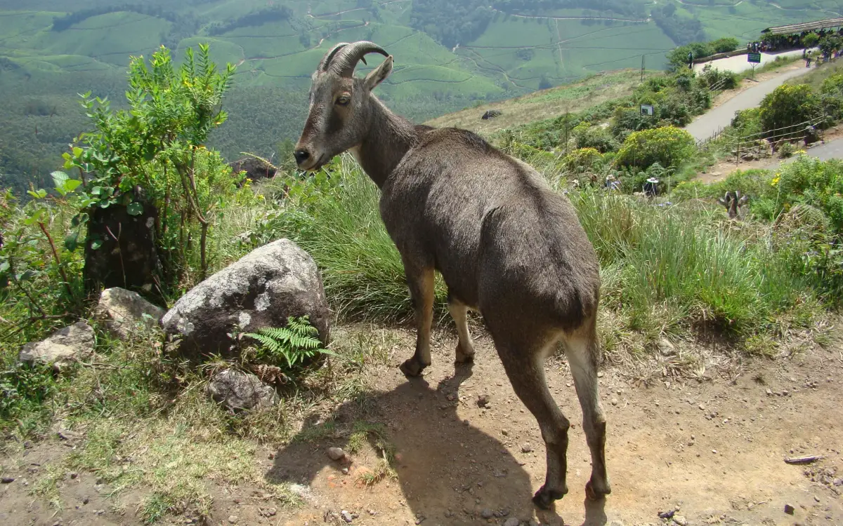
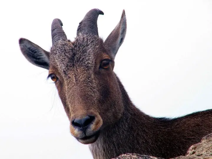
  • Elephants, gaur, Nilgiri tahr and deer are all recorded in this sanctuary, and gaur in particular are placid until they are not. Stay on the track, keep well back, and do not walk in at dusk.
  • The road above Koviloor is graded earth and the last stretch towards Kadavari is a single-vehicle track through felled plantation. In rain it is the hazard on this trip, ahead of anything on foot.
  • This is inhabited farmland inside a protected area. Do not cross fences, do not walk through planted terraces, and do not assume open ground is public ground.
  • Neelakurinji is a protected plant and picking it is an offence. In the 2026 season the department has published penalties for damaging it at other sites in this division.
Official eco & forest programmes

Experiences around Kurinjimala Sanctuary trek

These are official or public-sector eco offerings that match this place, town or forest destination. Confirm availability, permits, tariffs and reporting times with the official operator before travel.

Meesapulimala, Kurinjimala Sanctuary trek
trekforest staycamping

Meesapulimala trek through Rhodo Valley

Hard high-altitude trek from the Munnar side via Rhodo Valley, run through KFDC eco-tourism with guide, food and stay options.

KFDC Ecotourism MunnarOvernight with next-day trek
Official source →
Meesapulimala Base Camp, Kurinjimala Sanctuary trek
campingforest staytrek

Munnar Base Camp tent stay

KFDC tent stay near Meesapulimala base camp, with campfire, food and optional trek towards Meesapulimala or Rhodo Valley.

KFDC Ecotourism MunnartentOvernight
Official source →
Meesapulimala Base Camp, Kurinjimala Sanctuary trek
forest staytrekviewpoint

Munnar Sky Cottage

Lonely cliff-side KFDC cottage facing a waterfall and Anamudi views, paired with Meesapulimala trekking.

KFDC Ecotourism Munnarforest cottageOvernight
Official source →
Rhodo Valley, Kurinjimala Sanctuary trek
forest staytrekviewpoint

Munnar Rhodo Mansion

KFDC Rhodo Valley night stay with elephant-trench protection, campfire, food and next-day Meesapulimala climb.

KFDC Ecotourism Munnarforest cottageOvernight
Official source →
Eravikulam National Park, Kurinjimala Sanctuary trek
wildlifeviewpoint

Eravikulam National Park visit

High-altitude grassland national park and Nilgiri tahr habitat near Munnar.

Kerala Forest Department
Official source →
Chinnar Wildlife Sanctuary, Kurinjimala Sanctuary trek
trekwildlifeforest stay

Chinnar Wildlife Sanctuary eco visit

Dry-forest wildlife sanctuary east of Munnar, listed in Kerala Tourism’s ecotourism inventory.

Kerala Forest Department
Official source →
Pambadum Shola National Park, Kurinjimala Sanctuary trek
trekwildlifeforest stay

Pambadum Shola National Park eco visit

Shola forest national park near the Munnar/Vattavada side, listed as an ecotourism destination and programme.

Kerala Forest Department
Official source →
Anamudi Shola, Kurinjimala Sanctuary trek
trekwildlife

Anamudi Shola eco visit

Shola-grassland forest landscape in Idukki, included in Kerala Tourism’s official ecotourism destination list.

Kerala Forest Department
Official source →
Marayoor, Kurinjimala Sanctuary trek
wildlifeinterpretationtrek

Marayoor sandalwood forest eco visit

Sandalwood and dry-forest landscape on the Munnar-Chinnar side, listed by Kerala Tourism as an ecotourism destination.

Kerala Forest Department
Official source →
Stay · eat · do · rent · see · shop

Stays, food & things to do near Kurinjimala Sanctuary trek

Verified hotels, homestays, restaurants, experiences, sights, shops and rentals around Kurinjimala Sanctuary trek — commission-free, with direct contact. Filter by what you need.

Eravikulam National Park Official Ticket Booking — Official park ticket booking in MunnarPhoto: Jiths
Top pick
Official park ticket booking · Munnar
Eravikulam National Park Official Ticket Booking
55.2 km · 92 min drive~₹1100–1270 by taxi

Official park ticket booking in Munnar. Eravikulam National Park, Munnar, Kerala 685612 · official booking, national park, Rajamala.

Directions Commission-freeView details
Munnar Wildlife Division Online Booking — Official forest booking office in MunnarPhoto: Jiths
Top pick
Official forest booking office · Munnar
Munnar Wildlife Division Online Booking
45.6 km · 73 min drive~₹930–1070 by taxi

Official Munnar Wildlife Division booking portal for forest stays, trekking and protected-area visitor services.

Directions Commission-freeView details
KDHP Tea Museum Munnar — Tea museum in MunnarPhoto: Ingo Mehling
Top pick
Tea museum · Munnar
KDHP Tea Museum Munnar
47.2 km · 75 min drive~₹960–1110 by taxi

Official Kanan Devan Hills Plantations tea museum at Nullatanni Estate, a short drive from Munnar town.

Directions Commission-freeView details
Luxury resort · Munnar
Blanket Hotel & Spa Munnar
50.7 km · 84 min drive~₹1020–1180 by taxi

Blanket Hotel & Spa is in Pallivasal overlooking Attukad Waterfalls. Compare its room categories by the view and room arrangement you want; the property offers several different suites. Ask for the total rate, meal inclusions and the transfer from your actual Munnar arrival point.

Directions Commission-freeView details
Tea-estate bungalows · Munnar
KDHP Tea Sanctuary Bungalows

KDHP offers separate tea-estate bungalows around Munnar, including Kalaar, Lake View and Viriparai. Choose the named bungalow before comparing bedrooms and access. KDHP House is the reservations office; obtain arrival directions for the bungalow you book.

Commission-freeView details
Luxury resort · Munnar
Chandy's Windy Woods Munnar
53.9 km · 87 min drive~₹1080–1250 by taxi

Chandy’s Windy Woods is a resort on terraced hill slopes near Munnar. Its hillside setting is a different choice from a town hotel. Compare the room category and view, and check the road transfer before combining your stay with early sightseeing departures.

Directions Commission-freeView details
Luxury resort and spa · Munnar
The Fog Resort & Spa Munnar
60.5 km · 94 min drive~₹1190–1380 by taxi

Luxury resort and spa at Chithirapuram with villas, Ayurveda spa, restaurant and direct reservations.

Directions Commission-freeView details
Luxury hotel and spa · Munnar
Amber Dale Luxury Hotel & Spa Munnar
52.3 km · 83 min drive~₹1050–1210 by taxi

Amber Dale Luxury Hotel & Spa sits on KSEB Tunnel Road at Pallivasal, Munnar. It pairs a restaurant and Ayurveda spa with a conference hall and activities such as cycling, trekking and camp fires.

Directions Commission-freeView details
Luxury hotel and spa · Munnar
The Panoramic Getaway Munnar
57.2 km · 89 min drive~₹1130–1320 by taxi

The Panoramic Getaway is at Chithirapuram, with separate family and adults’ pool areas and room choices including family suites. Compare the room layout and pool access you need, then confirm meals and the current total booking price.

Directions Commission-freeView details
Official budget forest stay · Munnar
Pampadum Shola Forest Stays, Munnar Wildlife
11.6 km · 24 min drive~₹180–210 by auto

Official budget forest stay in Munnar. Pampadum Shola National Park, booked through Forest Information Centre, Wildlife Warden's Office, Munnar PO, Idukki District, Kerala 685612 · Budget official forest stay · Forest stay, Pampadum Shola, Official booking.

Directions Commission-freeView details
Official trekking booking · Munnar
Munnar Wildlife Trekking Official Booking
45.6 km · 73 min drive~₹930–1070 by taxi

Official Munnar Wildlife Division trekking information and booking contact. Forest Information Centre, Wildlife Warden's Office, Munnar PO, Idukki District, Kerala 685612 · trekking, official booking, forest.

Directions Commission-freeView details
Luxury boutique spa resort · Munnar
SpiceTree Munnar
65.2 km · 97 min drive~₹1280–1480 by taxi

SpiceTree Munnar is on Muttukad–Periakanal Road at Nadukkurissu, in the Chinnakkanal area. Its pool villas, cottages with a Jacuzzi and honeymoon suites with a plunge pool are different room choices. Specify the category and inclusions when requesting a quote.

Directions Commission-freeView details
Mid-range town hotel · Munnar
Grand Plaza Munnar
46.8 km · 75 min drive~₹950–1100 by taxi

Eco boutique hotel with 39 rooms overlooking tea plantations. Set on M.S.A Road close to the heart of Munnar.

Directions Commission-freeView details
Resort · Munnar
Misty Mountain Resort Munnar
53.3 km · 83 min drive~₹1060–1240 by taxi

Misty Mountain Resort offers standard, valley-view and deluxe room categories near Munnar. Decide whether the view or room arrangement is your priority when comparing quotes. Ask the hotel which category is available for your dates and how meals and sightseeing transfers are charged.

Directions Commission-freeView details
Premium nature resort · Munnar
Rivulet Resort Munnar
59.5 km · 93 min drive~₹1180–1360 by taxi

Premium Chithirapuram-side nature resort with restaurant, activities and direct booking evidence. Rivulet Resort, Chithirapuram P O, Munnar, Kerala 685565 · Premium nature resort · Resort, Chithirapuram, Nature stay.

Directions Commission-freeView details
Premium tea-valley resort · Munnar
Tea Valley Resort Munnar
51.0 km · 82 min drive~₹1020–1190 by taxi

Tea Valley Resort is on Bisonvalley Road at Pothamedu, Pallivasal. Choose it for a stay among tea plantations rather than a town-centre address. Ask about the final road approach, room category and meal arrangements when comparing the full cost of a Munnar holiday.

Directions Commission-freeView details
Hotel restaurants · Munnar
Desi Aromas & Underground Restaurants, The Panoramic Getaway
57.2 km · 89 min driveIndian, Kerala, Mexican, Italian, Cafe, Multi-cuisine~₹1130–1320 by taxi

Two named restaurants at The Panoramic Getaway: Desi Aromas for Indian cuisine and Underground for grill specialties.

Directions Commission-freeView details
Adventure tour operator · Munnar
Kalypso Adventures Munnar Trekking

Adventure operator with Munnar trekking itineraries, cycling and walking holidays in Kerala. Trekking, adventure operator, Munnar trekking.

Directions Commission-freeView details
Ayurveda spa · Munnar
Blanket Ayurveda Spa Munnar
50.7 km · 84 min drive~₹1020–1180 by taxi

In-house Ayurveda and wellness center at Blanket Hotel & Spa near Attukad Waterfalls. Ayurveda, spa, wellness.

Directions Commission-freeView details
Ayurvedic spa · Munnar
Tattvam Ayurvedic Spa, The Panoramic Getaway
57.2 km · 89 min drive~₹1140–1320 by taxi

Ayurvedic spa in Munnar. The Panoramic Getaway, Chithirapuram, Munnar, Kerala 685565 · Short therapies from Rs. 1199; Ayurveda packages from Rs. 4750; taxes extra · spa, ayurveda, wellness.

Directions Commission-freeView details
Ayurveda spa · Munnar
Amber Dale Ayurveda & Spa
52.3 km · 83 min drive~₹1050–1210 by taxi

Ayurveda and spa facility at Amber Dale Luxury Hotel & Spa in Pallivasal. Ayurveda, spa, wellness.

Directions Commission-freeView details
Spa · Munnar
Bodhi Tree Spa at The Fog Munnar
60.4 km · 94 min drive~₹1190–1380 by taxi

Spa in Munnar. Spa, wellness, Chithirapuram.

Directions Commission-freeView details
Hotel restaurant · Munnar
Grand Spices Restaurant, Grand Plaza Munnar
46.8 km · 75 min drive~₹950–1100 by taxi

Multi-cuisine restaurant at Grand Plaza Munnar on M. S. A Road. Restaurant, multi-cuisine, hotel dining.

Directions Commission-freeView details
Restaurant · Munnar
Alaska Multi Cuisine Restaurant at The Fog Munnar
60.5 km · 94 min drive~₹1190–1380 by taxi

Restaurant in Munnar. Restaurant, multi-cuisine, Kerala food.

Directions Commission-freeView details

Book with the place itself. India’s cyber-crime coordination centre warned in April 2025 that convincing copies of hotel and pilgrimage booking sites are being pushed through sponsored search and social ads, taking payment for rooms the property never hears about. Every listing here links to the business’s own contact details and its own Google or Bing profile — we take no commission and sit in nobody’s payment path. If a booking page reached you through an ad, check the address bar against the property’s own site before you pay. Fraud can be reported on cybercrime.gov.in or on 1930.

Ranked guides

Top experiences around Munnar

32 more places around Munnar. Open a guide to plan the visit and onward journey.

hill stationMunnar

Kerala’s most famous hill station, known for tea estates, viewpoints and cool weather.

wildlifeEravikulam National Park

High-altitude grassland park, Nilgiri tahr habitat and access point for Anamudi views.

viewpointAnamudi Peak

The highest peak in South India, viewed through Eravikulam/Rajamala access contexts near Munnar.

wildlifeRajamala

Rajamala is the designated tourism and awareness zone of Eravikulam National Park near Munnar. It is not a separate unrestricted summit trek or the whole national park.

museumTea Museum

Tea-history museum in Munnar linked with the plantation story of the high ranges.

damMattupetty Dam

Reservoir, boating and lake-view stop on the Munnar-Mattupetty sightseeing circuit, usually paired with Echo Point and Kundala.

viewpointEcho Point

37.3 km · 62 min drive

Popular Munnar lakeside viewpoint on the Mattupetty-Kundala route, useful for short stops, photos and family sightseeing.

damKundala Lake

26.2 km · 48 min drive

High-range lake and dam stop beyond Mattupetty on the Top Station route.

viewpointTop Station

13.4 km · 30 min drive

A border-highland viewpoint in Theni, Tamil Nadu, normally approached through Munnar, Mattupetty and Kundala; named for the former tea-transport terminus, with a separate stepped viewpoint walk.

trekMeesapulimala trek

25.0 km · 46 min drive

Popular high-altitude Western Ghats trek, usually booked through official eco-tourism channels.

viewpointKolukkumalai

High tea-estate sunrise viewpoint reached by jeep from the Munnar side.

wildlifeChinnar Wildlife Sanctuary

Dry-forest wildlife sanctuary on the Marayoor-Udumalpet side of Idukki.

heritageMarayoor

29.3 km · 56 min drive

High-range village known for natural sandalwood forests, dolmens and sugarcane jaggery.

wildlifePambadum Shola National Park

7.8 km · 16 min drive

Pampadum Shola National Park protects high-elevation forest beside the Top Station–Vattavada road. The Top Station forest check post is the reporting anchor here; forest stays and guided walks require their own confirmed arrangements.

wildlifeAnamudi Shola

33.5 km · 63 min drive

Anamudi Shola National Park protects Mannavan, Pullaradi and Idivara shola forests in the Kanthalloor–Vattavada high ranges. Methappu is the visitor anchor on this page; this is not Anamudi Peak or the Rajamala visitor area.

waterfallLakkam Waterfalls

31.1 km · 64 min drive

Waterfall stop on the Munnar-Marayoor route, usually paired with Eravikulam and Marayoor days.

waterfallAttukad Waterfalls

Waterfall area near Munnar commonly used for short scenic drives and monsoon views.

viewpointLockhart Gap

The pass itself on the Munnar–Bodimettu highway, where the ridge drops away east — and the lay-by the Chokramudi Peak trek reports from, 51 m from the forest counter. A second, busier viewpoint signed "Lockhart Gap Road View Point" sits 1.7 km east.

damAnayirankal Dam

Anayirankal is a KSEB earth-and-rockfill dam and reservoir in the Panniyar hydel system near Chinnakanal and Santhanpara. The map identifies the published hydel visitor-centre marker; boating is not currently assured.

waterfallPower House Waterfalls

The Muthirapuzha spread sideways over bare rock at 796 m, below the tailrace of Pallivasal — the first hydroelectric station Kerala built. Free, unmanaged and very quiet, down about a kilometre of steep narrow lane. ⚠ Not the Chinnakanal falls that Kerala Tourism describes under this name, 21 km east.

viewpointBlossom Hydel Park

The Kerala State Electricity Board’s riverside flower park on the Munnar–Aluva road, 3.3 km below Munnar town and 1.2 km from the KSRTC stand at Old Munnar. It runs along the east bank of the Muthirapuzha immediately above the 1944 R. A. Headworks weir that feeds Pallivasal, Kerala’s first hydroelectric station — which is what the "hydel" in the name means. Open daily 09:15 to 20:15 with tickets sold online by Kerala Hydel Tourism Centre.

hill stationDevikulam / Sita Devi Lake

Hill-station and lake landscape near Munnar associated with Devikulam and Sita Devi, best planned as a quieter high-range side trip.

waterfallNayamakad Waterfalls

Nyayamakad, also called Nayamakad, is the waterfall and tea-estate landscape on the Munnar–Rajamala approach. The map uses the identifiable Nyamakad roadside stream-view base, not a waterfall lip, pool entrance or estate walking permit.

trekChokramudi Peak trek

Forest Department peak trek from the counter at Gap Road, 13.2 km from Munnar: a mapped 2.09 km path climbing about 460 m of grassland and shola to a summit whose altitude four sources disagree about.

trekThoovanam Falls trek

35.1 km · 64 min drive

Forest Department guided walk in Chinnar Wildlife Sanctuary, from the Alampetty counter on SH17 down the river to the Thoovanam waterfall. Kerala Tourism contradicts itself on which river it follows: its own destination article says the Pambar, and the page selling this programme says the Chinnar.

trekChinnar Dolmen Culture trek

35.1 km · 64 min drive

Forest Department culture trek in Chinnar Wildlife Sanctuary to prehistoric dolmen (muniyara) sites, run with local tribal Eco-Development Committees. Report at the Alampetty guide stand on the Marayoor–Udumalpet road (SH17), 6.4 km beyond Marayoor.

trekVasyappara Trekking and Camping

Forest Department trekking-and-camping programme at Vasyappara in Chinnar Wildlife Sanctuary — an overnight stay in a mud hut on a hill crest, published by the department as the Chinnar Valley Safari Trail. Report at 3 pm at the Chinnar check post on the Marayoor–Udumalpet road, not at the Alampetty counter 10.2 km back.

hill stationKanthalloor

7.0 km · ~18 min by auto

High-range village near Marayoor often called the “Kashmir of Kerala”, known for terraced farms of apples, oranges, strawberries and vegetables at around 1,800 m.

hill stationVattavada

2.8 km · ~7 min by auto

Cool high-altitude farming village beyond Munnar near the Tamil Nadu border, known for terraced vegetable and fruit cultivation, Kurinji slopes and quiet valley views.

viewpointPothamedu Viewpoint

A road-accessible viewpoint in Pothamedu south of Munnar, looking across planted hills and wooded valleys. The viewpoint marker is separate from the wider village and from private plantation walking routes.

wildlifeMathikettan Shola National Park

Mathikettan Shola protects a remnant of native Cardamom Hills forest in Idukki. Visits are arranged through the Forest Department, with distinct Pethotty and Choondal approaches; a reservoir viewpoint is not a park-entry permit.

viewpointChathurangapara Viewpoint

A wind-turbine ridge in Chathurangappara, Udumbanchola taluk, with views towards Theni’s cultivated plains; reached from the Munnar–Kumily road, with an exposed final hill approach.

Roampedia is commission-free — own or know a stay, eatery, guide or shop near Kurinjimala Sanctuary trek? List it and it appears here once verified.

Add a nearby business
Trek facts

Kurinjimala Sanctuary trek — at a glance

DifficultyModerate
DurationA full day from Munnar, most of it on the road
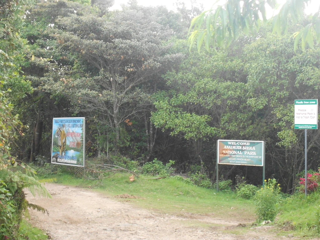
OperatorKerala Forest and Wildlife Department, Munnar Wildlife Division — which is on the sanctuary's own entrance board above Kadavari, photographed and uploaded to Wikimedia Commons by a contributor from the valley, and is the clearest confirmation on the open record of who administers this ground. The local office is the Shola National Parks Range under an Assistant Wildlife Warden, at Top Station and Yellappetty. The department's brochure states that eco-tourism here is organised jointly with the Eco-Development Committees of local tribal communities, which is the same model used at Chinnar and Pampadum Shola.
TimingsCURRENT CHECK, 4 SEPTEMBER 2026: no Kurinjimala walk, opening notice or booking product appears in the Forest Department's current programme and ecotourism lists, while its own older brochure still gives no hours for the two walks it names. The absence of a listing does not prove that access is closed. Ignore Google's misleading 'open 24 hours' label for a protected area; ring 04865 231587 for the date you want, use daylight only and plan to be off the ground by mid-afternoon.
Best timeSeptember–October for the flower; December to February for the walking. Kerala Tourism's own line is that neelakurinji flowers fully in September and October, and the 2026 bloom across the Munnar high range is expected to peak through September. For the ground itself rather than the flower, the settled cold weather from December to February is the best of the year at this altitude: dry air, long visibility, cold nights. June to August is the south-west monsoon on an exposed 2,000 m ridge, when the graded earth road above Koviloor is the real hazard and mist can close the valley for days. ⚠ One warning specific to 2026: Manorama reported on 30 July that the violet hillsides circulating in social media were mettukurinji rather than the twelve-year neelakurinji, so do not use somebody's reel as your calendar.

Entry: 🔴 No fee is published for anything at Kurinjimala, by the department or by anyone else, and we will not invent one. The brochure lists four facilities — a nature trail to the Kurinji land, a trek to cliffy rocks, a stay at Kadavari and a stay at Narco point — and prints no tariff against any of them. Nothing here is sold through the department's booking site, which carries Pampadum Shola and Anamudi Shola accommodation only. For scale rather than for guidance: the department's ticketed kurinji viewing at Chokramudi is ₹200 for adults with a lower rate for under-18s, and Meesapulimala is ₹1,200 a head through the Kerala Forest Development Corporation. Neither price applies here. Carry cash and expect no card machine.

Photography: No camera charge is published here, because no charge of any kind is published here. Drones should be assumed banned: this is a notified wildlife sanctuary with elephant and gaur in it, and the department has banned them over the kurinji areas it has opened this season. The one piece of photographic etiquette that matters more than the rules is that Kottakamboor, Koviloor and Kadavari are working villages — ask before you point a camera at somebody's field or somebody's house.

Permit: There is no permit counter and no register on this boundary, which is a fact about the sanctuary rather than an invitation. The department's own brochure routes enquiries and reservation through two offices — the Forest Information Centre at the Munnar division office on 04865 231587, and the Assistant Wildlife Warden of the Shola National Parks Range at Top Station and Yellappetty — and it is those offices, not a gate, that decide whether a walk runs. For comparison, permits for neighbouring Pampadum Shola are issued at the Top Station check-post or online; Kurinjimala has neither route. If you are walking beyond the village on your own, understand that nobody is recording that you have done so.

Booking: Rechecked in English and Malayalam on 4 September 2026: the Forest Department's current programme list, state ecotourism list and the Munnar Wildlife Division booking inventory expose no Kurinjimala trek, trail or stay. They do list neighbouring managed products, so the absence is specific rather than a site-wide failure—but it still cannot prove that every local walk is closed. The department's Kurinjimala brochure instructs visitors to telephone. Call 04865 231587 before committing to the drive and ask for the named nature trail or cliffy-rock trek.

Parking: Roadside at Kottakamboor, informally, on the shoulder by the village junction. There is no laid-out car park anywhere near this sanctuary, no attendant and no charge. Beyond the village the road narrows to a single vehicle and there is nowhere to turn a large car around for some distance, which is the practical argument for stopping at the junction and walking on.

Wildlife: Elephant, gaur, Nilgiri tahr and deer are the four the notification and the department's own descriptions name, and all four belong on this ground — Kurinjimala's stated conservation value is as much about being the corridor between Chinnar, Anamudi Shola, Pampadum Shola and the proposed Palani Hills National Park as about the flower. Gaur are the animal to plan around: they are common on cultivated edges here, they look placid, and they are not. Elephant movement is why the Forest Department's log houses in this range are built behind elephant-proof trenches, one of which is visible in the Commons photograph of a Bison Log House at Vattavada. The plant list is shorter and more famous: Strobilanthes kunthiana above all, in a shola-and-grassland mosaic that is exactly what the acacia and eucalyptus plantations across this valley displaced.

Getting here

How to reach Kurinjimala Sanctuary trek

  • ✈︎ By air Cochin International Airport (COK) is the nearest at 147.8 km by road from the pin, about three hours and seventeen minutes measured — down through Munnar and Adimali on NH85 and then out to Nedumbassery. Coimbatore is the other realistic arrival for this corner of the high range and the Forest Department's own brochure quotes it at 160 km against Kochi's 170. Neither is a short transfer: budget the best part of a day either side.
  • 🚆︎ By train Idukki district has no railway, so every railhead is outside it. Measured by road from the pin: Aluva 154.4 km and about three hours seventeen. The department's brochure gives the same two options it has given for years — Aluva at 180 km in Kerala and Udumalpet at 110 km in Tamil Nadu — and by road today Udumalpet measures 74.3 km and about two hours, which is the shorter run if you are coming from the Coimbatore side. Neither has a connection onward into the sanctuary; you will be changing to road transport whichever you use.
  • 🚗︎ By road The route is Munnar–Mattupetty–Kundala–Top Station–Vattavada–Koviloor–Kottakamboor, 45.8 km and about an hour and twenty-five minutes. It is a mountain road throughout and slower than its length suggests, with the Top Station stretch busy in season. Above Koviloor the surface becomes graded earth and above Kottakamboor it is a single-vehicle track through felled plantation. ⚠ The old Kodaikanal–Munnar road runs on east of Kadavari and is mapped closed to the public — locally the Escape Road — so there is no through route to Tamil Nadu here; Kodaikanal by a road you can legally drive measures 115.8 km and nearly four hours.
  • 🚌︎ By bus There is no bus into the sanctuary. KSRTC and private services run the Munnar–Top Station–Vattavada road and that is as close as public transport gets; from Vattavada it is 3.9 km on to Kottakamboor and there is no scheduled service beyond. ⚠ In May 2026 the Devikulam and Munnar panchayats agreed to bar large tourist buses from Mattupetty, Kundala, Top Station, Rajamala and Vattavada and to regulate private vehicles by e-pass, with local jeeps and autorickshaws to carry visitors instead. Onmanorama reported on 22 August 2026 that the scheme had still not started because the fares for those jeeps had not been fixed, so the position on the day you travel is worth establishing before you set out.
Getting back

If you are travelling by bus or ferry, check the return service with the operator before setting out. Leave time to reach the stop or jetty after your visit.

Ask at the bus stand for the time of the last service back, not the next one. If you miss it, an auto or app cab is the fallback — agree the fare before you get in.

Do

Things to do

  • Stand at the Kottakamboor junction and read the valley, which is the honest headline activity here: the terraces stop, the plantation begins, and the line between them is the argument this sanctuary has been having for twenty years.
  • Ask about the department's nature trail to the Kurinji land — one of two walks the Forest Department lists for Kurinjimala in its own brochure, with no published length, price or start time, and only a telephone number to establish whether it is running.
  • Ask about the trek to cliffy rocks, the second of the two, which is the nearest thing to the summit walk that aggregator pages have been promising here for years without ever naming a counter.
  • Walk or drive out towards Kadavari, 3.5 km on the mapped path and 9.3 km by road, to see a farming settlement living inside a wildlife sanctuary at two thousand metres.
  • Find the sanctuary's own entrance board above Kadavari — a green Forest Department sign on a dirt track through eucalyptus, which is the only piece of signage this place has and is photographed on Wikimedia Commons.
  • Look at the vegetable terraces properly. Beans, potato, carrot, beetroot, cabbage, garlic and radish grown at 2,000 m is a piece of agricultural Kerala that exists nowhere else in the state.
  • Watch for the pack ponies. Kadavari's harvest goes out east to the Tamil Nadu market on animals rather than lorries, and it is the working freight system of a village inside a protected area.
  • Go as far east as you legally can and stop where the old Kodaikanal–Munnar road is closed. The Escape Road is one of the more evocative dead ends in the Western Ghats.
  • Look for gaur on the cultivated edges at either end of the day, which is where they are, and Nilgiri tahr on the open rock above.
  • Learn to tell kurinji from the plants that pretend to be it, which is the single most useful thing you can take away from this valley in 2026.
  • Pair it with Pampadum Shola National Park, 11.6 km back down the road, where the same range office does have log houses, permits and a nature camp you can actually book.
  • Add Top Station, 12.8 km back, for the view down into Tamil Nadu that everybody else on this road has come for.
Prepare

What to carry

  • Telephone 04865 231587 before you do anything else. That is the Forest Information Centre at the Munnar division office and it is the number the department prints on its own Kurinjimala brochure; the walks here have no published schedule, so the call is the only way to find out whether one is running.

  • Ask the two questions that actually matter on that call: is either of the two listed walks operating this month, and has any part of Kurinjimala been opened for the 2026 kurinji season. As of 25 August 2026 we could find no announcement that it had.
  • Do not drive to the centre-of-area pin at 10.228781 / 77.267605; there is no road, building or gate within 320 m of it. Navigate to Kottakamboor.
  • Budget an hour and twenty-five minutes each way from Munnar and treat it as a full day. It is 45.8 km on a mountain road with the Top Station stretch busy in season.
  • Take a vehicle with ground clearance if you intend to go above Koviloor. The surface is graded earth and the Kadavari track is single-vehicle width cut through felled plantation.
  • Go in September or October if the flower is the point, and December to February if the walking is. Kerala Tourism puts full neelakurinji flowering in September–October; the cold weather is the best of the year for being out on this ground.
  • Treat viral photographs as advertising, not evidence. Manorama reported on 30 July 2026 that the violet hillsides in the Munnar reels were mettukurinji, a different plant, and that the twelve-year bloom was still to come.

  • Carry everything: two litres of water a head, food, a windproof layer and a hat. There is no shop, no tap, no toilet and no shelter past the village, and at 2,000 m the wind matters more than the temperature.
  • Tell your accommodation where you are going and when you will be back. There is no counter to sign in at here, so that conversation is the only record that you went.
  • Keep to the track and off the terraces. This is titled, farmed, contested land inside a notified sanctuary, and open ground is not public ground.
  • Ask before photographing people at work. Kottakamboor, Koviloor and Kadavari are villages going about their day, not a set.
  • Give gaur a very wide berth and do not walk out at dusk. They are common on cultivated edges here and they are the animal that hurts people in this district.
  • Do not pick the kurinji, and do not let anyone with you pick it. It is a protected plant, and the department has published penalties for damaging it at the sites it has opened this season.
  • Take cash. There is nothing to pay for at the sanctuary because nothing is priced, but there is no ATM beyond Munnar and the shops and homestays at Vattavada are cash businesses.
  • Fill the tank in Munnar. There is no fuel at Vattavada or Kottakamboor and the round trip is over ninety kilometres of mountain road.
  • Check the vehicle rules for the Vattavada road before you set off. A bus ban and an e-pass scheme were agreed in May 2026 and were still not in force on 22 August, which means they could start at any time.
  • Start early enough to be off the hill by mid-afternoon. The road down is graded earth in places and is not one to be driving in mist or in the dark.
  • Do not plan on crossing to Kodaikanal. The old road east of Kadavari is mapped closed to the public, and the legal drive round measures 115.8 km and takes nearly four hours.
  • Bring binoculars. This is open, terraced, long-sightline country and the difference between a drive and a wildlife morning is whether you can resolve what is on the far slope.
  • If you want a walk you can definitely do, book Pampadum Shola instead and come here to look. Permits for Pampadum Shola are issued at the Top Station check-post or online, 11.6 km back down the road, and it is run by the same range office.
  • Read the size figure you are given anywhere else with suspicion. The most-copied English source says this sanctuary is 32 hectares; the department's own brochure says 32 square kilometres, and it is right.
  • Leave the whole valley as you found it. There is no waste collection on this ground, and litter at two thousand metres stays at two thousand metres.
Facilities

On site

  • Nothing at the boundary: no ticket window, no visitor centre, no gate, no register and no departmental staff anywhere on the sanctuary edge
  • The Forest Department's entrance board on the track above Kadavari — the only signage this sanctuary has, naming the Munnar Wildlife Division
  • Kottakamboor village at the pin: village office 90 m, post office 152 m by the road, a ration shop 122 m and a school and anganwadi in the same cluster
  • No shop, no drinking water, no toilet and no shelter of any kind between the village and Kadavari. Everything goes with you
  • Two stays listed by the department in its own brochure — at Kadavari and at Narco point — neither of which appears on any booking system
  • The nearest bookable departmental accommodation is at Pampadum Shola and Anamudi Shola, 11.6 km south, sold through booking.munnarwildlife.com
  • The nearest departmental building on the ground is the forest office and nature camp on the Vattavada road, 10.137124 / 77.254548, about 8 km south — a Pampadum Shola facility
  • Roadside parking only, on the shoulder at the village junction. No car park, no attendant, and nowhere to turn a large vehicle above the village
  • Fuel, ATMs, pharmacies and a hospital are all back at Munnar, 45.8 km. Vattavada, 3.9 km, has a panchayat office, small shops and homestays
  • Mobile signal is unreliable through most of this valley and gone on the far side of the ridge — tell somebody where you have gone
Stay safe

Safety

  • 🌫 Mist closes this valley quickly and completely. Visibility can drop from the whole eastern range to twenty metres while you are still deciding whether to carry on, and the graded earth road is far more dangerous in it than the walking is.
  • The road is the hazard, not the hill. Above Koviloor the surface is graded earth on a gradient, above Kottakamboor it is a single-vehicle track, and wet earth at this angle is genuinely slippery — plan the driving with more care than the walking.
  • 🐘 Elephant, gaur and Nilgiri tahr are all recorded here, and gaur on cultivated edges are the ones that hurt people. Keep well back, keep to the track, and do not walk out at dusk.
  • There is no counter, no register and nobody who knows you are on this ground. Tell your accommodation where you have gone and when you expect to be back, because it is the only alarm that exists.
  • Mobile signal is unreliable through the valley and absent on the far side of the ridge. Do not plan on being able to call for help from beyond the village.
  • This is inhabited, titled farmland inside a protected area. Do not cross fences, do not walk through planted terraces, and do not assume that open ground is open to you.
  • Neelakurinji is protected and picking it is an offence, with penalties published by the department at the sites it has opened for the 2026 season.
Getting around Kurinjimala Sanctuary trekNot wheelchair accessible
Terrain
Steep
From the entrance
You stop on the shoulder at the Kottakamboor village junction, where the tarmac from Koviloor meets the old Kodaikanal–Munnar road. That much is level, made and fine for anybody: the village office is 90 m away, the post office 152 m, and the view up the valley towards the sanctuary is from the roadside itself. Everything past the junction is graded earth on a gradient, narrowing above the village to a single-vehicle track cut through felled plantation. There is no gate, no forecourt, no laid path and no signage of any kind until the Forest Department board on the track above Kadavari, 9.3 km on by road.
Step-free access
The sanctuary itself cannot be visited in a wheelchair and there is no version of it that can. There is no made surface anywhere past the village, no handrail, no accessible toilet at the junction or anywhere beyond it, and no departmental staff on the ground to arrange a transfer. What is genuinely accessible is the junction: tarmac to the shoulder, a wide view up the valley to the protected ground, and the terraced farmland that is half the story of this place. If that is the visit you can make, it is a real one, and the drive up through Top Station and Vattavada is worth it on its own.
Prams
Not possible above the village junction. The roadside is level and fine with a pram, and the valley view from it is the same view; the track beyond is loose graded earth on a gradient with a single-vehicle width and no verge, and there is no shop, tap or toilet past the last houses.
  • There is no counter, no register and no staff on this boundary, so nobody knows you are on the ground unless you have told somebody yourself. Tell your accommodation where you are going and when you expect to be back.
  • The road above Koviloor is graded earth on a gradient and the last stretch towards Kadavari is a single-vehicle track through felled plantation. Wet earth at that angle is genuinely slippery, and the driving is more dangerous here than the walking.
  • Mist closes this valley quickly and can take visibility from the whole eastern range to twenty metres. It is the reason to be off the hill by mid-afternoon rather than at dusk.
  • Elephant, gaur, Nilgiri tahr and deer are all recorded in the sanctuary. Gaur on cultivated edges are the animal that hurts people in this district: keep well back, keep to the track, and do not walk out at last light.
  • There is no shop, no drinking water, no toilet and no shelter between the village and Kadavari. Everything you need goes with you.
  • Mobile signal is unreliable across most of the valley and absent beyond the ridge. Do not plan on being able to call for help from inside the sanctuary.
  • This is inhabited, titled and legally contested farmland with a sanctuary drawn over it. Do not cross fences, do not walk through planted terraces, and do not assume open ground is public ground.
  • Neelakurinji is a protected plant and picking it is an offence, with penalties published by the department at the sites it has opened for the 2026 season.

Checked 25 August 2026 against source 1source 2source 3source 4. Conditions change and surfaces vary with weather — if step-free access is essential, confirm with the site before you travel.

Practical things near Kurinjimala Sanctuary trek

These services are listed within about 1.2 km of Kurinjimala Sanctuary trek. Walking distances follow mapped routes; access and opening hours can change. Other services may be closer but are not included here.

If you need help at Kurinjimala Sanctuary trek
112All emergencies (police · fire · medical)The single number to call in any emergency (ERSS).

Emergency numbers are verified against official government and state tourism sources. 112 works anywhere in India.

Nearby

What’s near Kurinjimala Sanctuary trek

hill stationVattavada

Cool high-altitude farming village beyond Munnar near the Tamil Nadu border, known for terraced vegetable and fruit cultivation, Kurinji slopes and quiet valley views.

2.8 km · ~7 min by auto · straight line
hill stationKanthalloor

High-range village near Marayoor often called the “Kashmir of Kerala”, known for terraced farms of apples, oranges, strawberries and vegetables at around 1,800 m.

7.0 km · ~18 min by auto · straight line
wildlifePambadum Shola National Park

Pampadum Shola National Park protects high-elevation forest beside the Top Station–Vattavada road. The Top Station forest check post is the reporting anchor here; forest stays and guided walks require their own confirmed arrangements.

7.8 km · 16 min drive
viewpointTop Station

A border-highland viewpoint in Theni, Tamil Nadu, normally approached through Munnar, Mattupetty and Kundala; named for the former tea-transport terminus, with a separate stepped viewpoint walk.

13.4 km · 30 min drive
trekMeesapulimala trek

Popular high-altitude Western Ghats trek, usually booked through official eco-tourism channels.

25.0 km · 46 min drive
damKundala Lake

High-range lake and dam stop beyond Mattupetty on the Top Station route.

26.2 km · 48 min drive
heritageMarayoor

High-range village known for natural sandalwood forests, dolmens and sugarcane jaggery.

29.3 km · 56 min drive
waterfallLakkam Waterfalls

Waterfall stop on the Munnar-Marayoor route, usually paired with Eravikulam and Marayoor days.

31.1 km · 64 min drive
wildlifeAnamudi Shola

Anamudi Shola National Park protects Mannavan, Pullaradi and Idivara shola forests in the Kanthalloor–Vattavada high ranges. Methappu is the visitor anchor on this page; this is not Anamudi Peak or the Rajamala visitor area.

33.5 km · 63 min drive
trekThoovanam Falls trek

Forest Department guided walk in Chinnar Wildlife Sanctuary, from the Alampetty counter on SH17 down the river to the Thoovanam waterfall. Kerala Tourism contradicts itself on which river it follows: its own destination article says the Pambar, and the page selling this programme says the Chinnar.

35.1 km · 64 min drive
trekChinnar Dolmen Culture trek

Forest Department culture trek in Chinnar Wildlife Sanctuary to prehistoric dolmen (muniyara) sites, run with local tribal Eco-Development Committees. Report at the Alampetty guide stand on the Marayoor–Udumalpet road (SH17), 6.4 km beyond Marayoor.

35.1 km · 64 min drive
viewpointEcho Point

Popular Munnar lakeside viewpoint on the Mattupetty-Kundala route, useful for short stops, photos and family sightseeing.

37.3 km · 62 min drive

All 27 places to visit in Munnar →

Walking and driving times are real routed distances, except the few marked “straight line”, which are direct-line estimates and will read short. Fare figures are estimates from Kerala’s notified auto/taxi tariff and exclude waiting and night charges. Routing: © openrouteservice.org by HeiGIT | Map data © OpenStreetMap contributors

Nearby toilets, pharmacies, ATMs, seating and vets are community-mapped and may be incomplete or out of date. Map data © OpenStreetMap contributors | Walking times © openrouteservice.org by HeiGIT

On the map

Where Kurinjimala Sanctuary trek is

Good to know

Kurinjimala Sanctuary trek — frequently asked

Is there actually a trek inside Kurinjimala Sanctuary?

On the Forest Department's own document, yes. The department's published brochure for Kurinjimala lists four eco-tourism facilities: a nature trail to the Kurinji land, a trek to cliffy rocks, a stay at Kadavari and a stay at Narco point. What it does not list is a price, a season, a duration, a meeting point or a booking route, and none of the four appears on the department's reservation site at booking.munnarwildlife.com, which sells accommodation at Pampadum Shola and Anamudi Shola and nothing here. The two numbers the brochure gives for enquiries and reservation are the Forest Information Centre at the Wildlife Warden's Office in Munnar on 04865 231587, and the Office of the Assistant Wildlife Warden, Shola National Parks Range, at Top Station. Ring before you travel; do not assume a departure time exists.

How do I reach Kurinjimala Sanctuary trek?

You drive to Kottakamboor, 45.8 km and about an hour and twenty-five minutes from Munnar town, measured by road from this page's pin. The route runs Munnar–Mattupetty–Kundala–Top Station and then north through Vattavada and Koviloor; Vattavada village measures 42.9 km, which is where the department's own "about 42 km from Munnar" comes from. From Kottakamboor the old Kodaikanal–Munnar road carries on north-east and crosses into the sanctuary about 600 m out of the village. Kadavari is a further 3.5 km. There is no bus into the sanctuary and no counter at the boundary.

What are the entry fee and timings at Kurinjimala Sanctuary trek?

Neither is published, by anybody, and we will not invent them. The Forest Department's brochure for Kurinjimala prints no tariff and no hours for any of its four facilities. No official walk-in hours are published; that does not mean visitors may enter a protected area at any time. For comparison, the department's ticketed kurinji viewing at Chokramudi is ₹200 for adults, 07:00 to 16:00, and Meesapulimala is ₹1,200 a head through the Forest Development Corporation — but neither of those is Kurinjimala, and neither price applies here.

When is the best time to visit Kurinjimala Sanctuary trek?

September and October if you are coming for the neelakurinji: that is Kerala Tourism's own window for full flowering, and it is the period the 2026 bloom is expected to peak. December to February is the settled, dry, cold weather and the best walking. June to August is the south-west monsoon on an exposed 2,000 m ridge and is the season to avoid. One warning that is specific to this year — the violet hillsides circulating on social media through July 2026 were reported by Manorama to be mettukurinji, a different plant, not the twelve-year neelakurinji.

How big is the sanctuary really?

32 square kilometres — about 3,200 hectares. The Kerala Forest Department's own brochure prints 32 Sq. Km twice, the sanctuary's Management Plan 2012–22 gives approximately 32 square kilometres, and the Malayalam sources all say 32 ചതുരശ്ര കി.മി. English Wikipedia says "approximately 32 hectares", which is a third of a square kilometre and is wrong by a factor of a hundred, and a large number of travel sites have copied it. For what it is worth, the boundary traced on OpenStreetMap measures about 24.8 km², but that trace is derived from a georeferenced raster rather than from the notification, so treat it as an outline and not as a survey.

Can I see neelakurinji at Kurinjimala in 2026?

We cannot tell you that you can. The 2026 bloom is real and the department has opened ticketed viewing for it — at Chokramudi from 24 August and at Meesapulimala once flowering is general — but as of 25 August 2026 we could find no announcement in English or Malayalam that Kurinjimala itself has been opened for the season, and it appears on none of the published lists of viewing sites. That is an odd thing to have to write about the sanctuary named for the plant, and it is the first question to put to the Wildlife Warden's office.

How much time do I need for Kurinjimala Sanctuary trek?

Budget the day rather than the walk. It is roughly an hour and a half each way by road from Munnar to Kottakamboor, on a mountain road that is slower than its distance suggests, and there is no published duration for either of the department's two walks. If a walk is running when you ring, ask for its length and its start time on the phone and plan backwards from being off the hill by mid-afternoon, which is the ordinary rule on any Munnar-division programme.

Is the Kodaikanal–Munnar road through here open?

No. The historic road runs through this country and it is the reason Kadavari exists where it does, but the section east of Kadavari is mapped on OpenStreetMap with access=no and the description "This road is closed for public". Locally it is the Escape Road. You can drive as far as Kadavari from the Kerala side; you cannot continue to Kodaikanal, and the 55 km figure you will see quoted between the two places is a line on a map, not a route you can drive.

What else is near Kurinjimala Sanctuary trek?

Pampadum Shola National Park and its forest office are the nearest departmental presence, about 11 km south towards Top Station, and permits for Pampadum Shola are issued at the Top Station check-post or online. Top Station itself, Vattavada's viewpoints, Kundala and Mattupetty are all on the road you came in on. Anamudi Shola National Park lies west, Chinnar Wildlife Sanctuary north-west, and Kurinjimala physically connects them — the sanctuary's stated conservation value is as much about being the corridor between four protected areas as about the flower.

What should I know before visiting Kurinjimala Sanctuary trek?

That this is inhabited, titled, contested farmland with a sanctuary drawn over it, and that behaving accordingly is the whole etiquette of the place. There is no counter to check in at, so nobody knows you are here. The land either side of the track belongs to somebody. The road surface above Koviloor is graded earth and the last stretch to Kadavari is not a road for a low car. And the plant everything is named for is protected — picking neelakurinji is an offence, and in the 2026 season the department has published penalties for damaging it.

Where exactly is this page pinned, and why?

At the Kottakamboor junction, 10.202338 / 77.257929, where the road into the sanctuary leaves the last public village. There is no trekking counter to pin to, so the pin sits at the reporting point a visitor can actually reach: 90 m from the village office, 152 m on the routed walk from the post office, at the start of the road that mappls files as the sanctuary's own address — Kottakamboor Kadawari Road. The pin it replaces, 10.21 / 77.24, was a two-decimal guess that fell outside the sanctuary boundary altogether. Google's own marker for Kurinjimala, at 10.228781 / 77.267605, is a centre-of-area pin with no road, building or gate within 320 m of it, and is not used here.

Read before you go

Kurinjimala Sanctuary trek guides, stories & itineraries

Stories & history of Kurinjimala Sanctuary trek

Written about Kurinjimala Sanctuary trek itself — its history, its legends and the arguments about them.

Around Munnar

These guides explore Munnar and the surrounding area. Choose a visit that fits your interests, allowing separately for travel between stops.

In-depth guides to Munnar

Written about Munnar as a whole rather than about Kurinjimala Sanctuary trek — its history, its streets, and how to spend a day in it.

Kerala-wide guides & itineraries

Route-level itineraries and practical guides for the rest of Kerala.

See all 153 Idukki guides & stories →

Image credits

Photographs: Suresh Krishna (CC BY-SA 2.0), തങ്കച്ചൻ നെല്ലിക്കുന്നേൽ (CC BY-SA 4.0), Jaseem Hamza (CC BY 3.0), Vinayaraj (CC BY-SA 4.0), Johirsuresh1998 (CC BY-SA 4.0), Praveen Chandrasekhar (CC BY-SA 4.0), Peter Vangeit (CC BY 3.0), Chrisisapilot (CC BY-SA 4.0), Niyas8001 (CC BY-SA 4.0), Athulvis (CC BY-SA 4.0), Jan J George (CC BY-SA 4.0), Sarathgks92 (CC BY-SA 4.0), Jiths (CC BY 2.0), Fotokannan (CC BY-SA 3.0). Wikimedia Commons.