India·Kerala·Idukki·Munnar·wildlife

Anamudi Shola

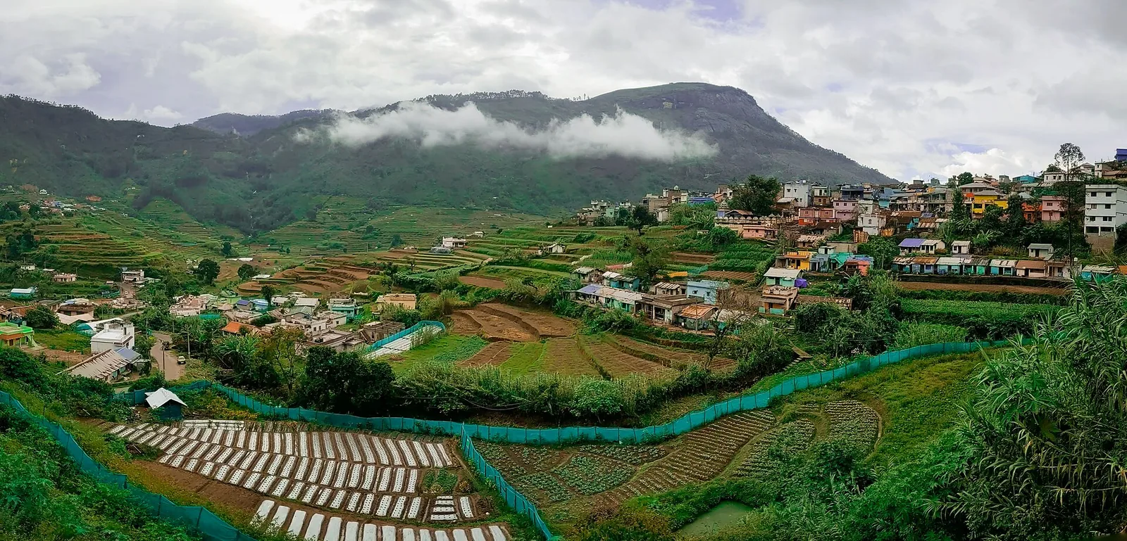
Anamudi Shola National Park is a protected cloud-forest landscape on the Kanthalloor–Vattavada side of Idukki. Start with the Methappu forest check post, the visitor anchor used here, and arrange any forest stay or guided access with Munnar Wildlife Division before setting out.

Anamudi Shola, Munnar
Practical guide

Plan Anamudi Shola

Who's going?Tailor Anamudi Shola to your trip
Typewildlife
AreaMunnar
DistrictIdukki
Best timeOctober to February is the peak visiting…
Time neededReserve half a day for the approach and…
Places to visit27Listed businesses75

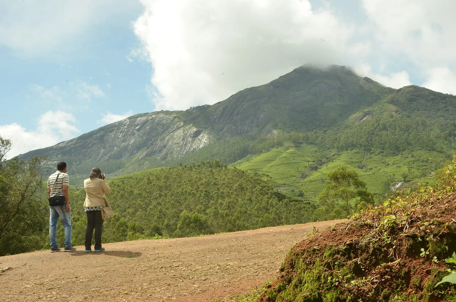
This is a visit to montane forest, its water sources and its carefully managed edges. Anamudi Peak lies in a different national park: booking or reaching Anamudi Shola does not give access to the summit or to Eravikulam’s Rajamala circuit.

The story

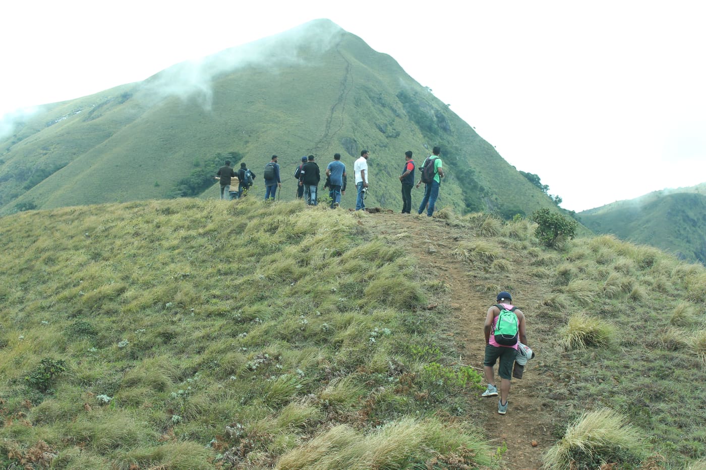
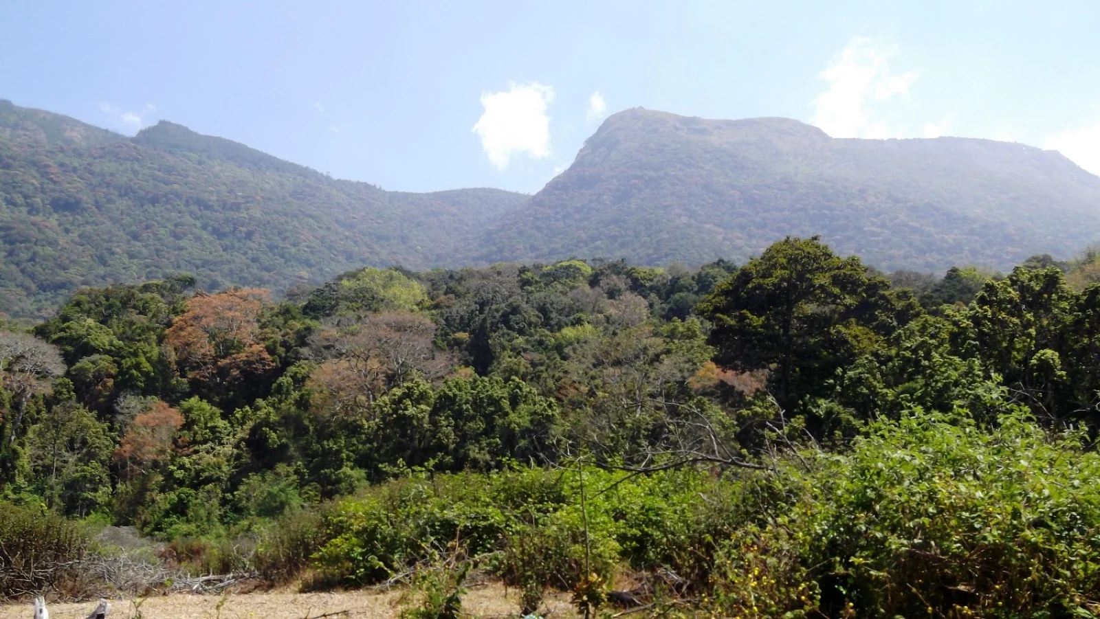
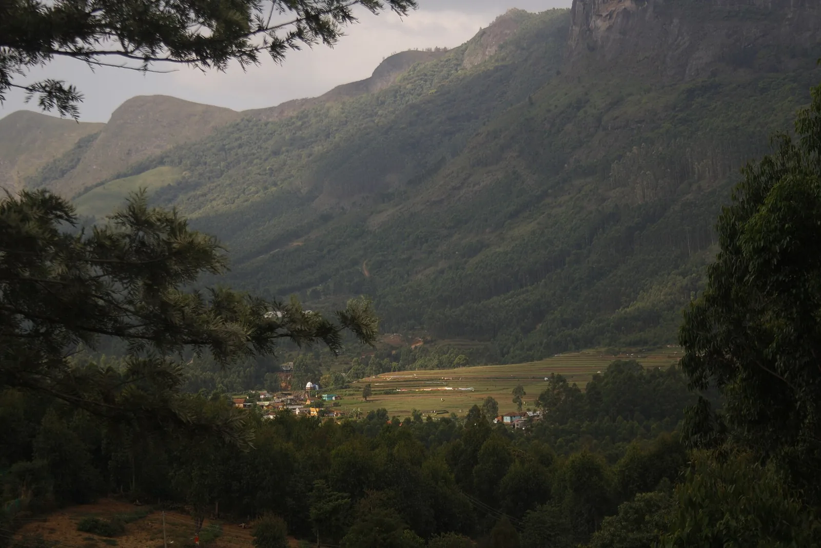
Anamudi Shola rewards attention at the scale of a leaf, a fern crown and a shaded hollow. Its forest is not a uniform green covering: older broad-leaved stands, planted trees and recovering ground meet across a high, folded landscape. The boundaries between them explain much of what the park is protecting.

The story of Anamudi Shola

Three named forests form the park’s historical core: Mannavan Shola, Pullaradi Shola and Idivara Shola. Keeping those names in mind gives Anamudi Shola more definition than the familiar phrase “near Munnar”. The visitor is entering a group of protected high-range forests, approached through different settlements and forest stations, rather than a single summit attraction.

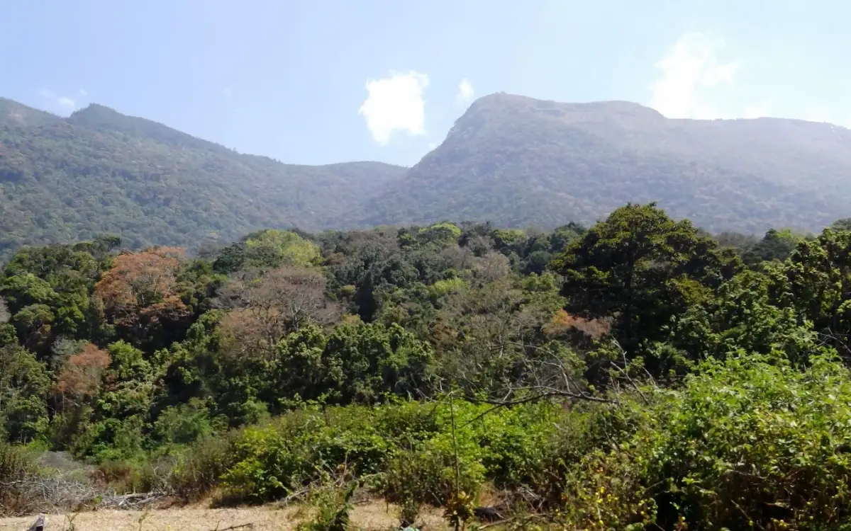
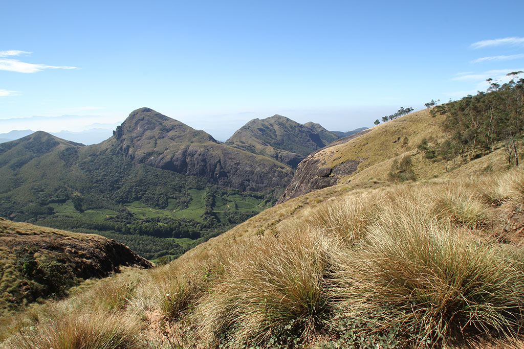
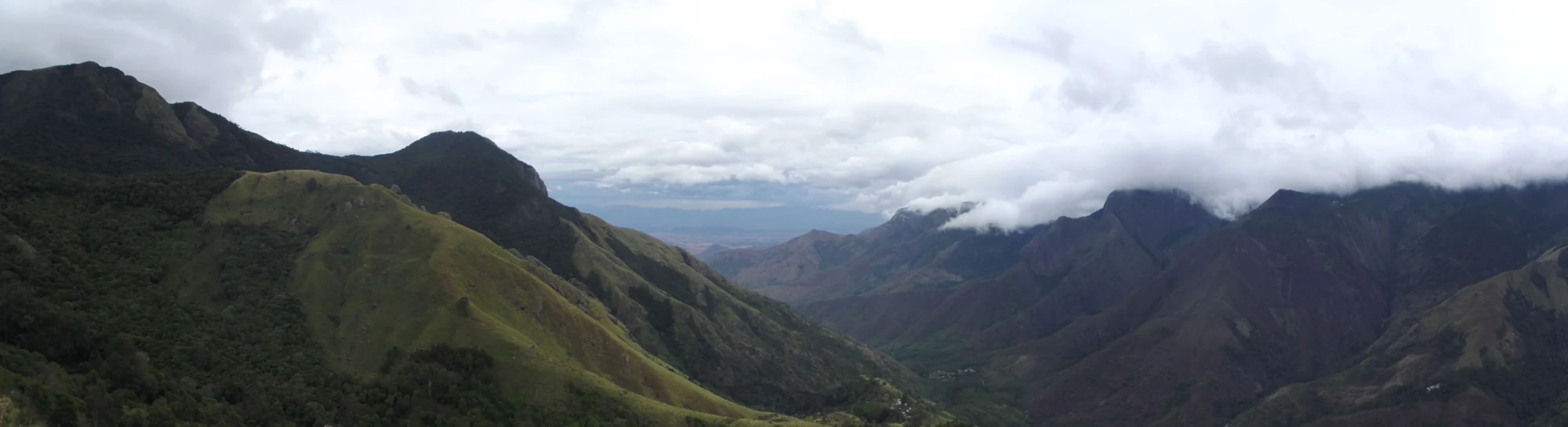
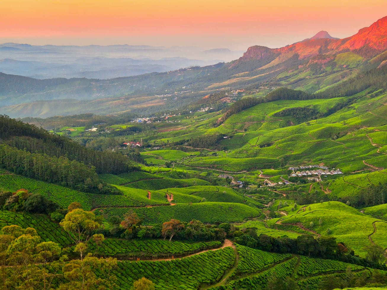
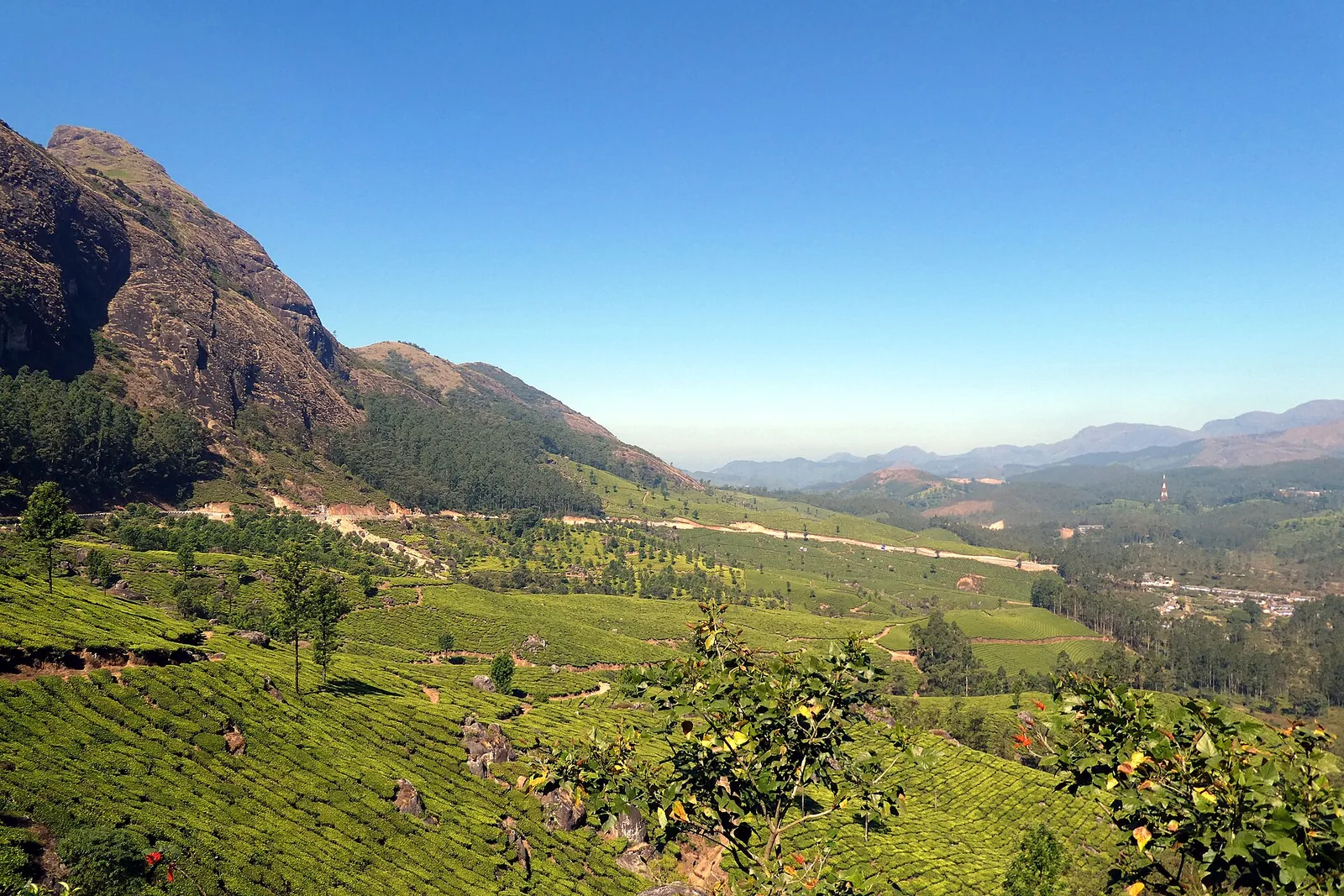
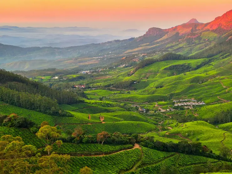
The Forest Department describes the principal habitat as tropical montane cloud forest. Height changes the conditions under which trees grow: the management plan places the landscape between about 1,700 and 2,500 metres. That is a range across the park, not the elevation of every visitor building. Cool air, frequent moisture and sheltered terrain support a forest whose appearance differs sharply from the open tea slopes passed on the approach.

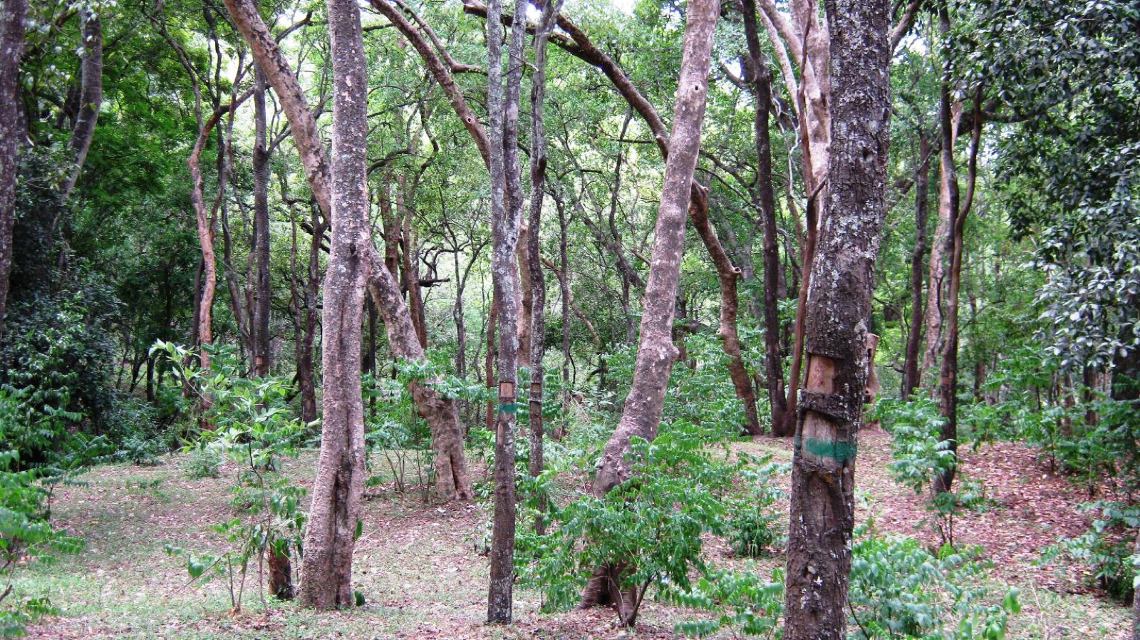
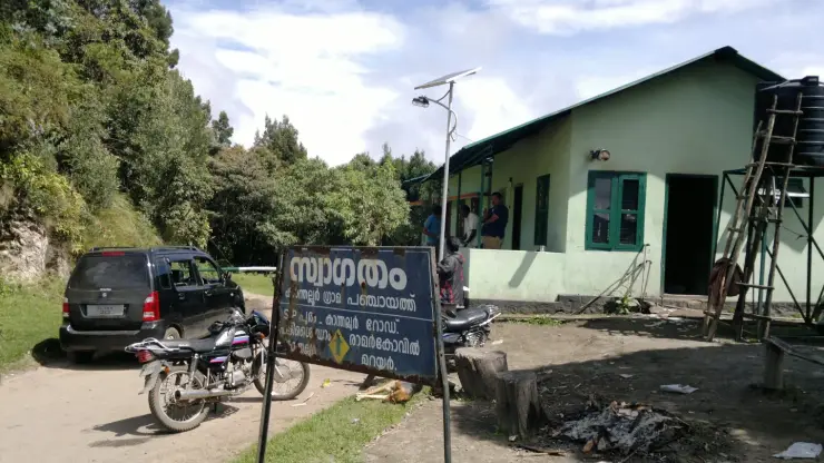
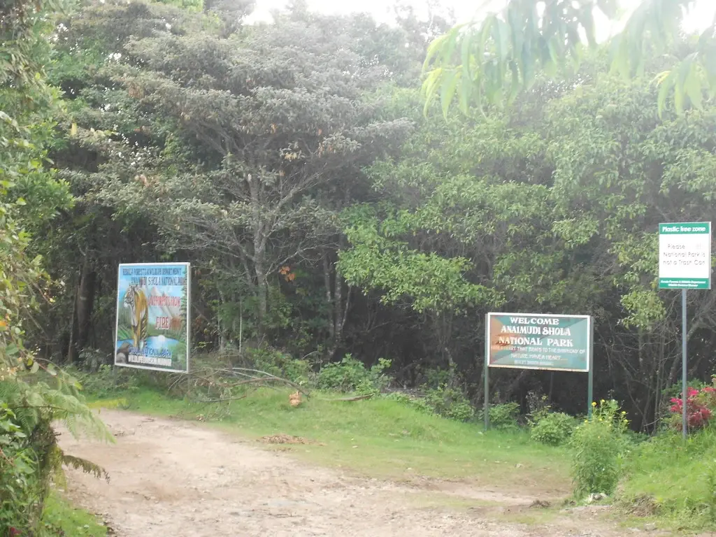
Mannavan Shola’s canopy is worth reading in layers. Branches and leaves occupy several heights, while the sheltered ground supports plants adapted to shade and moisture. A photograph of the entrance shows how abruptly a bright open track can meet a dark stand of trees. The effect is produced by the structure of the vegetation, not by distance from the road: a few steps can change light conditions without taking someone deep into the park.

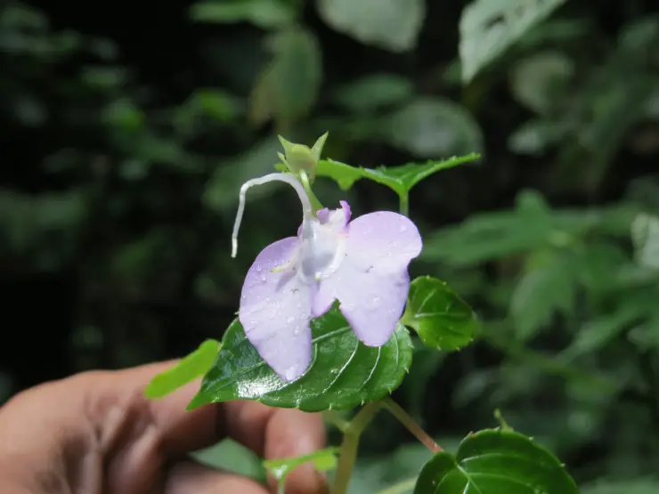
The tree fern Cyathea crinita has a particular place in Anamudi Shola’s conservation story. The management plan identifies the park as an important habitat and treats the fern as its flagship species. This shifts attention away from a checklist of large mammals. A plant with a restricted habitat can explain why a damp patch of forest matters even when no conspicuous animal appears during a visit.

Tree-fern habitat is not a collecting ground. The value lies in the living setting around the plant: shade, soil moisture and the surrounding vegetation. Removing a frond, trampling around a stem for a photograph or clearing the foreground defeats the reason for looking. A guided visit can help a visitor notice small features without turning observation into disturbance.

The forest also has a water history. Its earlier management placed these sholas in a protection working circle to conserve water sources. That purpose predates the national-park title. The landscape’s importance therefore reaches beyond its scenery and beyond the people staying inside it: keeping forested catchments intact was already a management concern when the reserves were administered under Travancore.

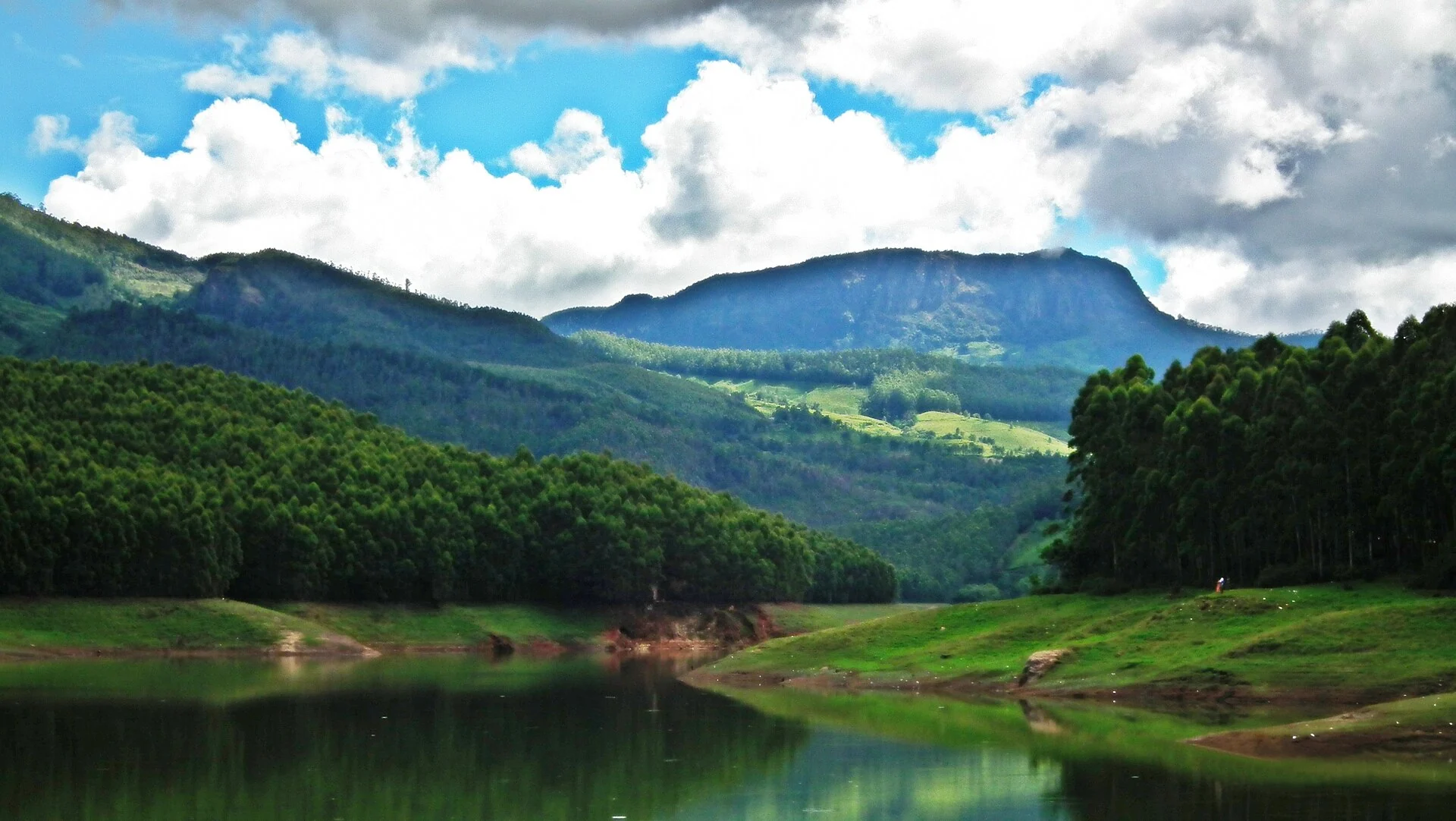
Not every wooded slope here is an old shola. The park’s management plan describes eucalyptus and black-wattle plantations and sets out restoration work in the Pazhathottam area. A planted stand may look green from a vehicle while supporting a different structure from native montane forest. The distinction matters when interpreting an apparently bare restoration patch beside a dense row of trees.

Restoration is a gradual change in habitat, not a promise that every cleared plantation has already become mature forest. The 2020–2030 plan proposes removing selected exotic stands and recovering shola–grassland vegetation. Its targets describe work to be undertaken during that period. They should not be mistaken for a completed transformation visible everywhere on the day of a visit.

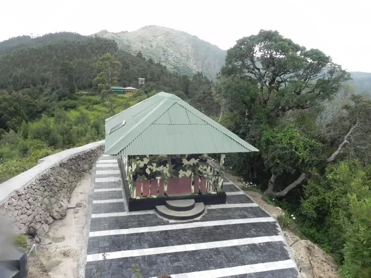
Methappu is one of the park’s named tourism areas. The management plan describes a check post, an information point and forest accommodation here, on the approach from the Kundala side. Perumala is another visitor area associated with a stone house. These are useful names when speaking to the forest office or a driver; “Anamudi” alone can direct a conversation towards the much better-known mountain.

Anamudi Shola also sits beside working settlements and plantations. Its conservation programme involves eco-development committees, including a committee associated with the restoration work. This is a landscape in which protection, local employment and visitor management meet. Choosing an official forest programme supports that arrangement; it does not grant independent access to every forest track or neighbouring farm.

Read the full history of Anamudi Shola 187 more words

History

Mannavan, Pullaradi and Idivara were notified as reserved forests in 1901 under the Travancore administration. Their protection working circle emphasised conservation of water sources rather than timber harvesting. That earlier purpose helps explain why these particular high-altitude forests later became a national park.

The Kerala Government’s December 2003 notification created Anamudi Shola National Park. The management plan distinguishes the notified extent of about 7.5 square kilometres from a much larger area measured by its GIS survey, and calls for boundary reconciliation. Those figures describe different records; neither should be casually used as a precise measure of the visitor area.

The 2020–2030 management plan makes plantation restoration a central task, particularly at Pazhathottam. Its proposed removal of black wattle and eucalyptus continues the shift from managing tree-covered land to recovering a particular native shola–grassland ecosystem.

Why visit

To understand Mannavan Shola as a cloud-forest habitat, with tree ferns and layered evergreen vegetation rather than a single scenic lookout.

To spend longer at a specifically booked forest house in the Methappu or Perumala visitor areas.

To see how native forest, exotic plantations and restoration ground differ within one protected high-range landscape.

What to expect

Highlights

  • Mannavan Shola, with layered evergreen canopy and a distinctive tree-fern habitat.
  • The Methappu visitor area and forest accommodation, separate from the Perumala approach.
  • Native shola and older plantation stands, with restoration proposed for the Pazhathottam area.
Getting there

How to visit

  • Specify Methappu when arranging this visit. Perumala is another named access and accommodation area, and a general Anamudi Shola map search may send a driver towards the wrong side.
  • Ask the Wildlife Division to confirm the particular stay or guided visit and its reporting instructions. A listed room does not establish a daily walk-in trekking departure.
  • Use the permitted visitor area and the route assigned by forest staff. The old road through the park is not an unrestricted shortcut between hill settlements.

Distance by road

  • Kochi107 km
  • Madurai172 km
  • Thiruvananthapuram226 km
  • Coimbatore252 km
  • Kozhikode276 km

Road km to Idukki; ghat roads and traffic vary — allow extra.

Timing

Best time

October to February is the peak visiting season identified in the park management plan. Cloud, rain and cold remain possible; forest access can be suspended during severe weather, fire risk or other official restrictions.

Weather in Anamudi SholaSeasonal guide

Live forecast loads in your browser.

Today at Anamudi Shola
Sunrise6:10 am
Sunset6:13 pm
Golden hour best light5:13 pm–6:13 pm
Blue hour after sunset6:13 pm–6:38 pm
Sun sets toward compass bearingW · 268°
Moon tonight🌖 Waning gibbous · 89%
South-west monsoon. June to September brings heavy rain to Kerala. Trails, falls and ghat roads can be slippery, swollen or closed at short notice, and forest departments sometimes suspend access. Check locally on the day before you travel.

Check the official alert before you travel. Kerala’s beaches, waterfalls and trekking routes close at short notice during heavy rain, and district alert levels change day to day. We do not publish an alert level of our own — read it from the state authority: Kerala State Disaster Management Authority, or the district control room on 1077.

Sun and moon are calculated for this location and shown in IST. Photography windows are the hour around sunrise and sunset; the sunset bearing is degrees clockwise from true north. Moon phase is accurate to about half a day.

Visitor notes

  • Methappu and Perumala are distinct visitor areas in the same protected landscape. Confirm the name on the reservation, especially when arriving from Kanthalloor.
  • The published shola accommodation includes simple forest stays. Expect limited connectivity and arrange arrival transport before leaving the last settlement.
  • The word shola refers to the native montane forest. A straight plantation row and a dense irregular canopy tell different parts of this landscape’s history.
Safety

Good to know

  • Give elephants and other wildlife the road and remain with the assigned guide on a permitted walk. A clear track is not proof that it is open to visitors.
  • Keep fire and smoking out of the forest. The visitor entrance’s own signs identify a plastic-free zone and warn against fire.
Official eco & forest programmes

Experiences around Anamudi Shola

These are official or public-sector eco offerings that match this place, town or forest destination. Confirm availability, permits, tariffs and reporting times with the official operator before travel.

Meesapulimala, Anamudi Shola
trekforest staycamping

Meesapulimala trek through Rhodo Valley

Hard high-altitude trek from the Munnar side via Rhodo Valley, run through KFDC eco-tourism with guide, food and stay options.

KFDC Ecotourism MunnarOvernight with next-day trek
Official source →
Meesapulimala Base Camp, Anamudi Shola
campingforest staytrek

Munnar Base Camp tent stay

KFDC tent stay near Meesapulimala base camp, with campfire, food and optional trek towards Meesapulimala or Rhodo Valley.

KFDC Ecotourism MunnartentOvernight
Official source →
Meesapulimala Base Camp, Anamudi Shola
forest staytrekviewpoint

Munnar Sky Cottage

Lonely cliff-side KFDC cottage facing a waterfall and Anamudi views, paired with Meesapulimala trekking.

KFDC Ecotourism Munnarforest cottageOvernight
Official source →
Rhodo Valley, Anamudi Shola
forest staytrekviewpoint

Munnar Rhodo Mansion

KFDC Rhodo Valley night stay with elephant-trench protection, campfire, food and next-day Meesapulimala climb.

KFDC Ecotourism Munnarforest cottageOvernight
Official source →
Eravikulam National Park, Anamudi Shola
wildlifeviewpoint

Eravikulam National Park visit

High-altitude grassland national park and Nilgiri tahr habitat near Munnar.

Kerala Forest Department
Official source →
Chinnar Wildlife Sanctuary, Anamudi Shola
trekwildlifeforest stay

Chinnar Wildlife Sanctuary eco visit

Dry-forest wildlife sanctuary east of Munnar, listed in Kerala Tourism’s ecotourism inventory.

Kerala Forest Department
Official source →
Pambadum Shola National Park, Anamudi Shola
trekwildlifeforest stay

Pambadum Shola National Park eco visit

Shola forest national park near the Munnar/Vattavada side, listed as an ecotourism destination and programme.

Kerala Forest Department
Official source →
Anamudi Shola, Anamudi Shola
trekwildlife

Anamudi Shola eco visit

Shola-grassland forest landscape in Idukki, included in Kerala Tourism’s official ecotourism destination list.

Kerala Forest Department
Official source →
Marayoor, Anamudi Shola
wildlifeinterpretationtrek

Marayoor sandalwood forest eco visit

Sandalwood and dry-forest landscape on the Munnar-Chinnar side, listed by Kerala Tourism as an ecotourism destination.

Kerala Forest Department
Official source →
Stay · eat · do · rent · see · shop

Stays, food & things to do near Anamudi Shola

Verified hotels, homestays, restaurants, experiences, sights, shops and rentals around Anamudi Shola — commission-free, with direct contact. Filter by what you need.

Eravikulam National Park Official Ticket Booking — Official park ticket booking in MunnarPhoto: Jiths
Top pick
Official park ticket booking · Munnar
Eravikulam National Park Official Ticket Booking
53.4 km · 93 min drive~₹1070–1240 by taxi

Official park ticket booking in Munnar. Eravikulam National Park, Munnar, Kerala 685612 · official booking, national park, Rajamala.

Directions Commission-freeView details
Munnar Wildlife Division Online Booking — Official forest booking office in MunnarPhoto: Jiths
Top pick
Official forest booking office · Munnar
Munnar Wildlife Division Online Booking
43.8 km · 75 min drive~₹890–1040 by taxi

Official Munnar Wildlife Division booking portal for forest stays, trekking and protected-area visitor services.

Directions Commission-freeView details
KDHP Tea Museum Munnar — Tea museum in MunnarPhoto: Ingo Mehling
Top pick
Tea museum · Munnar
KDHP Tea Museum Munnar
45.5 km · 76 min drive~₹920–1070 by taxi

Official Kanan Devan Hills Plantations tea museum at Nullatanni Estate, a short drive from Munnar town.

Directions Commission-freeView details
Luxury resort · Munnar
Blanket Hotel & Spa Munnar
48.9 km · 85 min drive~₹990–1140 by taxi

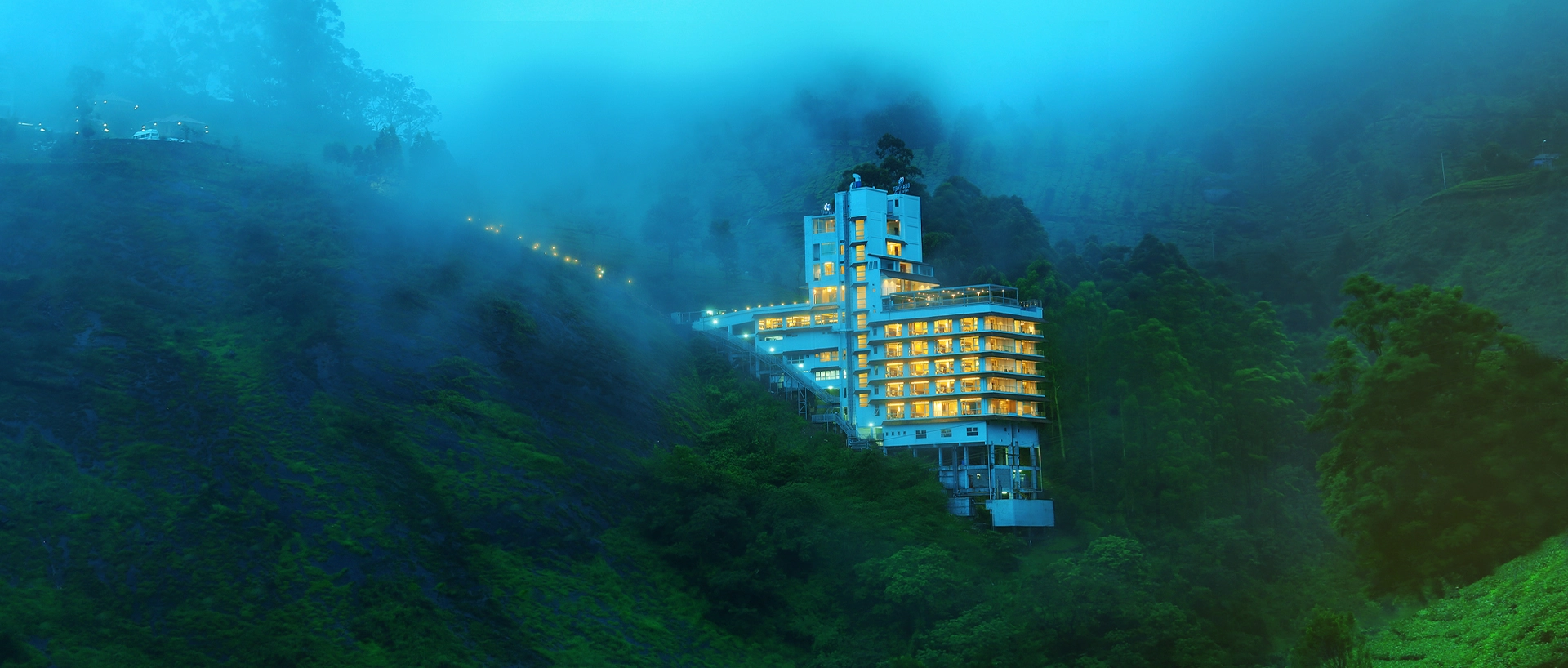
Blanket Hotel & Spa is in Pallivasal overlooking Attukad Waterfalls. Compare its room categories by the view and room arrangement you want; the property offers several different suites. Ask for the total rate, meal inclusions and the transfer from your actual Munnar arrival point.

Directions Commission-freeView details
Tea-estate bungalows · Munnar
KDHP Tea Sanctuary Bungalows

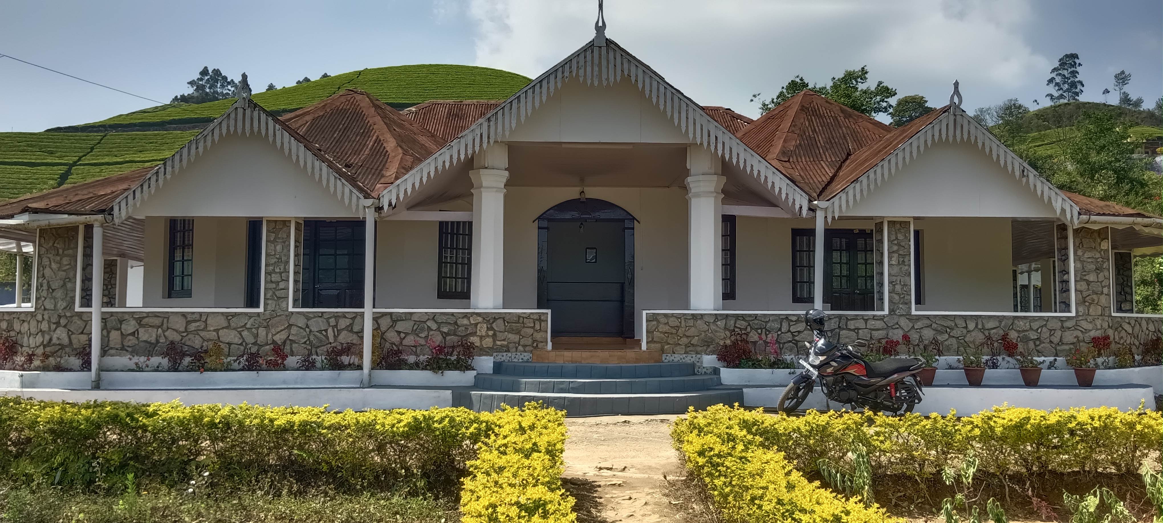
KDHP offers separate tea-estate bungalows around Munnar, including Kalaar, Lake View and Viriparai. Choose the named bungalow before comparing bedrooms and access. KDHP House is the reservations office; obtain arrival directions for the bungalow you book.

Commission-freeView details
Luxury resort · Munnar
Chandy's Windy Woods Munnar
52.2 km · 88 min drive~₹1040–1210 by taxi

Chandy’s Windy Woods is a resort on terraced hill slopes near Munnar. Its hillside setting is a different choice from a town hotel. Compare the room category and view, and check the road transfer before combining your stay with early sightseeing departures.

Directions Commission-freeView details
Luxury resort and spa · Munnar
The Fog Resort & Spa Munnar
58.8 km · 96 min drive~₹1160–1350 by taxi

Luxury resort and spa at Chithirapuram with villas, Ayurveda spa, restaurant and direct reservations.

Directions Commission-freeView details
Luxury hotel and spa · Munnar
Amber Dale Luxury Hotel & Spa Munnar
50.6 km · 84 min drive~₹1020–1180 by taxi

Amber Dale Luxury Hotel & Spa sits on KSEB Tunnel Road at Pallivasal, Munnar. It pairs a restaurant and Ayurveda spa with a conference hall and activities such as cycling, trekking and camp fires.

Directions Commission-freeView details
Luxury hotel and spa · Munnar
The Panoramic Getaway Munnar
55.5 km · 90 min drive~₹1100–1280 by taxi

The Panoramic Getaway is at Chithirapuram, with separate family and adults’ pool areas and room choices including family suites. Compare the room layout and pool access you need, then confirm meals and the current total booking price.

Directions Commission-freeView details
Official budget forest stay · Munnar
Pampadum Shola Forest Stays, Munnar Wildlife
24.4 km · 44 min drive~₹540–640 by taxi

Official budget forest stay in Munnar. Pampadum Shola National Park, booked through Forest Information Centre, Wildlife Warden's Office, Munnar PO, Idukki District, Kerala 685612 · Budget official forest stay · Forest stay, Pampadum Shola, Official booking.

Directions Commission-freeView details
Official trekking booking · Munnar
Munnar Wildlife Trekking Official Booking
43.8 km · 75 min drive~₹890–1040 by taxi

Official Munnar Wildlife Division trekking information and booking contact. Forest Information Centre, Wildlife Warden's Office, Munnar PO, Idukki District, Kerala 685612 · trekking, official booking, forest.

Directions Commission-freeView details
Luxury boutique spa resort · Munnar
SpiceTree Munnar
63.4 km · 98 min drive~₹1250–1440 by taxi

SpiceTree Munnar is on Muttukad–Periakanal Road at Nadukkurissu, in the Chinnakkanal area. Its pool villas, cottages with a Jacuzzi and honeymoon suites with a plunge pool are different room choices. Specify the category and inclusions when requesting a quote.

Directions Commission-freeView details
Mid-range town hotel · Munnar
Grand Plaza Munnar
45.0 km · 76 min drive~₹920–1060 by taxi

Eco boutique hotel with 39 rooms overlooking tea plantations. Set on M.S.A Road close to the heart of Munnar.

Directions Commission-freeView details
Resort · Munnar
Misty Mountain Resort Munnar
51.6 km · 84 min drive~₹1030–1200 by taxi

Misty Mountain Resort offers standard, valley-view and deluxe room categories near Munnar. Decide whether the view or room arrangement is your priority when comparing quotes. Ask the hotel which category is available for your dates and how meals and sightseeing transfers are charged.

Directions Commission-freeView details
Premium nature resort · Munnar
Rivulet Resort Munnar
57.8 km · 95 min drive~₹1150–1330 by taxi

Premium Chithirapuram-side nature resort with restaurant, activities and direct booking evidence. Rivulet Resort, Chithirapuram P O, Munnar, Kerala 685565 · Premium nature resort · Resort, Chithirapuram, Nature stay.

Directions Commission-freeView details
Premium tea-valley resort · Munnar
Tea Valley Resort Munnar
49.3 km · 84 min drive~₹990–1150 by taxi

Tea Valley Resort is on Bisonvalley Road at Pothamedu, Pallivasal. Choose it for a stay among tea plantations rather than a town-centre address. Ask about the final road approach, room category and meal arrangements when comparing the full cost of a Munnar holiday.

Directions Commission-freeView details
Hotel restaurants · Munnar
Desi Aromas & Underground Restaurants, The Panoramic Getaway
55.5 km · 90 min driveIndian, Kerala, Mexican, Italian, Cafe, Multi-cuisine~₹1100–1280 by taxi

Two named restaurants at The Panoramic Getaway: Desi Aromas for Indian cuisine and Underground for grill specialties.

Directions Commission-freeView details
Adventure tour operator · Munnar
Kalypso Adventures Munnar Trekking

Adventure operator with Munnar trekking itineraries, cycling and walking holidays in Kerala. Trekking, adventure operator, Munnar trekking.

Directions Commission-freeView details
Ayurveda spa · Munnar
Blanket Ayurveda Spa Munnar
48.9 km · 85 min drive~₹990–1140 by taxi

In-house Ayurveda and wellness center at Blanket Hotel & Spa near Attukad Waterfalls. Ayurveda, spa, wellness.

Directions Commission-freeView details
Ayurvedic spa · Munnar
Tattvam Ayurvedic Spa, The Panoramic Getaway
55.5 km · 90 min drive~₹1100–1280 by taxi

Ayurvedic spa in Munnar. The Panoramic Getaway, Chithirapuram, Munnar, Kerala 685565 · Short therapies from Rs. 1199; Ayurveda packages from Rs. 4750; taxes extra · spa, ayurveda, wellness.

Directions Commission-freeView details
Ayurveda spa · Munnar
Amber Dale Ayurveda & Spa
50.6 km · 84 min drive~₹1020–1180 by taxi

Ayurveda and spa facility at Amber Dale Luxury Hotel & Spa in Pallivasal. Ayurveda, spa, wellness.

Directions Commission-freeView details
Spa · Munnar
Bodhi Tree Spa at The Fog Munnar
58.6 km · 95 min drive~₹1160–1350 by taxi

Spa in Munnar. Spa, wellness, Chithirapuram.

Directions Commission-freeView details
Hotel restaurant · Munnar
Grand Spices Restaurant, Grand Plaza Munnar
45.0 km · 76 min drive~₹920–1060 by taxi

Multi-cuisine restaurant at Grand Plaza Munnar on M. S. A Road. Restaurant, multi-cuisine, hotel dining.

Directions Commission-freeView details
Restaurant · Munnar
Alaska Multi Cuisine Restaurant at The Fog Munnar
58.8 km · 96 min drive~₹1160–1350 by taxi

Restaurant in Munnar. Restaurant, multi-cuisine, Kerala food.

Directions Commission-freeView details

Book with the place itself. India’s cyber-crime coordination centre warned in April 2025 that convincing copies of hotel and pilgrimage booking sites are being pushed through sponsored search and social ads, taking payment for rooms the property never hears about. Every listing here links to the business’s own contact details and its own Google or Bing profile — we take no commission and sit in nobody’s payment path. If a booking page reached you through an ad, check the address bar against the property’s own site before you pay. Fraud can be reported on cybercrime.gov.in or on 1930.

Ranked guides

Top experiences around Anamudi Shola

32 more places around Munnar. Open a guide to plan the visit and onward journey.

hill stationMunnar

Kerala’s most famous hill station, known for tea estates, viewpoints and cool weather.

wildlifeEravikulam National Park

High-altitude grassland park, Nilgiri tahr habitat and access point for Anamudi views.

viewpointAnamudi Peak

The highest peak in South India, viewed through Eravikulam/Rajamala access contexts near Munnar.

wildlifeRajamala

Rajamala is the designated tourism and awareness zone of Eravikulam National Park near Munnar. It is not a separate unrestricted summit trek or the whole national park.

museumTea Museum

Tea-history museum in Munnar linked with the plantation story of the high ranges.

damMattupetty Dam

33.0 km · 58 min drive

Reservoir, boating and lake-view stop on the Munnar-Mattupetty sightseeing circuit, usually paired with Echo Point and Kundala.

viewpointEcho Point

35.5 km · 64 min drive

Popular Munnar lakeside viewpoint on the Mattupetty-Kundala route, useful for short stops, photos and family sightseeing.

damKundala Lake

10.6 km · 22 min drive

High-range lake and dam stop beyond Mattupetty on the Top Station route.

viewpointTop Station

23.8 km · 48 min drive

A border-highland viewpoint in Theni, Tamil Nadu, normally approached through Munnar, Mattupetty and Kundala; named for the former tea-transport terminus, with a separate stepped viewpoint walk.

trekMeesapulimala trek

8.0 km · 18 min drive

Popular high-altitude Western Ghats trek, usually booked through official eco-tourism channels.

viewpointKolukkumalai

High tea-estate sunrise viewpoint reached by jeep from the Munnar side.

wildlifeChinnar Wildlife Sanctuary

Dry-forest wildlife sanctuary on the Marayoor-Udumalpet side of Idukki.

heritageMarayoor

26.9 km · 44 min drive

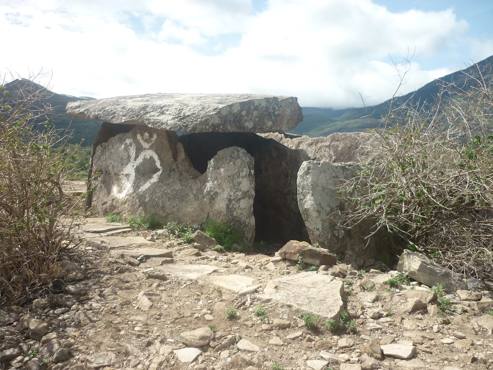
High-range village known for natural sandalwood forests, dolmens and sugarcane jaggery.

wildlifePambadum Shola National Park

25.8 km · 47 min drive

Pampadum Shola National Park protects high-elevation forest beside the Top Station–Vattavada road. The Top Station forest check post is the reporting anchor here; forest stays and guided walks require their own confirmed arrangements.

waterfallLakkam Waterfalls

28.7 km · 53 min drive

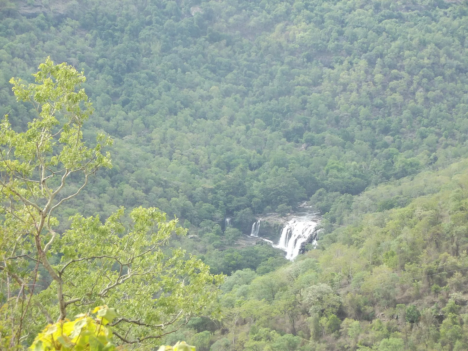
Waterfall stop on the Munnar-Marayoor route, usually paired with Eravikulam and Marayoor days.

waterfallAttukad Waterfalls

Waterfall area near Munnar commonly used for short scenic drives and monsoon views.

viewpointLockhart Gap

The pass itself on the Munnar–Bodimettu highway, where the ridge drops away east — and the lay-by the Chokramudi Peak trek reports from, 51 m from the forest counter. A second, busier viewpoint signed "Lockhart Gap Road View Point" sits 1.7 km east.

damAnayirankal Dam

Anayirankal is a KSEB earth-and-rockfill dam and reservoir in the Panniyar hydel system near Chinnakanal and Santhanpara. The map identifies the published hydel visitor-centre marker; boating is not currently assured.

waterfallPower House Waterfalls

The Muthirapuzha spread sideways over bare rock at 796 m, below the tailrace of Pallivasal — the first hydroelectric station Kerala built. Free, unmanaged and very quiet, down about a kilometre of steep narrow lane. ⚠ Not the Chinnakanal falls that Kerala Tourism describes under this name, 21 km east.

viewpointBlossom Hydel Park

The Kerala State Electricity Board’s riverside flower park on the Munnar–Aluva road, 3.3 km below Munnar town and 1.2 km from the KSRTC stand at Old Munnar. It runs along the east bank of the Muthirapuzha immediately above the 1944 R. A. Headworks weir that feeds Pallivasal, Kerala’s first hydroelectric station — which is what the "hydel" in the name means. Open daily 09:15 to 20:15 with tickets sold online by Kerala Hydel Tourism Centre.

hill stationDevikulam / Sita Devi Lake

Hill-station and lake landscape near Munnar associated with Devikulam and Sita Devi, best planned as a quieter high-range side trip.

waterfallNayamakad Waterfalls

Nyayamakad, also called Nayamakad, is the waterfall and tea-estate landscape on the Munnar–Rajamala approach. The map uses the identifiable Nyamakad roadside stream-view base, not a waterfall lip, pool entrance or estate walking permit.

trekChokramudi Peak trek

Forest Department peak trek from the counter at Gap Road, 13.2 km from Munnar: a mapped 2.09 km path climbing about 460 m of grassland and shola to a summit whose altitude four sources disagree about.

trekKurinjimala Sanctuary trek

33.5 km · 63 min drive

The 32 km² sanctuary above Kottakamboor and Vattavada, notified in 2006 for one plant — Strobilanthes kunthiana — with two walks and two stays in the Forest Department's own brochure and nothing bookable online.

trekThoovanam Falls trek

32.7 km · 53 min drive

Forest Department guided walk in Chinnar Wildlife Sanctuary, from the Alampetty counter on SH17 down the river to the Thoovanam waterfall. Kerala Tourism contradicts itself on which river it follows: its own destination article says the Pambar, and the page selling this programme says the Chinnar.

trekChinnar Dolmen Culture trek

Forest Department culture trek in Chinnar Wildlife Sanctuary to prehistoric dolmen (muniyara) sites, run with local tribal Eco-Development Committees. Report at the Alampetty guide stand on the Marayoor–Udumalpet road (SH17), 6.4 km beyond Marayoor.

trekVasyappara Trekking and Camping

Forest Department trekking-and-camping programme at Vasyappara in Chinnar Wildlife Sanctuary — an overnight stay in a mud hut on a hill crest, published by the department as the Chinnar Valley Safari Trail. Report at 3 pm at the Chinnar check post on the Marayoor–Udumalpet road, not at the Alampetty counter 10.2 km back.

hill stationKanthalloor

4.0 km · ~10 min by auto

High-range village near Marayoor often called the “Kashmir of Kerala”, known for terraced farms of apples, oranges, strawberries and vegetables at around 1,800 m.

hill stationVattavada

6.6 km · ~17 min by auto

Cool high-altitude farming village beyond Munnar near the Tamil Nadu border, known for terraced vegetable and fruit cultivation, Kurinji slopes and quiet valley views.

viewpointPothamedu Viewpoint

A road-accessible viewpoint in Pothamedu south of Munnar, looking across planted hills and wooded valleys. The viewpoint marker is separate from the wider village and from private plantation walking routes.

wildlifeMathikettan Shola National Park

Mathikettan Shola protects a remnant of native Cardamom Hills forest in Idukki. Visits are arranged through the Forest Department, with distinct Pethotty and Choondal approaches; a reservoir viewpoint is not a park-entry permit.

viewpointChathurangapara Viewpoint

A wind-turbine ridge in Chathurangappara, Udumbanchola taluk, with views towards Theni’s cultivated plains; reached from the Munnar–Kumily road, with an exposed final hill approach.

Roampedia is commission-free — own or know a stay, eatery, guide or shop near Anamudi Shola? List it and it appears here once verified.

Add a nearby business
Before you go

Anamudi Shola — at a glance

TimingsVisit only under the reporting arrangements confirmed by forest staff. Accommodation check-in times differ by building and do not establish public opening hours for the whole park
Best timeThe management plan identifies October–February as peak season. Choose the visit around confirmed access and safe road conditions, with mist and cool weather possible even outside the monsoon.

Entry: Confirm the charge for the specific permitted visit with Munnar Wildlife Division. Published accommodation prices are for named stays, not a general day-entry or trekking ticket

Photography: Photograph from the permitted visitor route. Leave plants and their immediate surroundings undisturbed, and allow wildlife to move away without pursuit. Ask forest staff about any equipment-specific permission before bringing a drone or arranging a commercial shoot.

Booking: Use the Forest Department booking catalogue for the separately named Methap Log House or Methap Stone House, and obtain the reporting instructions for the selected unit. Confirm any guided walk separately.

Parking: At Methappu, follow the forest staff’s parking directions and leave the barrier and forest-vehicle passage clear.

Getting here

How to reach Anamudi Shola

  • ✈︎ By air Cochin International Airport serves the western approach through Munnar. Give the driver the booked forest-house or check-post name, rather than Anamudi Peak, and allow the reservation’s arrival window to determine the travel plan.
  • 🚆︎ By train Aluva is a practical rail gateway for a journey through Munnar. Continue by road to the correct forest entrance; the station-to-Munnar leg and the onward high-range approach are separate parts of the journey. There is no railway at Methappu.
  • 🚗︎ By road Approach Methappu from the Munnar–Kundala side using the route confirmed by the forest office. For a Perumala reservation, arrange the Kanthalloor-side approach instead. The map identifies Methappu check post and should not be used to force a through-route across Mannavan Shola.
  • 🚌︎ By bus Use Munnar or Kanthalloor as the transport connection appropriate to the booked entrance. No scheduled bus departure to a Methappu visitor programme is confirmed here. Arrange the final vehicle and return pickup before leaving the settlement, particularly for an overnight stay.
Getting around

Getting around Anamudi Shola

Methappu and Perumala are separate approaches. Confirm the booked base before arranging the final taxi leg. Arrange a return pickup or overnight vehicle plan in advance because forest connectivity is limited.

Getting back

Arrange the return transfer with the forest stay or driver before arrival; the booked unit and its approach determine the collection point.

Do

Things to do

  • Join a specifically authorised forest walk and ask the guide to distinguish Mannavan Shola vegetation from neighbouring plantation stands.
  • Observe the forest edge’s changing light, canopy layers and fern habitat without leaving the assigned route.
  • Stay in a named forest house if its approach, meals and reporting arrangements suit the journey.
  • Learn about the park’s water-source protection and the restoration programme at Pazhathottam, without assuming that every restoration area is open to visitors.
Included

What’s included

  • Access and any guiding are limited to the programme specifically confirmed by the Forest Department.
  • A forest-house reservation and a trekking arrangement should be confirmed separately.
Plan

Good to know

  • Use the names Methappu and Perumala when arranging transport; the broad name Anamudi is easily confused with the peak.
  • A shola visit can be rewarding in mist because canopy and understory details remain visible when distant views disappear.
  • Ask which plantation-restoration features can be seen from the permitted route rather than seeking out work areas independently.
Facilities

On site

  • The management plan records information and accommodation facilities at Methappu and a stone house at Perumala; the current catalogue should be used to identify the exact stay.
  • Munnar Wildlife Division warns of minimal facilities and limited mobile or internet connectivity in its forest accommodation.
  • Settle meals and drinking-water arrangements with the booked property; do not assume an independent restaurant operates at the check post.
Stay safe

Safety

  • Keep to the route opened by the forest staff; do not follow patrol tracks or use the park as a road shortcut.
  • Give wildlife priority and stay with the guide. Elephant movement can change access independently of the weather.
  • Keep flames and smoking out of the visitor area and carry litter back as required by the posted plastic-free rules.
Getting around Anamudi Shola
From the entrance
Methappu checkpost and the separately named Methappu forest accommodation, reached on the confirmed operator approach.
Step-free access
A forest check post may be reachable by vehicle, but that does not make the forest paths or accommodation step-free. Ask about the actual building entrance, toilet and distance from parking when reserving. No universally accessible trail is established by the visitor information checked.

Checked 6 September 2026 against source 1. Conditions change and surfaces vary with weather — if step-free access is essential, confirm with the site before you travel.

Eat nearby

What to eat in Munnar

Meals belong to the approach settlement or the booked forest-house arrangement. Methappu is a reporting point, not a town restaurant strip.

Explore food in Munnar →
01

Before the Kundala-side approach

Finish a meal at an established stop on the approach and keep the agreed reporting time in view.

02

At a forest house

Confirm exactly which meals the reservation includes and when they are served; room availability alone does not establish catering.

03

For a Perumala booking

Use the Kanthalloor-side plan for meals and transport, instead of arranging a pickup at Methappu.

Nearby

What’s near Anamudi Shola

hill stationKanthalloor

High-range village near Marayoor often called the “Kashmir of Kerala”, known for terraced farms of apples, oranges, strawberries and vegetables at around 1,800 m.

4.0 km · ~10 min by auto · straight line
hill stationVattavada

Cool high-altitude farming village beyond Munnar near the Tamil Nadu border, known for terraced vegetable and fruit cultivation, Kurinji slopes and quiet valley views.

6.6 km · ~17 min by auto · straight line
trekMeesapulimala trek

Popular high-altitude Western Ghats trek, usually booked through official eco-tourism channels.

8.0 km · 18 min drive
damKundala Lake

High-range lake and dam stop beyond Mattupetty on the Top Station route.

10.6 km · 22 min drive
viewpointTop Station

A border-highland viewpoint in Theni, Tamil Nadu, normally approached through Munnar, Mattupetty and Kundala; named for the former tea-transport terminus, with a separate stepped viewpoint walk.

23.8 km · 48 min drive
wildlifePambadum Shola National Park

Pampadum Shola National Park protects high-elevation forest beside the Top Station–Vattavada road. The Top Station forest check post is the reporting anchor here; forest stays and guided walks require their own confirmed arrangements.

25.8 km · 47 min drive
heritageMarayoor

High-range village known for natural sandalwood forests, dolmens and sugarcane jaggery.

26.9 km · 44 min drive
waterfallLakkam Waterfalls

Waterfall stop on the Munnar-Marayoor route, usually paired with Eravikulam and Marayoor days.

28.7 km · 53 min drive
trekThoovanam Falls trek

Forest Department guided walk in Chinnar Wildlife Sanctuary, from the Alampetty counter on SH17 down the river to the Thoovanam waterfall. Kerala Tourism contradicts itself on which river it follows: its own destination article says the Pambar, and the page selling this programme says the Chinnar.

32.7 km · 53 min drive
damMattupetty Dam

Reservoir, boating and lake-view stop on the Munnar-Mattupetty sightseeing circuit, usually paired with Echo Point and Kundala.

33.0 km · 58 min drive
trekKurinjimala Sanctuary trek

The 32 km² sanctuary above Kottakamboor and Vattavada, notified in 2006 for one plant — Strobilanthes kunthiana — with two walks and two stays in the Forest Department's own brochure and nothing bookable online.

33.5 km · 63 min drive
viewpointEcho Point

Popular Munnar lakeside viewpoint on the Mattupetty-Kundala route, useful for short stops, photos and family sightseeing.

35.5 km · 64 min drive

All 27 places to visit in Munnar →

Walking and driving times are real routed distances, except the few marked “straight line”, which are direct-line estimates and will read short. Fare figures are estimates from Kerala’s notified auto/taxi tariff and exclude waiting and night charges. Routing: © openrouteservice.org by HeiGIT | Map data © OpenStreetMap contributors

On the map

Where Anamudi Shola is

Good to know

Anamudi Shola — frequently asked

Is Anamudi Shola the same as Anamudi Peak?

No. Anamudi Shola National Park is the Mannavan–Pullaradi–Idivara forest landscape. Anamudi Peak is in Eravikulam National Park. The two visits have different approaches and access arrangements.

Which entrance does this Anamudi Shola map show?

The map uses the Forest Department’s published Methappu check-post coordinate. Perumala is a separate visitor area. Use the reporting instructions for your particular reservation if it names a different entrance.

Can I book a trek online at Anamudi Shola?

The Forest Department’s current booking catalogue lists Methap Log House and Methap Stone House. A forest-house reservation does not by itself include a daily trekking departure; arrange any permitted walk with Munnar Wildlife Division.

What is Mannavan Shola known for?

It is one of the three forests making up the park and an important habitat for the tree fern Cyathea crinita. Its montane canopy and water-source protection are more useful ways to understand it than expecting a summit climb.

Can I drive through Anamudi Shola to Kanthalloor?

Do not plan an unrestricted forest shortcut. The management plan records restrictions on the road through Mannavan Shola. Confirm the permitted approach for Methappu or Perumala and follow the check-post instructions.

Are the forest houses like hotels in Munnar?

They are simple forest accommodation with limited connectivity. Confirm food, arrival transport and the exact building when reserving. A distant town hotel’s facilities should not be assumed at a forest house.

How do I reach Anamudi Shola?

Methappu checkpost and the separately named Methappu forest accommodation, reached on the confirmed operator approach.

How much time do I need for Anamudi Shola?

Reserve half a day for the approach and an agreed short forest visit. An overnight booking is a separate plan with its own reporting time; do not add an assumed trek to a room reservation.

What should I know before visiting Anamudi Shola?

Methappu and Perumala are distinct visitor areas in the same protected landscape. Confirm the name on the reservation, especially when arriving from Kanthalloor.

When is the best time to visit Anamudi Shola?

October–February is the park’s peak season. For a forest-house stay, first match the available unit to the approach you can reach before its check-in deadline.

What are the entry fee and timings at Anamudi Shola?

Choose the named forest house or permitted visit before checking its charge. Methappu accommodation, Perumala accommodation and a separately arranged walk are different reservations.

What else is near Anamudi Shola?

Nearby you can pair Kanthalloor (4.0 km), Vattavada (6.6 km), Meesapulimala trek (8.0 km), Kundala Lake (10.6 km).

Read before you go

Anamudi Shola guides, stories & itineraries

Stories & history of Anamudi Shola

Written about Anamudi Shola itself — its history, its legends and the arguments about them.

Around Munnar

These reads cover nearby destinations, each with its own arrival point and visit arrangements.

In-depth guides to Munnar

Written about Munnar as a whole rather than about Anamudi Shola — its history, its streets, and how to spend a day in it.

Kerala-wide guides & itineraries

Route-level itineraries and practical guides for the rest of Kerala.

See all 153 Idukki guides & stories →

Image credits

Photographs: Fotokannan (CC BY-SA 3.0), Kerala Forest and Wildlife Department (© Kerala Forest and Wildlife Department), Vinayaraj (CC BY-SA 4.0), Niyas8001 (CC BY-SA 4.0), Athulvis (CC BY-SA 4.0), Jan J George (CC BY-SA 4.0), Sarathgks92 (CC BY-SA 4.0), Jiths (CC BY 2.0), Jaseem Hamza (CC BY 3.0). Wikimedia Commons.