What to expect
Highlights
- Viewpoint stop at Echo Point
- Photography and landscape views
- Good add-on to nearby town or hill routes
Popular Munnar lakeside viewpoint on the Mattupetty-Kundala route, useful for short stops, photos and family sightseeing.
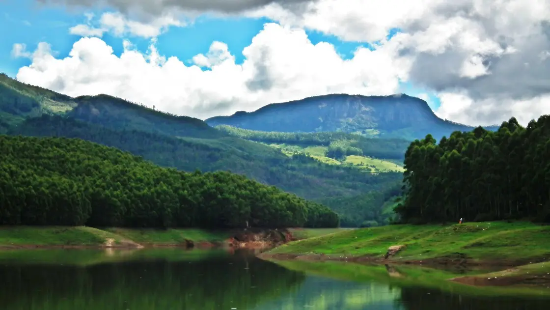
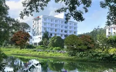
Set on a bend of the high-range road that climbs from Mattupetty towards Top Station, Echo Point is one of Munnar’s best-loved roadside halts — a lakeside clearing where the hills lean in so close that a shout thrown across the water comes back to you, clear and unhurried, a heartbeat later. Ringed by tea-clad slopes and shola forest and often wrapped in drifting mist, it pairs a genuinely fun natural curiosity with the kind of soft, blue-green Western Ghats scenery that makes people slow down, get out of the car and simply stand for a while.
The draw is in the name. Walk down to the water’s edge, cup your hands, and call out across the lake — and the sound travels over the still surface, strikes the wall of hills rising on the far side, and bounces straight back to you. On a quiet morning, before the tour buses arrive, the return is startlingly crisp; children shriek their own names and wait, grinning, for the valley to answer. It is the simplest of pleasures, and it is exactly why the place earned both its reputation and its name.
There is nothing supernatural about it, and the honest explanation only makes it more satisfying. An echo is just sound reflecting off a distant hard surface. Here the geography lines up perfectly: a broad sheet of calm water in the foreground, and a steep, near-continuous ridge of forested hills a few hundred metres across the lake. Your voice carries cleanly over the water with little to absorb it, hits the far slope, and reflects back. Because the hills sit far enough away, the returning sound arrives a fraction of a second after you stop speaking — long enough for your ear to register it as a separate echo rather than part of your own voice.
The setting does the rest of the work. Echo Point sits in a natural amphitheatre where, local guides like to say, three of the high range’s catchment slopes — the Mudrapuzha, Nallathanni and Kundala drainages — gather towards the valley floor. Whether or not you count ranges, the effect is real: hills curve around the lake on more than one side, so on a good day you can send your call in more than one direction and hear it answered from more than one.
The water itself belongs to the great chain of high-range reservoirs and streams that feed the Mattupetty and Kundala catchment — the same tea-country lakes that make this stretch of road so photogenic. The surface is usually glass-still in the early hours, mirroring the tea rows and the sky, before the day’s breeze ruffles it. Pedal boats, kayaks and rowing boats wait at a small boating jetty, and a slow paddle to the middle of the lake is the classic way to take in the surrounding slopes from the water.
Mist is part of the character here, not a flaw. Because Echo Point sits high and beside water, cloud and fog roll in and out through much of the cooler season, sometimes swallowing the far hills entirely — at which point the echo comes back out of a soft grey wall you cannot even see. When the cloud lifts, the slopes reappear layer by layer in every shade of green, and photographers who waited are rewarded with the classic blue-mountain Munnar view.
The point is also caught up in Munnar’s most famous botanical event. The surrounding grassy slopes are Neelakurinji country: once roughly every twelve years the Strobilanthes kunthiana shrub blooms in a single vast flush and washes the hills in violet-blue. In an off year there is nothing to see of it, but in a Kurinji year this whole high-range corridor, Echo Point included, becomes a pilgrimage for flower-watchers from across the country.
Echo Point has no ancient monument and no dynastic story — its history is the history of the Munnar high range itself, a landscape that was remote hill and grassland forest until the second half of the nineteenth century. What turned these mountains into a named, mapped, visited place was tea.
From the 1870s and 1880s, British planters pushed up into the Kannan Devan hills above the Muthirapuzha valley and began clearing the higher slopes for tea. The estates that grew here — later consolidated under the Kannan Devan Hills Produce and, in time, Tata — laid down the roads, the plantation villages and the whole working geography of modern Munnar. The lane that runs past Echo Point is one of those estate-and-tourism roads, threading from Munnar town up through Mattupetty towards the frontier viewpoint of Top Station.
The lakes that give this route its beauty are largely engineered. Through the twentieth century the high range was dammed for hydro-electricity and water storage — Mattupetty and Kundala among the best known — turning stream valleys into the calm reservoirs that now mirror the tea slopes. Echo Point’s own sheet of water sits within this catchment landscape, which is why boating and lakeside halts became part of the Munnar circuit at all.
Top Station, at the far end of the road, adds the older layer. In the early twentieth century it was the upper terminus of an ingenious ropeway-and-tramway system that carried tea down the escarpment towards the plains of the Tamil country — the ‘top’ station of that aerial link. Today the road that once served the plantations serves visitors, and Echo Point has grown from an unremarkable bend in it into a ticketed, jetty-equipped stop with parking, boats and roadside stalls, its fame spread almost entirely by word of mouth and the simple delight of hearing the hills talk back.
It delivers a genuine, repeatable natural phenomenon that everyone from toddlers to grandparents enjoys — you shout, the hills answer, and no ticket is needed to appreciate why.
The lakeside setting is quintessential Munnar: calm water in the foreground, tea-carpeted and shola-clad hills behind, and mist that comes and goes through the cooler months.
Boating on the lake — pedal boat, kayak or rowing boat — lets you take the whole amphitheatre in from the water, and is the single most popular thing to do here beyond the echo itself.
It sits perfectly on the Mattupetty–Kundala–Top Station sightseeing road, so it slots into a half-day loop with Mattupetty Dam, Kundala Lake and the Top Station viewpoint without any detour.
In a Neelakurinji year the surrounding slopes turn violet-blue, making this high-range corridor one of the most sought-after spots in South India for that once-in-twelve-years bloom.
It is an easy, low-effort stop — a short walk from the car park to the water — that rewards families, casual travellers and photographers alike, with woodland walks and birdlife for those who want to linger.
Road km to Idukki; ghat roads and traffic vary — allow extra.
Clear post-monsoon and winter days are best; mist can block views in hill areas.
Live forecast loads in your browser.
Check the official alert before you travel. Kerala’s beaches, waterfalls and trekking routes close at short notice during heavy rain, and district alert levels change day to day. We do not publish an alert level of our own — read it from the state authority: Kerala State Disaster Management Authority, or the district control room on 1077.
Sun and moon are calculated for this location and shown in IST. Photography windows are the hour around sunrise and sunset; the sunset bearing is degrees clockwise from true north. Moon phase is accurate to about half a day.
These are official or public-sector eco offerings that match this place, town or forest destination. Confirm availability, permits, tariffs and reporting times with the official operator before travel.

Hard high-altitude trek from the Munnar side via Rhodo Valley, run through KFDC eco-tourism with guide, food and stay options.
Official source →
KFDC tent stay near Meesapulimala base camp, with campfire, food and optional trek towards Meesapulimala or Rhodo Valley.
Official source →
Lonely cliff-side KFDC cottage facing a waterfall and Anamudi views, paired with Meesapulimala trekking.
Official source →
KFDC Rhodo Valley night stay with elephant-trench protection, campfire, food and next-day Meesapulimala climb.
Official source →
High-altitude grassland national park and Nilgiri tahr habitat near Munnar.
Official source →
Dry-forest wildlife sanctuary east of Munnar, listed in Kerala Tourism’s ecotourism inventory.
Official source →
Shola forest national park near the Munnar/Vattavada side, listed as an ecotourism destination and programme.
Official source →
Shola-grassland forest landscape in Idukki, included in Kerala Tourism’s official ecotourism destination list.
Official source →
Sandalwood and dry-forest landscape on the Munnar-Chinnar side, listed by Kerala Tourism as an ecotourism destination.
Official source →Verified hotels, homestays, restaurants, experiences, sights, shops and rentals around Echo Point — commission-free, with direct contact. Filter by what you need.
Two named restaurants at The Panoramic Getaway: Desi Aromas for Indian cuisine and Underground for grill specialties.
Multi-cuisine restaurant at Grand Plaza Munnar on M. S. A Road. Restaurant, multi-cuisine, hotel dining.
Restaurant in Munnar. Restaurant, multi-cuisine, Kerala food.
Two in-house multi-cuisine restaurants at Misty Mountain Resort, open from 7:30 AM to 10 PM. Restaurant, multi-cuisine, Pallivasal.
Cliff-edge a la carte restaurant above the valley at Chinnakanal. Fresh-cooked dishes with complimentary candle-light dinner arrangements.
Mattupetty-side restaurant in Munnar. Maduppetty, Idukki, Kerala · Restaurant, Mattupetty, Munnar route.
Broadbean Restaurant Munnar is a Kerala Tourism-listed restaurant record for Munnar food planning, useful for travellers who want a source-backed restaurant option rather than only resort dining. Restaurant, Food stop, Kerala Tourism record.
Café on Grahamsland Road, Mattupetty, Munnar, Kannan Devan Hills, Kerala 682612 in Munnar.
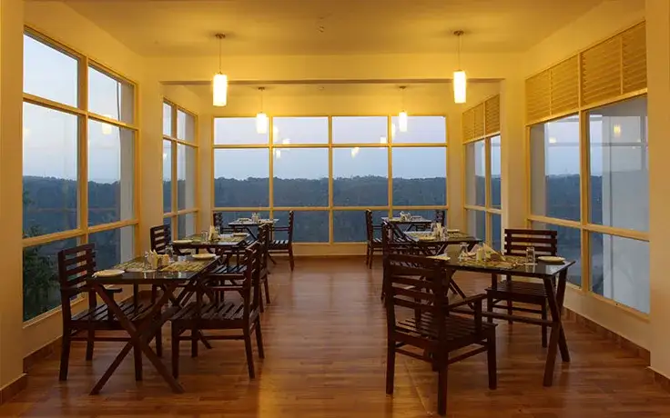
Glass-panelled fine-dining restaurant overlooking the Munnar hills at Chithirapuram. A live counter serves Malabar fish curry alongside global plates.
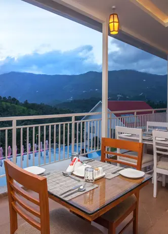
In-house restaurant at Pothamedu serving buffet breakfast and dinner. Panoramic valley views with daily service from 6am to 9:30pm.
Resort restaurant at Anachal spanning six cuisines from tandoori to satvik Jain. Highlights include biryani, dim sum and saffron-scented Arabic rice.
The Springvand restaurant at Trivers on Chithirapuram's Power House Road. Six cuisines served daily from 7:30am to 10pm.
Book with the place itself. India’s cyber-crime coordination centre warned in April 2025 that convincing copies of hotel and pilgrimage booking sites are being pushed through sponsored search and social ads, taking payment for rooms the property never hears about. Every listing here links to the business’s own contact details and its own Google or Bing profile — we take no commission and sit in nobody’s payment path. If a booking page reached you through an ad, check the address bar against the property’s own site before you pay. Fraud can be reported on cybercrime.gov.in or on 1930.
Find food, accommodation and activities across Munnar. Browse the guides for places to eat, stay and explore along your route.
32 more places around Munnar. Open a guide to plan the visit and onward journey.

17.1 km · 28 min drive
Kerala’s most famous hill station, known for tea estates, viewpoints and cool weather.

High-altitude grassland park, Nilgiri tahr habitat and access point for Anamudi views.

The highest peak in South India, viewed through Eravikulam/Rajamala access contexts near Munnar.
Rajamala is the designated tourism and awareness zone of Eravikulam National Park near Munnar. It is not a separate unrestricted summit trek or the whole national park.


5.9 km · 11 min drive
Reservoir, boating and lake-view stop on the Munnar-Mattupetty sightseeing circuit, usually paired with Echo Point and Kundala.
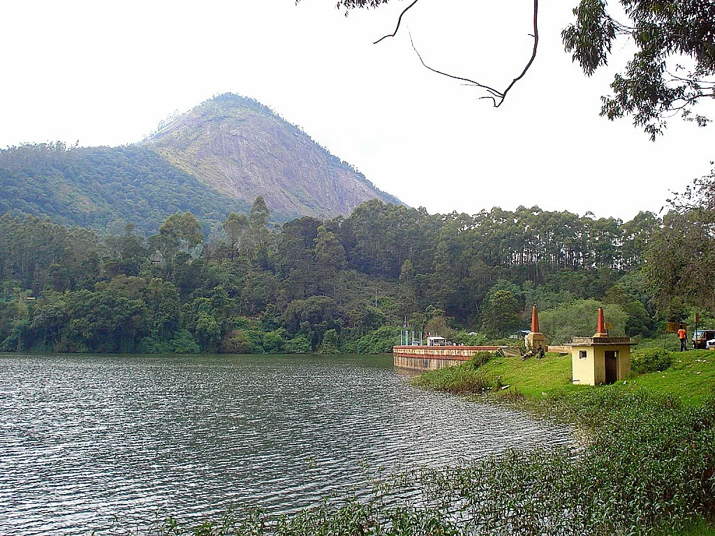
28.3 km · 49 min drive
High-range lake and dam stop beyond Mattupetty on the Top Station route.
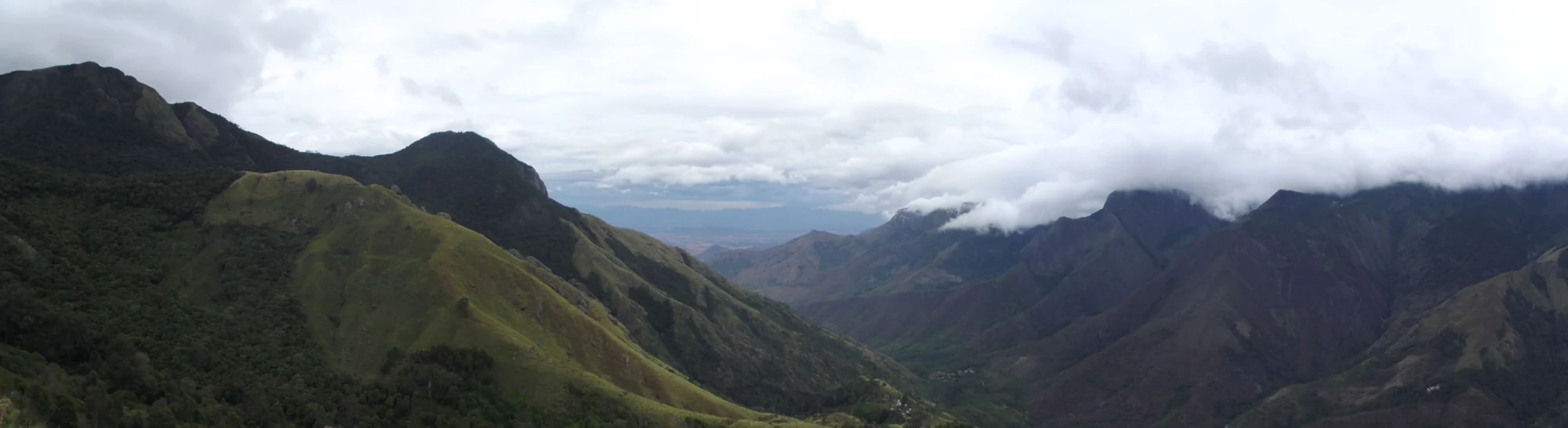
27.6 km · 47 min drive
A border-highland viewpoint in Theni, Tamil Nadu, normally approached through Munnar, Mattupetty and Kundala; named for the former tea-transport terminus, with a separate stepped viewpoint walk.
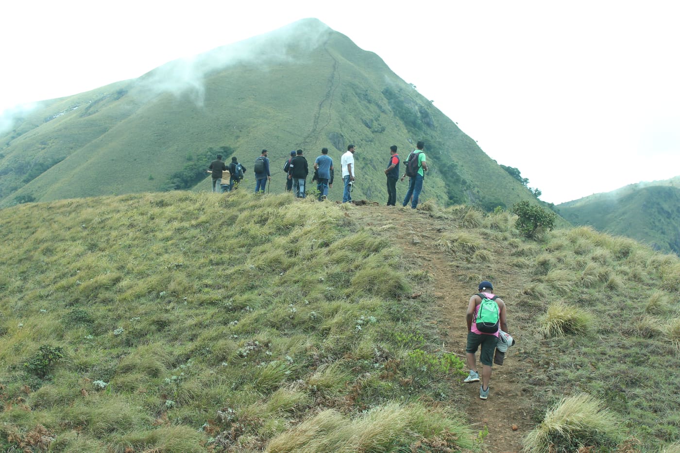
27.0 km · 47 min drive
Popular high-altitude Western Ghats trek, usually booked through official eco-tourism channels.
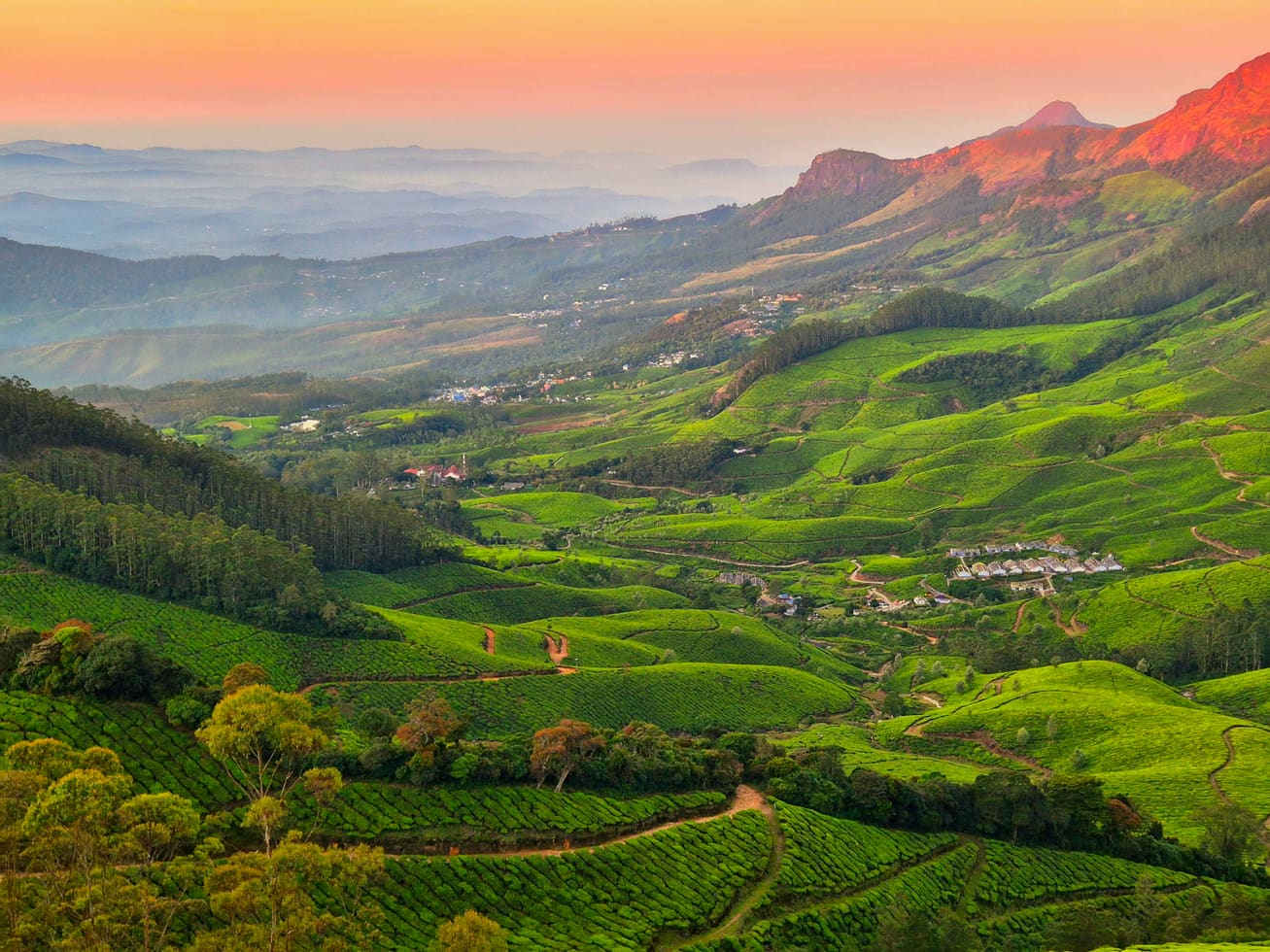
41.4 km · 59 min drive
High tea-estate sunrise viewpoint reached by jeep from the Munnar side.
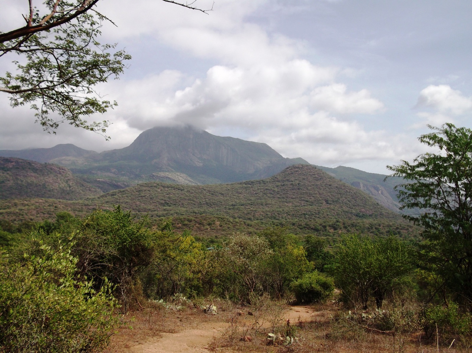
Dry-forest wildlife sanctuary on the Marayoor-Udumalpet side of Idukki.
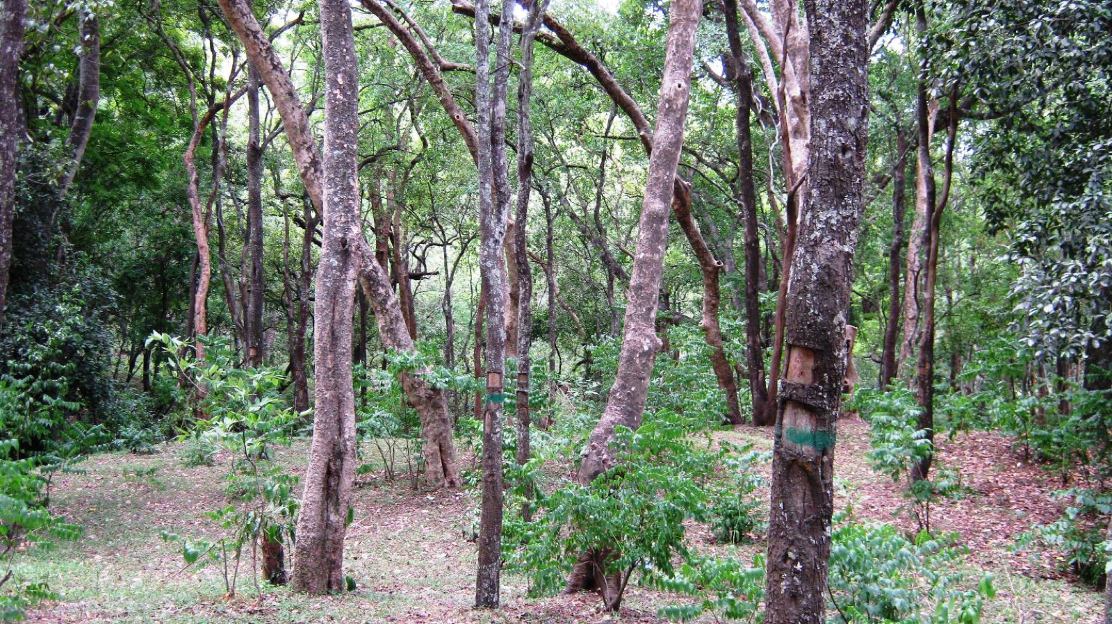
High-range village known for natural sandalwood forests, dolmens and sugarcane jaggery.
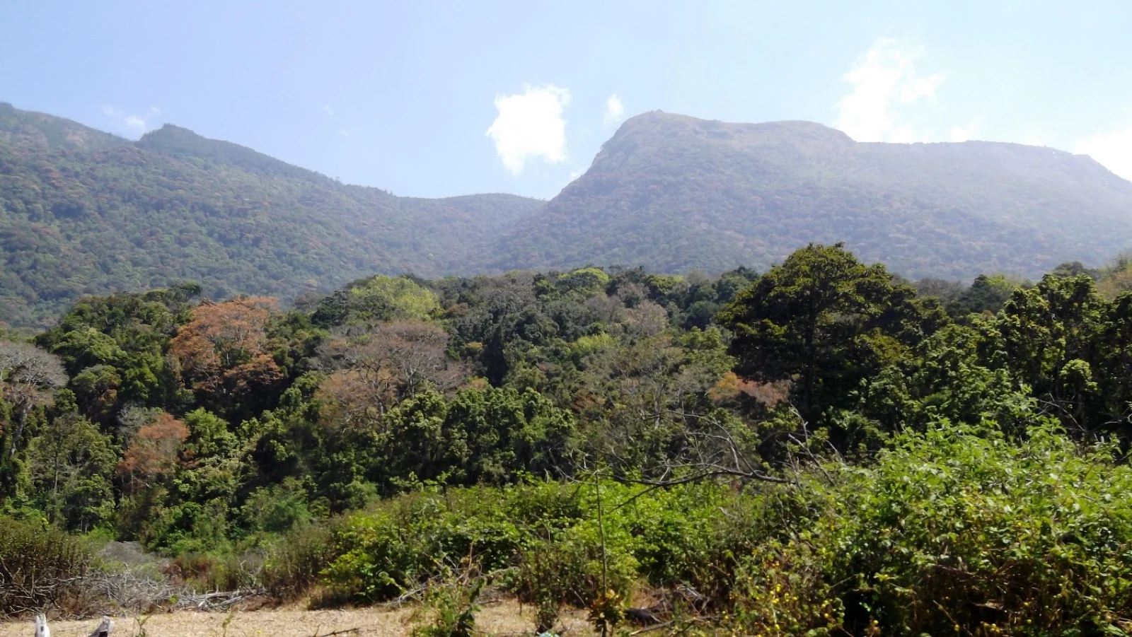
Pampadum Shola National Park protects high-elevation forest beside the Top Station–Vattavada road. The Top Station forest check post is the reporting anchor here; forest stays and guided walks require their own confirmed arrangements.
35.5 km · 64 min drive
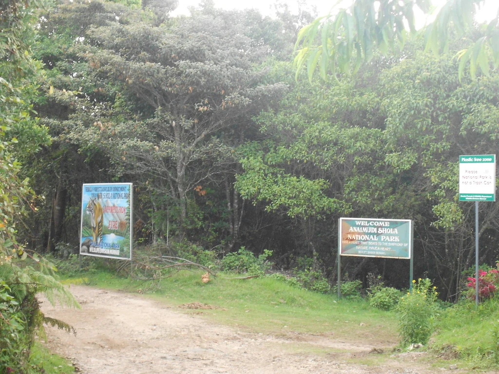
Anamudi Shola National Park protects Mannavan, Pullaradi and Idivara shola forests in the Kanthalloor–Vattavada high ranges. Methappu is the visitor anchor on this page; this is not Anamudi Peak or the Rajamala visitor area.

Waterfall stop on the Munnar-Marayoor route, usually paired with Eravikulam and Marayoor days.

Waterfall area near Munnar commonly used for short scenic drives and monsoon views.
26.7 km · 40 min drive
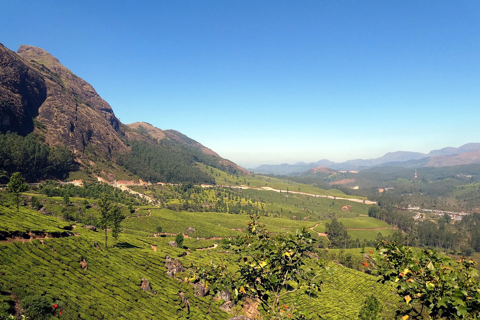
The pass itself on the Munnar–Bodimettu highway, where the ridge drops away east — and the lay-by the Chokramudi Peak trek reports from, 51 m from the forest counter. A second, busier viewpoint signed "Lockhart Gap Road View Point" sits 1.7 km east.

Anayirankal is a KSEB earth-and-rockfill dam and reservoir in the Panniyar hydel system near Chinnakanal and Santhanpara. The map identifies the published hydel visitor-centre marker; boating is not currently assured.

The Muthirapuzha spread sideways over bare rock at 796 m, below the tailrace of Pallivasal — the first hydroelectric station Kerala built. Free, unmanaged and very quiet, down about a kilometre of steep narrow lane. ⚠ Not the Chinnakanal falls that Kerala Tourism describes under this name, 21 km east.

19.2 km · 30 min drive
The Kerala State Electricity Board’s riverside flower park on the Munnar–Aluva road, 3.3 km below Munnar town and 1.2 km from the KSRTC stand at Old Munnar. It runs along the east bank of the Muthirapuzha immediately above the 1944 R. A. Headworks weir that feeds Pallivasal, Kerala’s first hydroelectric station — which is what the "hydel" in the name means. Open daily 09:15 to 20:15 with tickets sold online by Kerala Hydel Tourism Centre.

21.5 km · 35 min drive
Hill-station and lake landscape near Munnar associated with Devikulam and Sita Devi, best planned as a quieter high-range side trip.

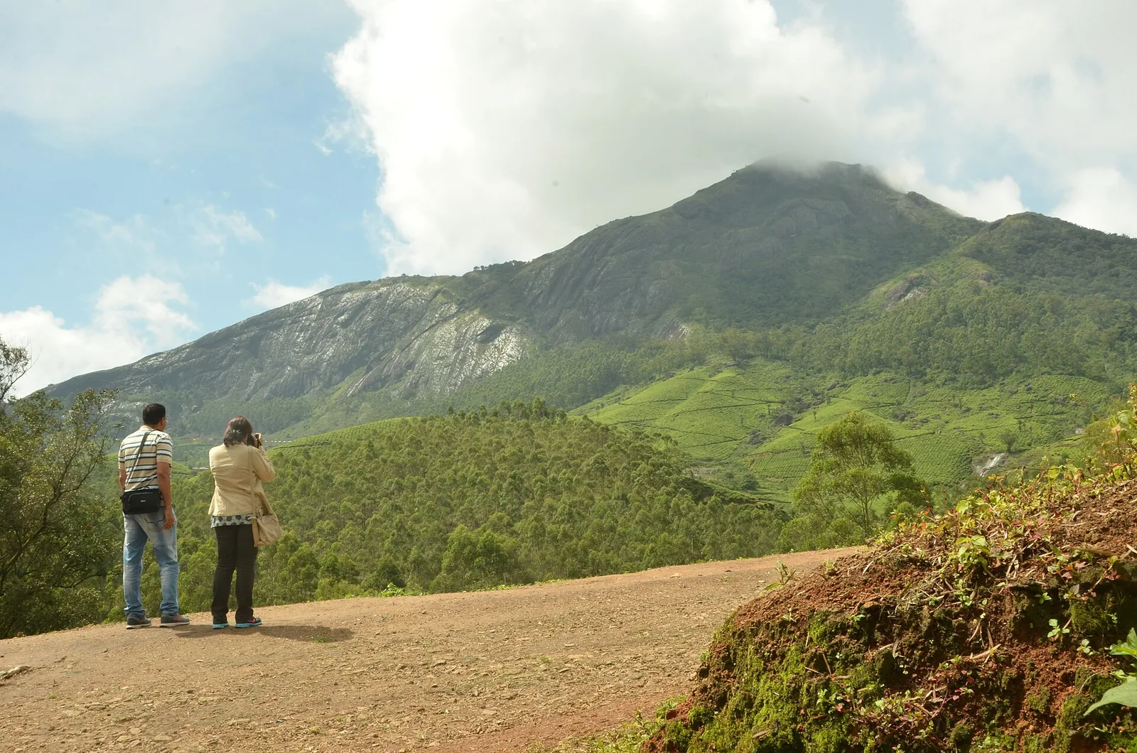
Nyayamakad, also called Nayamakad, is the waterfall and tea-estate landscape on the Munnar–Rajamala approach. The map uses the identifiable Nyamakad roadside stream-view base, not a waterfall lip, pool entrance or estate walking permit.
26.7 km · 40 min drive
Forest Department peak trek from the counter at Gap Road, 13.2 km from Munnar: a mapped 2.09 km path climbing about 460 m of grassland and shola to a summit whose altitude four sources disagree about.
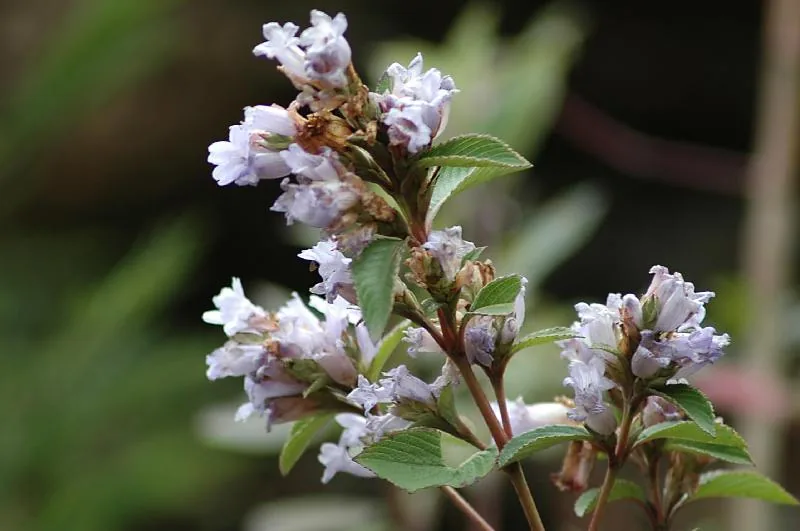
The 32 km² sanctuary above Kottakamboor and Vattavada, notified in 2006 for one plant — Strobilanthes kunthiana — with two walks and two stays in the Forest Department's own brochure and nothing bookable online.
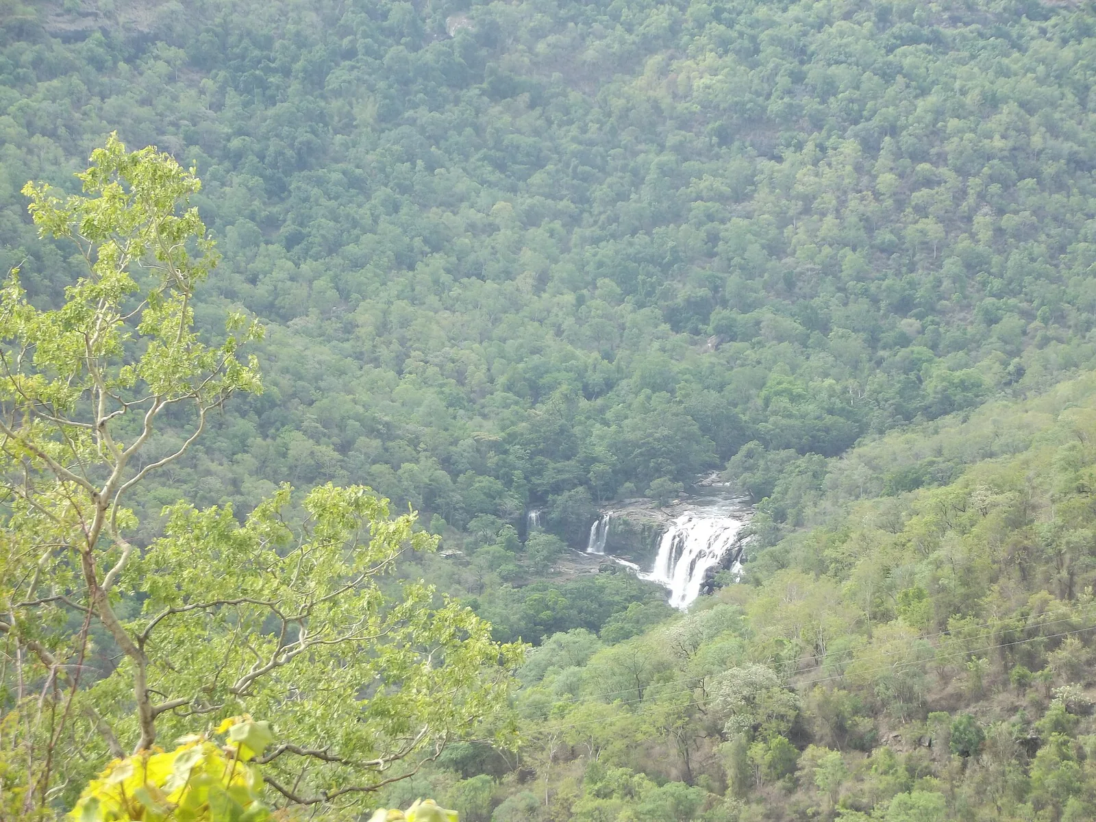
Forest Department guided walk in Chinnar Wildlife Sanctuary, from the Alampetty counter on SH17 down the river to the Thoovanam waterfall. Kerala Tourism contradicts itself on which river it follows: its own destination article says the Pambar, and the page selling this programme says the Chinnar.
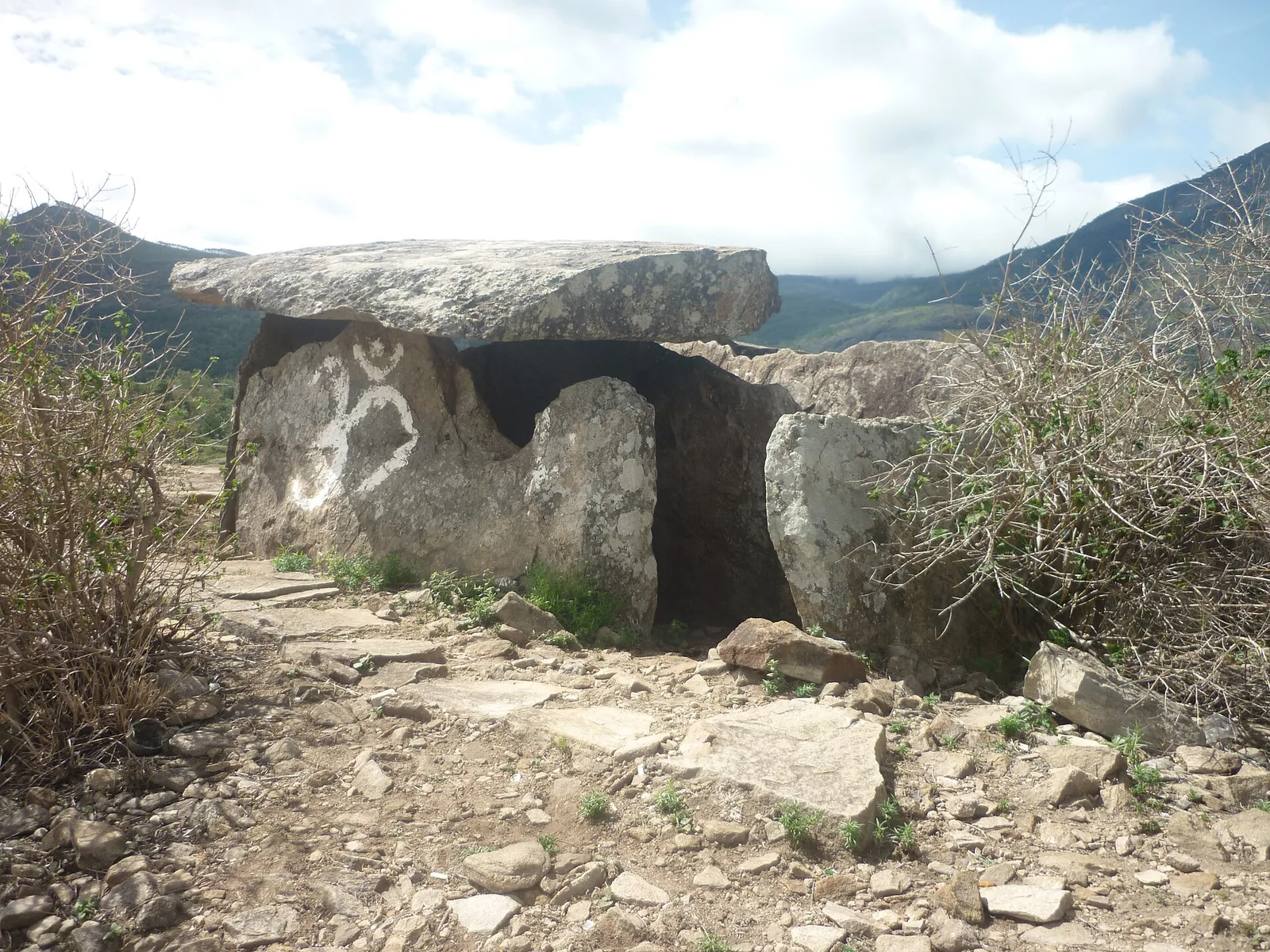
Forest Department culture trek in Chinnar Wildlife Sanctuary to prehistoric dolmen (muniyara) sites, run with local tribal Eco-Development Committees. Report at the Alampetty guide stand on the Marayoor–Udumalpet road (SH17), 6.4 km beyond Marayoor.
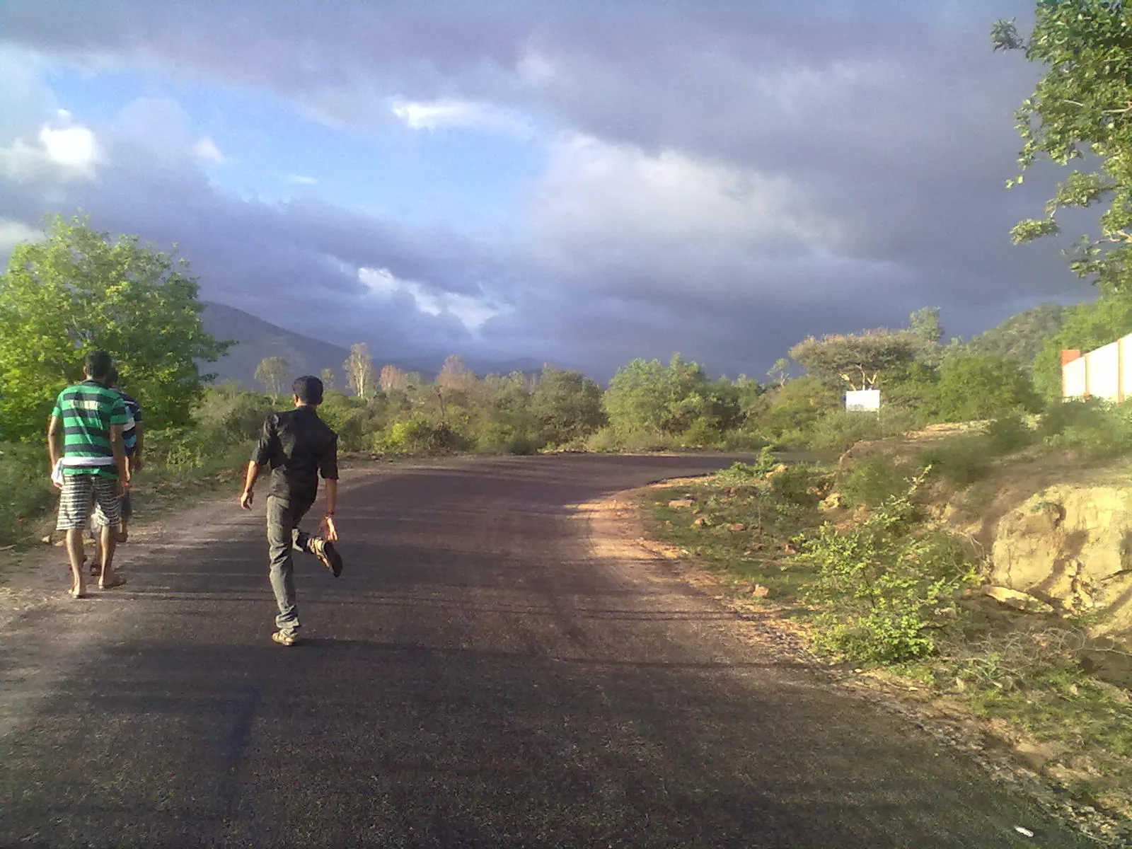
Forest Department trekking-and-camping programme at Vasyappara in Chinnar Wildlife Sanctuary — an overnight stay in a mud hut on a hill crest, published by the department as the Chinnar Valley Safari Trail. Report at 3 pm at the Chinnar check post on the Marayoor–Udumalpet road, not at the Alampetty counter 10.2 km back.
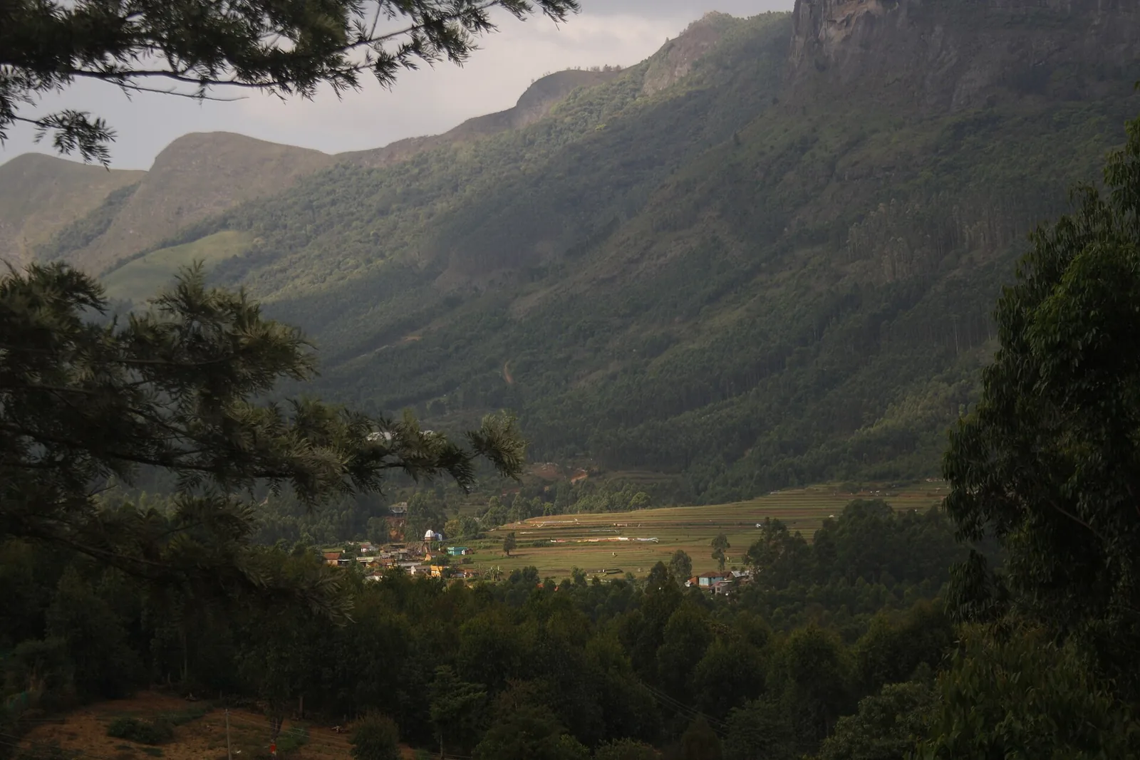
High-range village near Marayoor often called the “Kashmir of Kerala”, known for terraced farms of apples, oranges, strawberries and vegetables at around 1,800 m.
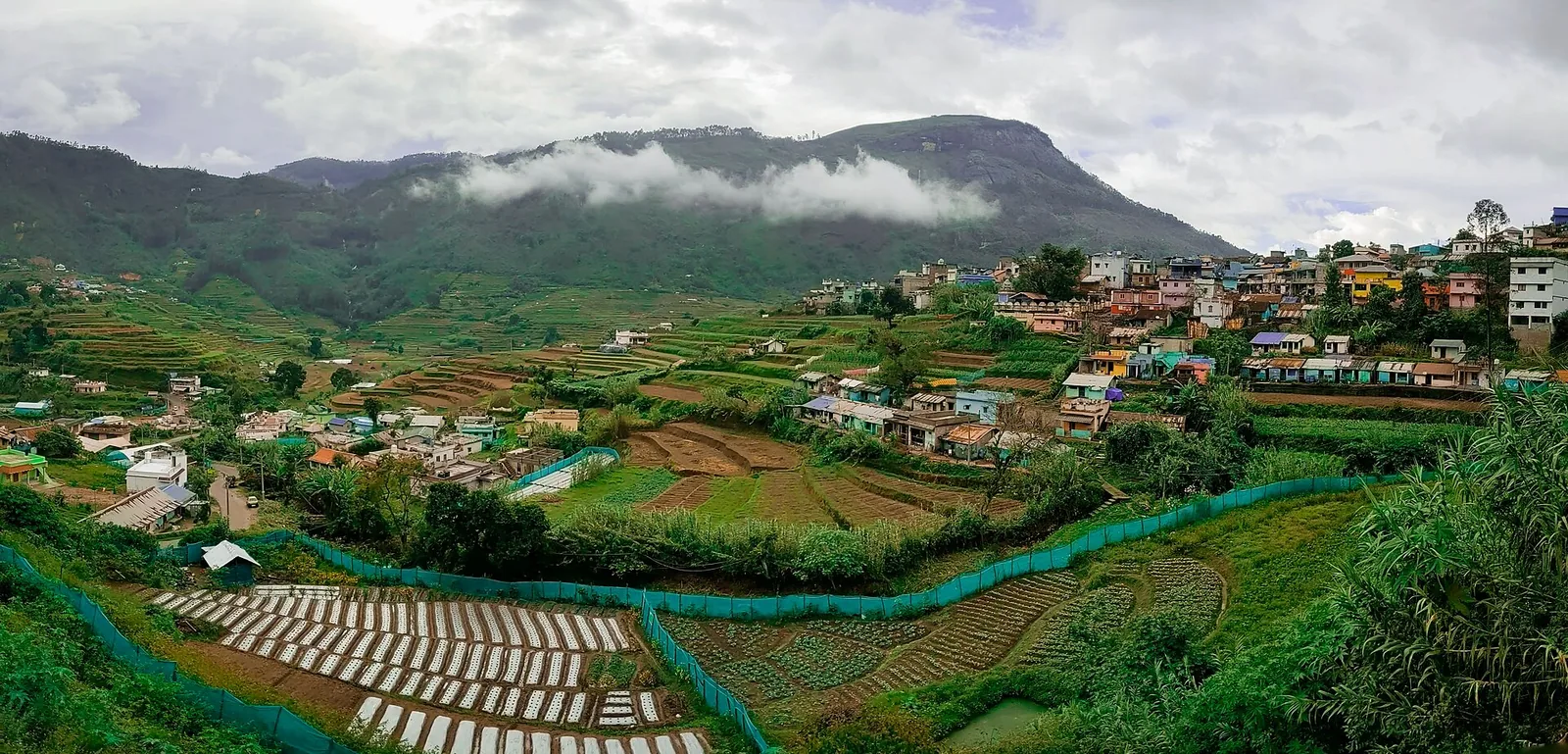
Cool high-altitude farming village beyond Munnar near the Tamil Nadu border, known for terraced vegetable and fruit cultivation, Kurinji slopes and quiet valley views.

20.5 km · 33 min drive
A road-accessible viewpoint in Pothamedu south of Munnar, looking across planted hills and wooded valleys. The viewpoint marker is separate from the wider village and from private plantation walking routes.

Mathikettan Shola protects a remnant of native Cardamom Hills forest in Idukki. Visits are arranged through the Forest Department, with distinct Pethotty and Choondal approaches; a reservoir viewpoint is not a park-entry permit.

A wind-turbine ridge in Chathurangappara, Udumbanchola taluk, with views towards Theni’s cultivated plains; reached from the Munnar–Kumily road, with an exposed final hill approach.
Roampedia is commission-free — own or know a stay, eatery, guide or shop near Echo Point? List it and it appears here once verified.
Add a nearby businessEntry: A small entry ticket, commonly cited at about ₹30 for adults and ₹15 for children; boating is charged separately, typically ₹100–₹600 depending on the boat and group size.
Festivals: No festival is held at Echo Point itself. It rides the wider Munnar calendar — the Neelakurinji flowering (roughly once in twelve years) is the great seasonal event for this corridor, and Munnar’s tea-country tourism peaks around the cool winter and Onam seasons.
Photography: No separate camera fee is generally charged; still and phone photography is free. Mornings and post-rain clearings, when mist lifts off the water and the blue hills emerge in layers, give the best shots.
If you are travelling by bus or ferry, check the return service with the operator before setting out. Leave time to reach the stop or jetty after your visit.
Ask at the bus stand for the time of the last service back, not the next one. If you miss it, an auto or app cab is the fallback — agree the fare before you get in.
If you need step-free access, contact the site before travelling. Ask about a level entrance, steps along the route, the nearest drop-off point, seating and accessible toilets.
Emergency numbers are verified against official government and state tourism sources. 112 works anywhere in India.
Reservoir, boating and lake-view stop on the Munnar-Mattupetty sightseeing circuit, usually paired with Echo Point and Kundala.
5.9 km · 11 min driveKerala’s most famous hill station, known for tea estates, viewpoints and cool weather.
17.1 km · 28 min driveThe Kerala State Electricity Board’s riverside flower park on the Munnar–Aluva road, 3.3 km below Munnar town and 1.2 km from the KSRTC stand at Old Munnar. It runs along the east bank of the Muthirapuzha immediately above the 1944 R. A. Headworks weir that feeds Pallivasal, Kerala’s first hydroelectric station — which is what the "hydel" in the name means. Open daily 09:15 to 20:15 with tickets sold online by Kerala Hydel Tourism Centre.
19.2 km · 30 min driveA road-accessible viewpoint in Pothamedu south of Munnar, looking across planted hills and wooded valleys. The viewpoint marker is separate from the wider village and from private plantation walking routes.
20.5 km · 33 min driveHill-station and lake landscape near Munnar associated with Devikulam and Sita Devi, best planned as a quieter high-range side trip.
21.5 km · 35 min driveForest Department peak trek from the counter at Gap Road, 13.2 km from Munnar: a mapped 2.09 km path climbing about 460 m of grassland and shola to a summit whose altitude four sources disagree about.
26.7 km · 40 min driveThe pass itself on the Munnar–Bodimettu highway, where the ridge drops away east — and the lay-by the Chokramudi Peak trek reports from, 51 m from the forest counter. A second, busier viewpoint signed "Lockhart Gap Road View Point" sits 1.7 km east.
26.7 km · 40 min drivePopular high-altitude Western Ghats trek, usually booked through official eco-tourism channels.
27.0 km · 47 min driveA border-highland viewpoint in Theni, Tamil Nadu, normally approached through Munnar, Mattupetty and Kundala; named for the former tea-transport terminus, with a separate stepped viewpoint walk.
27.6 km · 47 min driveHigh-range lake and dam stop beyond Mattupetty on the Top Station route.
28.3 km · 49 min driveAnamudi Shola National Park protects Mannavan, Pullaradi and Idivara shola forests in the Kanthalloor–Vattavada high ranges. Methappu is the visitor anchor on this page; this is not Anamudi Peak or the Rajamala visitor area.
35.5 km · 64 min driveHigh tea-estate sunrise viewpoint reached by jeep from the Munnar side.
41.4 km · 59 min driveWalking and driving times are real routed distances, except the few marked “straight line”, which are direct-line estimates and will read short. Fare figures are estimates from Kerala’s notified auto/taxi tariff and exclude waiting and night charges. Routing: © openrouteservice.org by HeiGIT | Map data © OpenStreetMap contributors
Because your voice carries across the open lake, strikes the steep hills a few hundred metres away and reflects back to you — a plain acoustic echo, not anything mysterious. It works best when you shout clearly across the water on a quiet day; heavy crowds, wind and thick mist can muffle the return, and the effect is strongest early in the morning before the site gets busy.
Yes, there is a small entry ticket — commonly cited at around ₹30 for adults and ₹15 for children. Boating is charged separately, on top of the entry fee.
Pedal boats, kayaks and rowing boats are available at the jetty, typically in the region of ₹100 to ₹600 depending on the boat and number of people. Rates and available craft change with the season and the water level, so ask at the boating counter on the day.
It is roughly 15 km from Munnar town, on the road that runs from Mattupetty Dam up towards Kundala Lake and Top Station. Most visitors come by hired car, taxi or autorickshaw as part of the Mattupetty–Top Station sightseeing circuit.
The cool, drier months from roughly September to February are the classic window, with misty mornings and pleasant temperatures; March to May is warmer but still fine. The June to August monsoon brings heavy rain and slippery paths. For the Neelakurinji bloom you must catch a Kurinji year, which recurs only about once every twelve years.
Most people spend about one to two hours — time to try the echo, take a boat out and enjoy the views. It works best as one stop on a wider high-range day out rather than a destination on its own, and can feel crowded and commercial at peak times, so an early start is the way to enjoy it at its quiet best.
Clear post-monsoon and winter days are best; mist can block views in hill areas.
Entry: A small entry ticket, commonly cited at about ₹30 for adults and ₹15 for children; boating is charged separately, typically ₹100–₹600 depending on the boat and group size. Timings: Generally open daily from around 7 am to 6 pm, though some sources quote longer hours; boating usually stops earlier than the gate.
Base yourself in Munnar or a nearby town in Idukki, then confirm the last-mile route locally before leaving. Go early for clearer light and easier parking; sunset viewpoints can crowd quickly. If the visit depends on forest, temple, boat, ferry, weather or seasonal access, check the official/local rule on the day before travel.
45 minutes to 2 hours.
Nearby you can pair Mattupetty Dam (5.9 km), Munnar (17.1 km), Blossom Hydel Park (19.2 km), Pothamedu Viewpoint (20.5 km).
Stay behind barriers and away from cliff edges. Avoid viewpoints during lightning or heavy rain.
We have not published a story about Echo Point itself yet. These cover Munnar and the wider district, with separate journeys between stops.
These guides explore Munnar and the surrounding area. Choose a visit that fits your interests, allowing separately for travel between stops.






Written about Munnar as a whole rather than about Echo Point — its history, its streets, and how to spend a day in it.




Route-level itineraries and practical guides for the rest of Kerala.



Photographs: Ruben Joseph (CC BY-SA 3.0), Dittymathew (CC BY-SA 3.0), Niyas8001 (CC BY-SA 4.0), Athulvis (CC BY-SA 4.0), Jan J George (CC BY-SA 4.0), Sarathgks92 (CC BY-SA 4.0), Jiths (CC BY 2.0), Jaseem Hamza (CC BY 3.0), Fotokannan (CC BY-SA 3.0). Wikimedia Commons.