India·Kerala·Idukki·Munnar·wildlife

Mathikettan Shola National Park

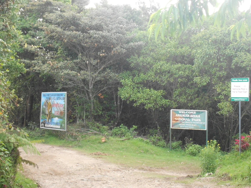
Mathikettan Shola National Park is a protected Cardamom Hills forest near Santhanpara and Pooppara in Idukki. Its visitor approaches at Pethotty and Choondal serve different routes and stays, so arrange the exact reporting point with Munnar Wildlife Division before travelling.

Mathikettan Shola National Park, Munnar
Practical guide

Plan Mathikettan Shola National Park

Who's going?Tailor Mathikettan Shola National Park to your trip
Typewildlife
AreaMunnar
DistrictIdukki
Best timeOctober–February is the peak season…
Time neededAllow half a day for a confirmed guided…
Entry₹400
Places to visit27Listed businesses120

The forest’s significance is unusually tangible: three streams begin here, elephants move through the landscape, and a tiny, distinctively patterned galaxy frog is the park’s flagship species. This is a guided forest visit, not an open extension of the Anayirankal reservoir drive.

The story

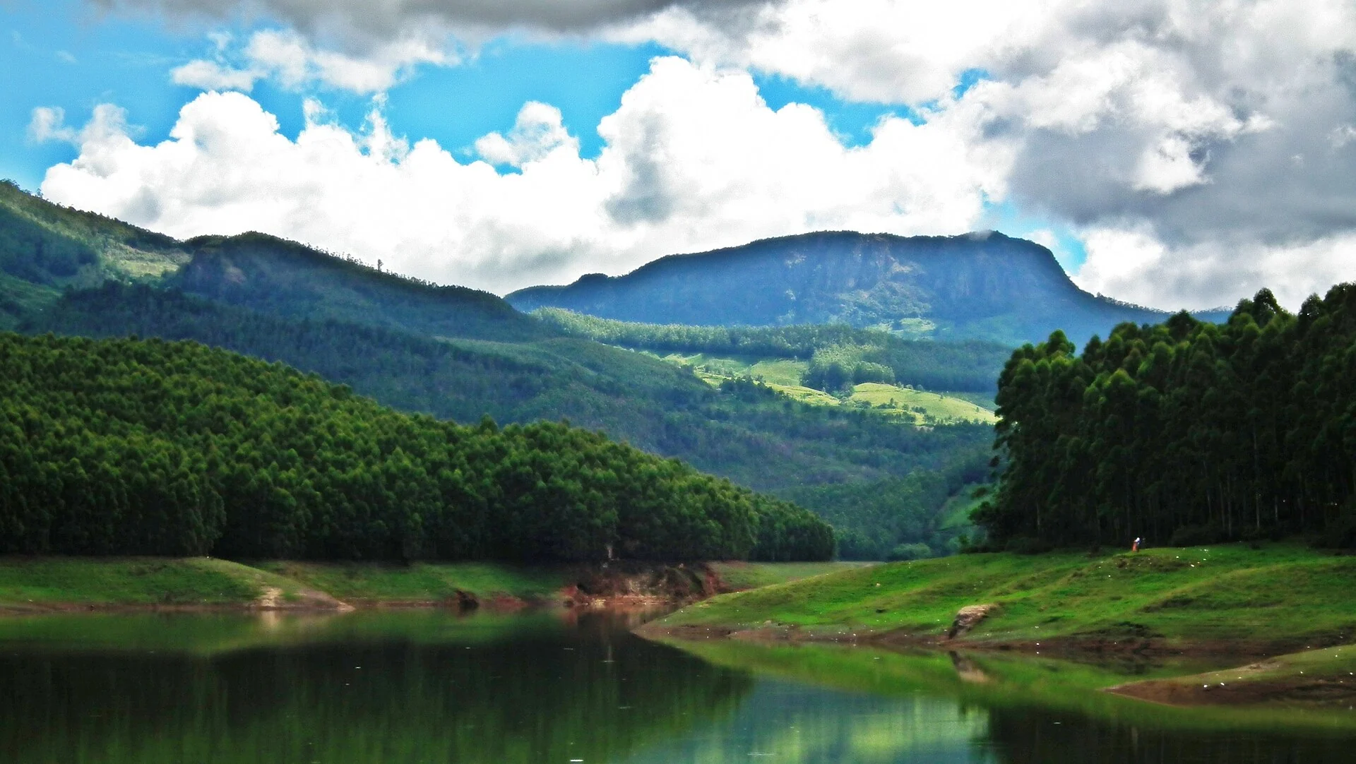
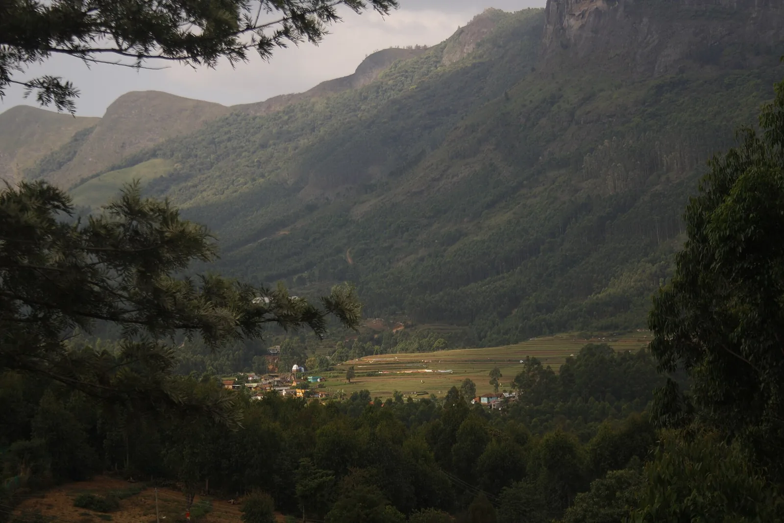
Mathikettan Shola is a forest of connections. Water gathers in its hills before joining the Panniyar system; elephants move between wooded patches; native vegetation survives beside a much larger plantation landscape. The park is small enough for those relationships to be visible in one visit, yet much larger in purpose than a viewpoint stop.

The story of Mathikettan Shola National Park

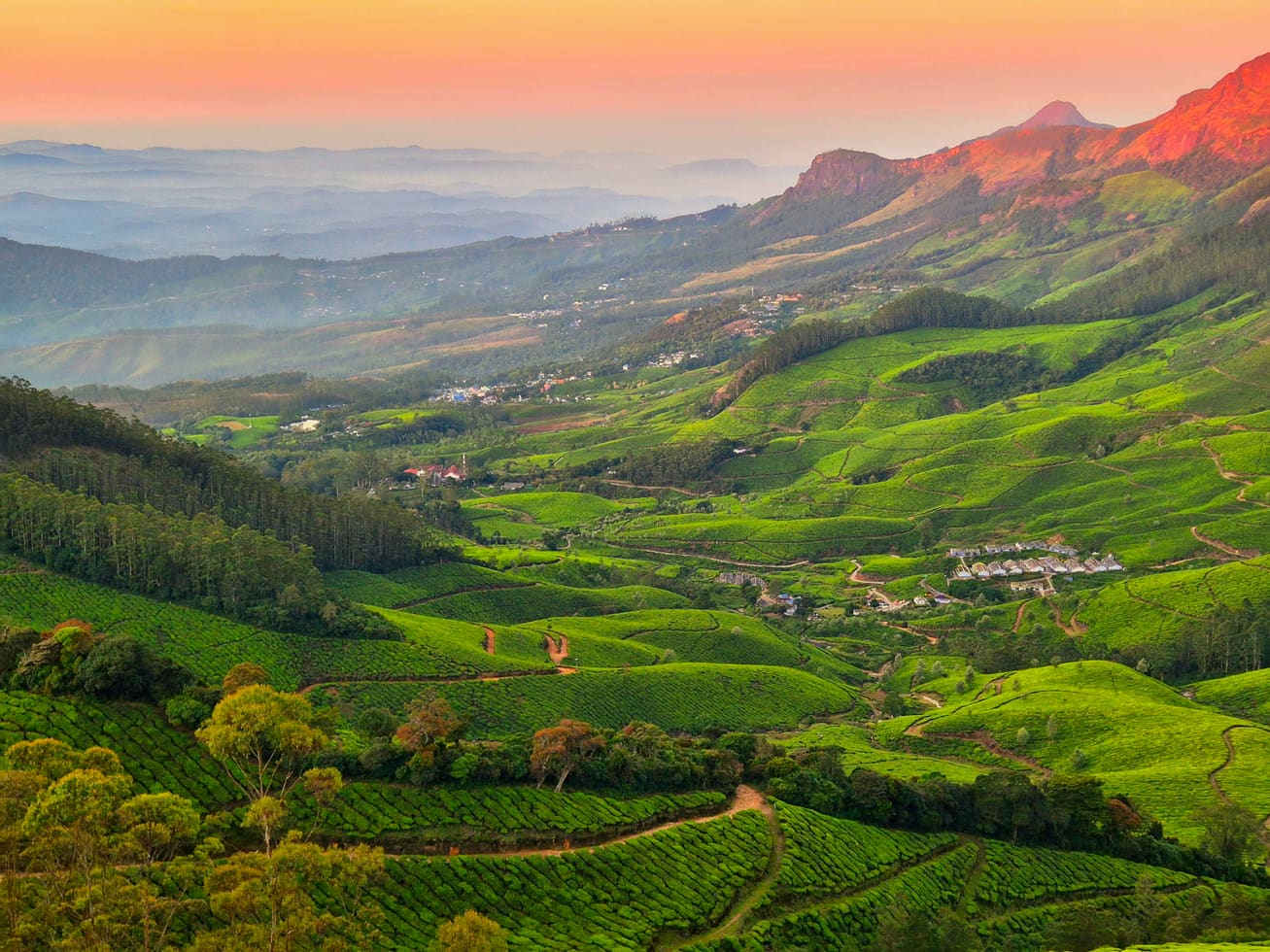
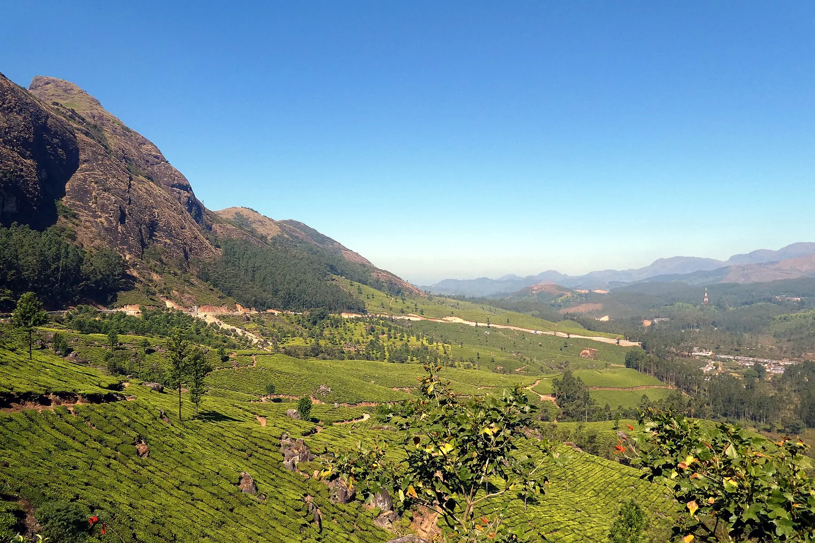
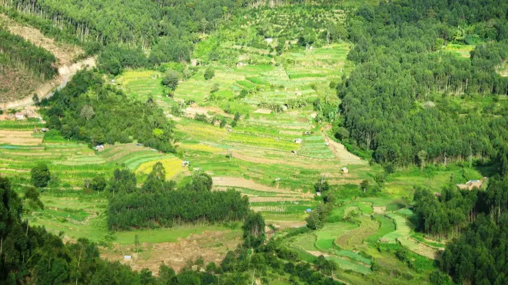
The Cardamom Hill Reserve provides the historical setting. Across that wider region, land and tree cover have long been managed through arrangements connected to cardamom cultivation. Mathikettan preserves a native-forest remnant within this cultivated landscape. Its value is not that it stands apart from everything around it, but that it retains habitat and water sources that the surrounding hills also depend on.

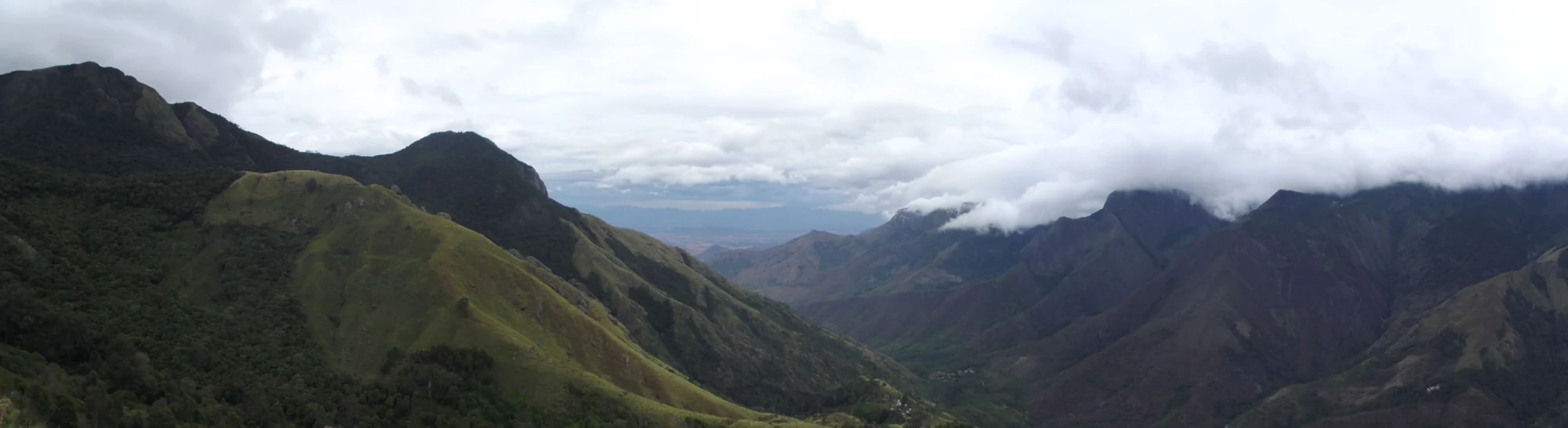
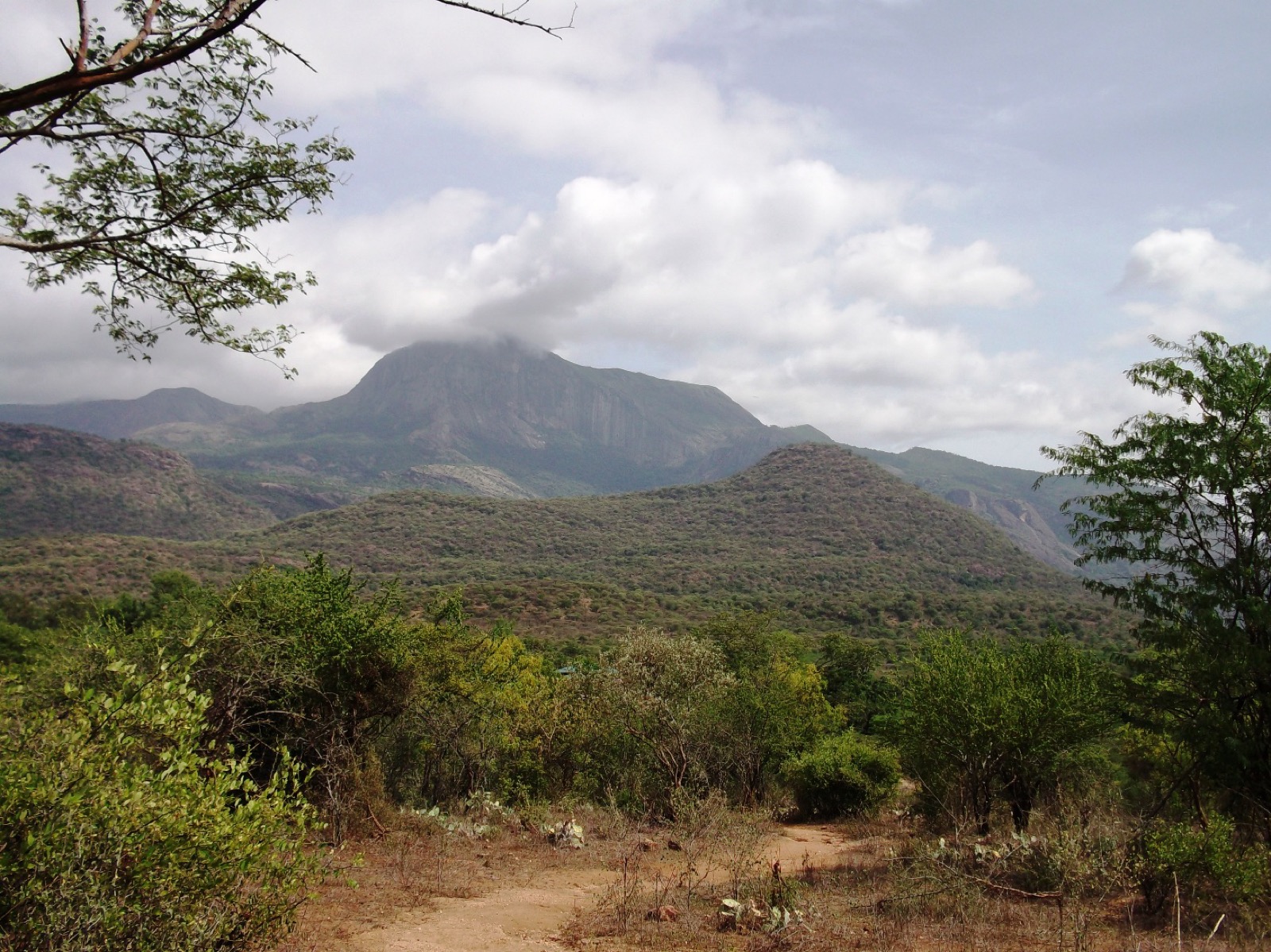
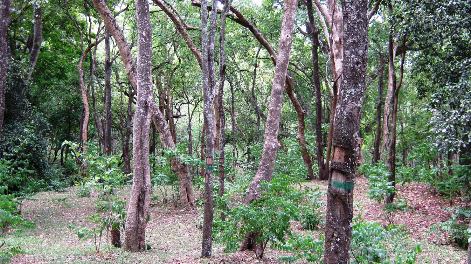
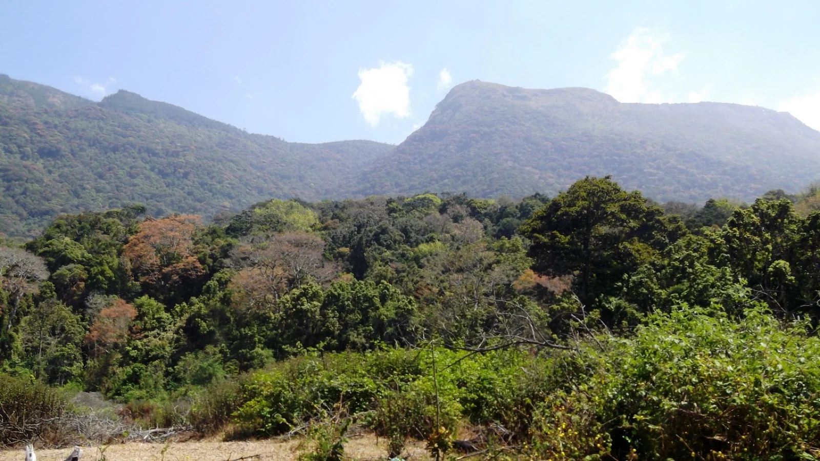
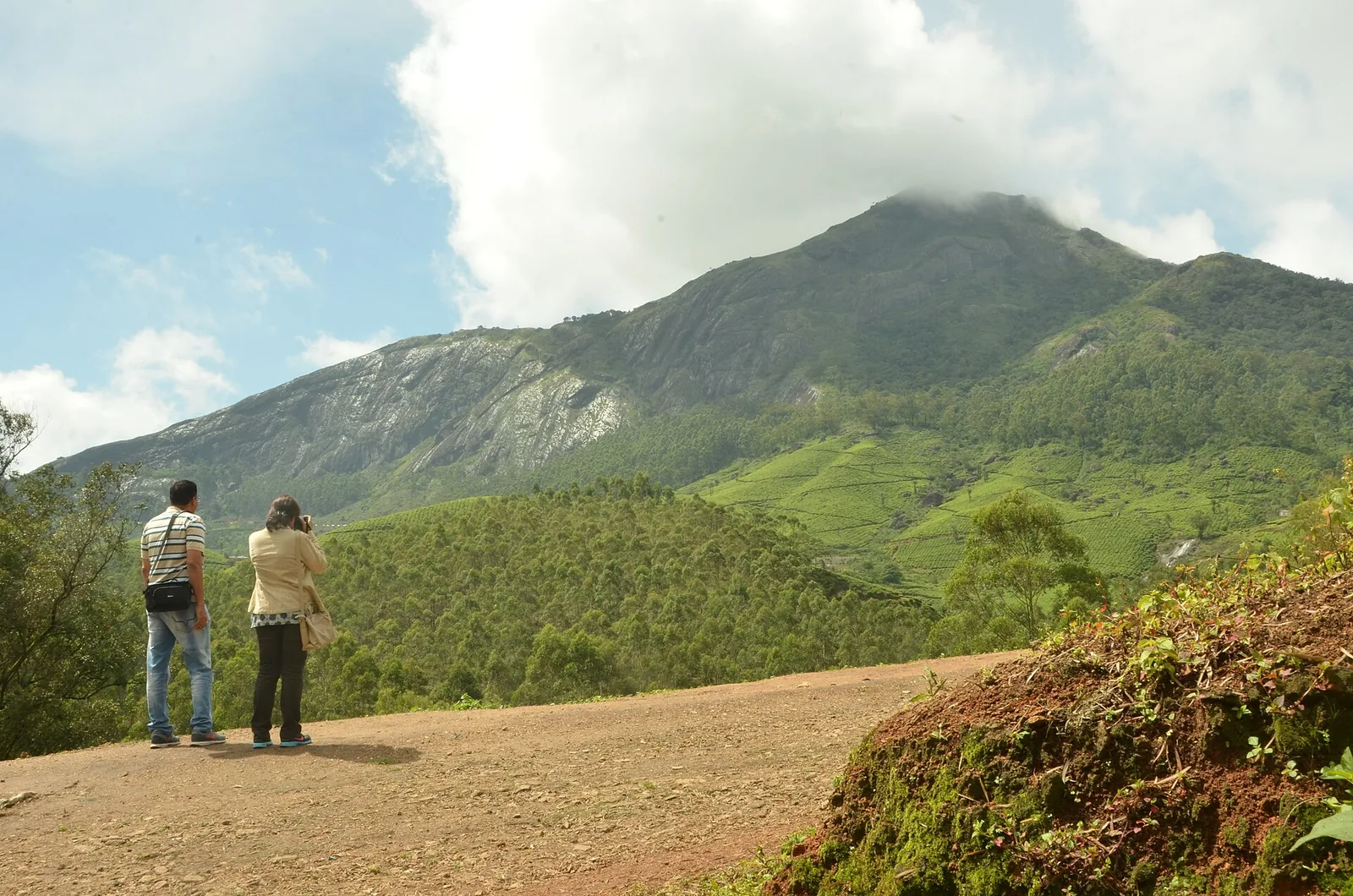
The Forest Department places the park’s principal vegetation between about 1,200 and 1,800 metres. Montane evergreen forest, other moist forest types and higher shola–grassland patches occupy different positions across the folds of the terrain. That range makes the word shola useful but incomplete: a visitor should expect transitions in canopy and slope, not an identical grove repeated from one boundary to the other.

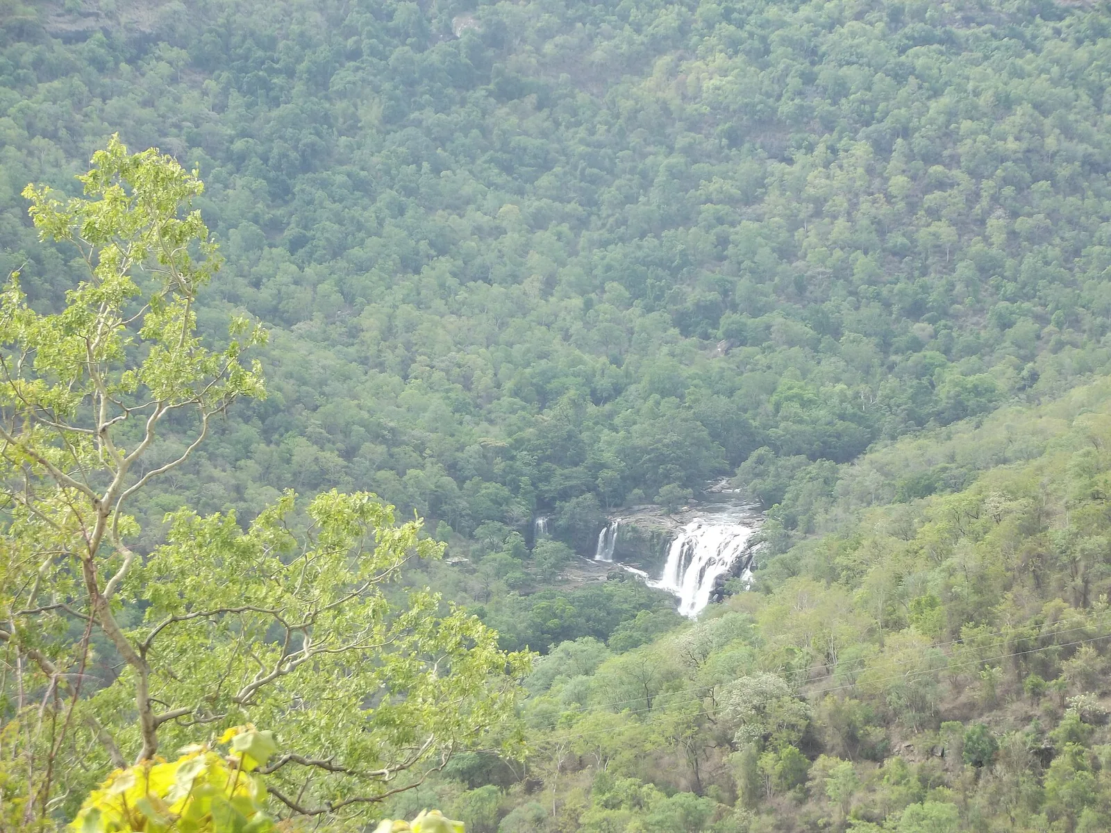
Three streams originate within the park: Uchinikuthipuzha, Mathikettanpuzha and Njandar. They are tributaries of the Panniyar, and the management plan links the watershed to agricultural and drinking-water needs around Santhanpara and Pooppara. A damp hollow on a forest walk is therefore part of a larger working water system. Its importance does not depend on becoming a large waterfall inside the visitor’s field of view.

The streams also explain why careful movement matters. Banks, shaded leaf litter and decaying wood are habitats, not obstacles to tidy away for a clearer photograph. A headwater forest is read through small signs of moisture and vegetation as much as through a broad panorama. Following a guide allows those details to be noticed without widening a path through them.

The galaxy frog, Melanobatrachus indicus, is Mathikettan’s most distinctive small-animal story. The management plan records observations during a 2004 study and again during a December 2019 amphibian survey, and adopts the species as the park’s flagship. These are documented scientific records separated by years, not evidence that every guided party can expect to see one.

The frog’s conservation value rests on its specialised microhabitat and restricted distribution. Its striking appearance can easily make it a photographic target, but turning logs or searching wet ground to find it would disturb the very setting being protected. A visitor can understand why the species matters from interpretation and habitat observation without being promised a sighting.

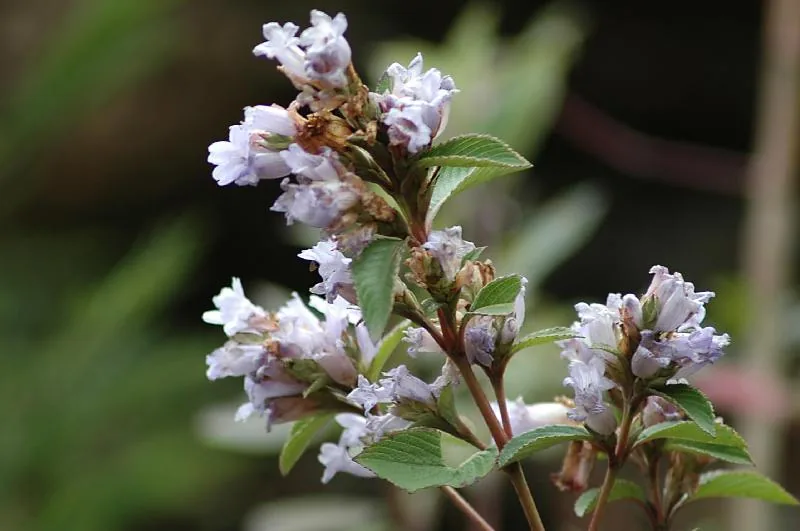
Mathikettan’s botanical interest is equally specific. The management plan records the description of Peperomia ekakesara and Memecylon idukkianum from the park in 2018 and 2019. These discoveries show why a remnant forest deserves close study even after the surrounding district has become a familiar tourism destination. A small area on a map can still contain plants whose scientific description is recent.

Elephants give the park a broader geographical role. The management plan identifies active wildlife movement and describes Mathikettan as a stepping stone in the wider connection between the Periyar and high-range landscapes. That wording is important: protecting one patch is part of maintaining a larger movement network, not a claim that tourists can follow a continuous walk from one protected area to another.

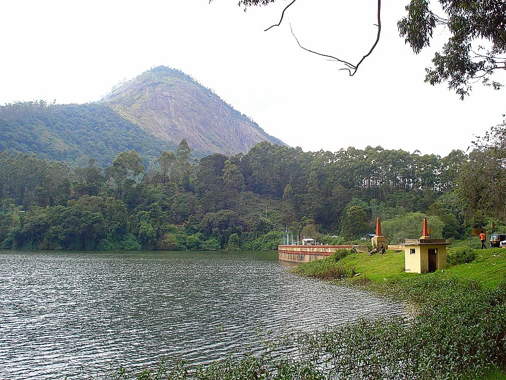
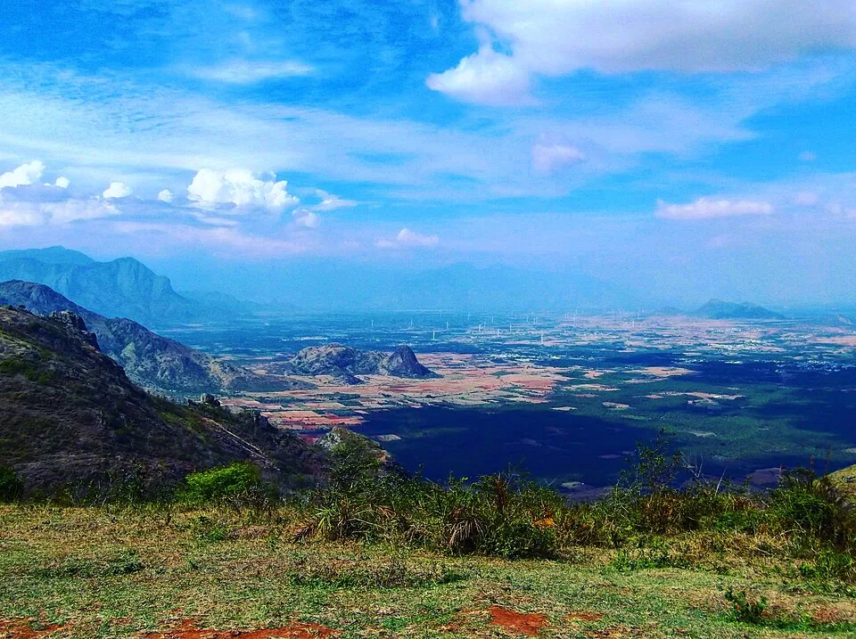
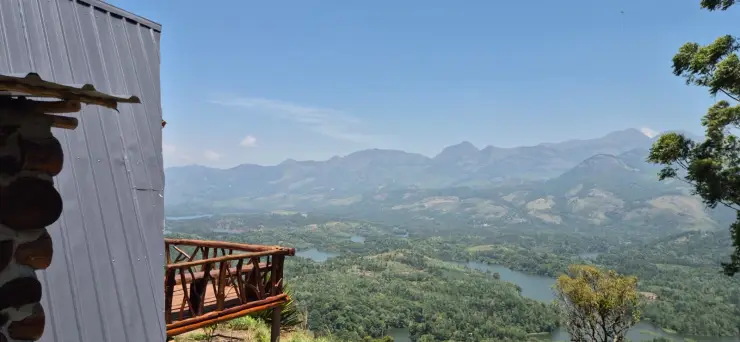
The Choondal outlook includes the Anayirankal reservoir landscape. Seen from above, water, cultivated slopes and forest patches form part of one scene. Operationally they remain separate: a Mathikettan forest programme does not include a dam visit or a boat ride. That distinction is particularly useful when an itinerary tries to combine several attractions along the Munnar–Pooppara corridor.

Tourism is organised with the Aduvilanthankudi eco-development committee. The management plan links the programme to local livelihoods and conservation work, while describing the nearby Muthuvan settlement as outside the national park. Community participation is part of the park’s management; it should not be turned into an assumption that visitors may enter homes or photograph people without invitation.

The strongest way to spend time here is to connect observations at different scales. A stream crossing belongs to a watershed; a tree species belongs to a forest community; an elephant’s route belongs to a landscape larger than the park. A guide can make those connections while keeping the walk within the part of the forest opened for visitors.

Read the full history of Mathikettan Shola National Park 164 more words

History

Mathikettan’s earlier protection belongs to the Cardamom Hill Reserve, recorded in the Travancore Gazette in August 1897. Later arrangements placed land and tree growth under different departments, reflecting the reserve’s complicated relationship with cardamom cultivation.

In October 2002, an area of 1,281.74 hectares was transferred to Forest Department administration. The Kerala Government then notified Mathikettan Shola National Park through GO(MS)50/2003/F&WLD dated 10 October 2003. The notification, reproduced in the management plan, provides a firmer chronology than the 2008 date found in some general tourism copy.

The modern management plan brings water-source protection, habitat connectivity, guided tourism and local eco-development into the same framework. Its scientific records, including the 2019 galaxy-frog survey, show that management depends on close observation as well as boundary protection.

Why visit

To see native Cardamom Hills forest rather than another cultivated spice-garden display.

To understand how the park’s three headwater streams connect forest protection to nearby settlements.

To join an authorised guided visit that explains small-species habitat alongside the park’s elephant-corridor role.

What to expect

Highlights

  • A surviving native-forest patch within the wider Cardamom Hill Reserve landscape.
  • Uchinikuthipuzha, Mathikettanpuzha and Njandar: three headwater streams belonging to the Panniyar system.
  • The documented galaxy-frog habitat and a forest corridor important to elephants.
Getting there

How to visit

  • Book the named Mathikettan Shola trekking programme and confirm the reporting entrance with the Forest Department before arranging the final vehicle.
  • Arrange a Forest Department guided visit or named accommodation. The management plan’s described five-kilometre Choondal route is not a guarantee of a departure on every date.
  • Keep any Anayirankal reservoir stop separate from the park programme. The northern outlook towards the water does not imply access to the dam, boating centre or a path down to the shore.

Distance by road

  • Kochi107 km
  • Madurai172 km
  • Thiruvananthapuram226 km
  • Coimbatore252 km
  • Kozhikode276 km

Road km to Idukki; ghat roads and traffic vary — allow extra.

Timing

Best time

October–February is the peak season identified by the park management plan. A confirmed guided visit and safe approach-road conditions matter more than the calendar; severe rain, fire risk or wildlife movement can alter access.

Weather in Mathikettan Shola National ParkSeasonal guide

Live forecast loads in your browser.

Today at Mathikettan Shola National Park
Sunrise6:09 am
Sunset6:06 pm
Golden hour best light5:06 pm–6:06 pm
Blue hour after sunset6:06 pm–6:31 pm
Sun sets toward compass bearingW · 263°
Moon tonight🌑 New moon · 0%
Retreating monsoon. October and November still see spells of rain from the retreating monsoon, though it is usually lighter than mid-year. Conditions are generally good but worth checking.

Sun and moon are calculated for this location and shown in IST. Photography windows are the hour around sunrise and sunset; the sunset bearing is degrees clockwise from true north. Moon phase is accurate to about half a day.

Visitor notes

  • Mathikettan has two visitor sides. A stay at Choondal and a meeting at Pethotty should never be treated as the same address.
  • The park was notified in October 2003. The 2008 date repeated in some tourism descriptions is not the date given in the notification reproduced by the management plan.
  • A tiny animal’s habitat can be a major conservation reason for visiting this forest; the galaxy frog is not an animal to seek by moving logs or searching streambeds.
Safety

Good to know

  • Stay with the appointed guide and give elephants priority. This is an active wildlife-movement landscape.
  • Do not enter headwater channels, turn over logs or collect plants. Damp microhabitats are part of what the park protects.
Official eco & forest programmes

Experiences around Mathikettan Shola National Park

These are official or public-sector eco offerings that match this place, town or forest destination. Confirm availability, permits, tariffs and reporting times with the official operator before travel.

Meesapulimala, Mathikettan Shola National Park
trekforest staycamping

Meesapulimala trek through Rhodo Valley

Hard high-altitude trek from the Munnar side via Rhodo Valley, run through KFDC eco-tourism with guide, food and stay options.

KFDC Ecotourism MunnarOvernight with next-day trek
Official source →
Meesapulimala Base Camp, Mathikettan Shola National Park
campingforest staytrek

Munnar Base Camp tent stay

KFDC tent stay near Meesapulimala base camp, with campfire, food and optional trek towards Meesapulimala or Rhodo Valley.

KFDC Ecotourism MunnartentOvernight
Official source →
Meesapulimala Base Camp, Mathikettan Shola National Park
forest staytrekviewpoint

Munnar Sky Cottage

Lonely cliff-side KFDC cottage facing a waterfall and Anamudi views, paired with Meesapulimala trekking.

KFDC Ecotourism Munnarforest cottageOvernight
Official source →
Rhodo Valley, Mathikettan Shola National Park
forest staytrekviewpoint

Munnar Rhodo Mansion

KFDC Rhodo Valley night stay with elephant-trench protection, campfire, food and next-day Meesapulimala climb.

KFDC Ecotourism Munnarforest cottageOvernight
Official source →
Eravikulam National Park, Mathikettan Shola National Park
wildlifeviewpoint

Eravikulam National Park visit

High-altitude grassland national park and Nilgiri tahr habitat near Munnar.

Kerala Forest Department
Official source →
Chinnar Wildlife Sanctuary, Mathikettan Shola National Park
trekwildlifeforest stay

Chinnar Wildlife Sanctuary eco visit

Dry-forest wildlife sanctuary east of Munnar, listed in Kerala Tourism’s ecotourism inventory.

Kerala Forest Department
Official source →
Pambadum Shola National Park, Mathikettan Shola National Park
trekwildlifeforest stay

Pambadum Shola National Park eco visit

Shola forest national park near the Munnar/Vattavada side, listed as an ecotourism destination and programme.

Kerala Forest Department
Official source →
Anamudi Shola, Mathikettan Shola National Park
trekwildlife

Anamudi Shola eco visit

Shola-grassland forest landscape in Idukki, included in Kerala Tourism’s official ecotourism destination list.

Kerala Forest Department
Official source →
Marayoor, Mathikettan Shola National Park
wildlifeinterpretationtrek

Marayoor sandalwood forest eco visit

Sandalwood and dry-forest landscape on the Munnar-Chinnar side, listed by Kerala Tourism as an ecotourism destination.

Kerala Forest Department
Official source →
Stay · eat · do · rent · see · shop

Stays, food & things to do near Mathikettan Shola National Park

Browse listed stays, food, activities, sights, shops and rentals around Mathikettan Shola National Park. Check each listing’s locality and contact the business directly for current arrangements.

12 places to eat near Mathikettan Shola National Park

Hotel restaurants · Munnar
Desi Aromas & Underground Restaurants, The Panoramic Getaway
22.4 km · straight-line distanceIndian, Kerala, Mexican, Italian, Cafe, Multi-cuisine

Two named restaurants at The Panoramic Getaway: Desi Aromas for Indian cuisine and Underground for grill specialties.

Directions Commission-freeView details
Hotel restaurant · Munnar
Grand Spices Restaurant, Grand Plaza Munnar
21.9 km · straight-line distance

Multi-cuisine restaurant at Grand Plaza Munnar on M. S. A Road. Restaurant, multi-cuisine, hotel dining.

Directions Commission-freeView details
Restaurant · Munnar
Alaska Multi Cuisine Restaurant at The Fog Munnar
20.7 km · straight-line distance

Restaurant in Munnar. Restaurant, multi-cuisine, Kerala food.

Directions Commission-freeView details
Restaurant · Munnar
Galaxy & Gaia Restaurants, Misty Mountain Munnar
22.7 km · straight-line distance

Two in-house multi-cuisine restaurants at Misty Mountain Resort, open from 7:30 AM to 10 PM. Restaurant, multi-cuisine, Pallivasal.

Directions Commission-freeView details
Restaurant · Munnar
Cliff Edge Restaurant - The Wind Munnar
9.4 km · straight-line distanceKerala, Continental, Chinese, North & South Indian

Cliff-edge a la carte restaurant above the valley at Chinnakanal. Fresh-cooked dishes with complimentary candle-light dinner arrangements.

Directions Commission-freeView details
Mattupetty-side restaurant · Munnar
The Ottway Hills Restaurant Munnar
19.0 km · straight-line distance

Mattupetty-side restaurant in Munnar. Maduppetty, Idukki, Kerala · Restaurant, Mattupetty, Munnar route.

Directions Commission-freeView details
Restaurant · Munnar
Broadbean Restaurant Munnar
20.2 km · straight-line distance

Broadbean Restaurant Munnar is a Kerala Tourism-listed restaurant record for Munnar food planning, useful for travellers who want a source-backed restaurant option rather than only resort dining. Restaurant, Food stop, Kerala Tourism record.

Directions Commission-freeView details
Café
Ripple Tea Store and Cafe
21.3 km · straight-line distance

Café on Grahamsland Road, Mattupetty, Munnar, Kannan Devan Hills, Kerala 682612 in Munnar.

Directions Commission-freeView details
Restaurant · Munnar
Bouquet Garni - The Leaf Munnar
21.5 km · straight-line distanceMulti-cuisine (Indian, Arabic, Chinese, Italian)

Glass-panelled fine-dining restaurant overlooking the Munnar hills at Chithirapuram. A live counter serves Malabar fish curry alongside global plates.

Directions Commission-freeView details
Restaurant · Munnar
Tea Valley Resort Restaurant
20.5 km · straight-line distanceMulti-cuisine

In-house restaurant at Pothamedu serving buffet breakfast and dinner. Panoramic valley views with daily service from 6am to 9:30pm.

Directions Commission-freeView details
Restaurant · Munnar
The Dining - ZeezMount Munnar
19.4 km · straight-line distanceIndian, Chinese, Continental, Italian, Arabic, Jain

Resort restaurant at Anachal spanning six cuisines from tandoori to satvik Jain. Highlights include biryani, dim sum and saffron-scented Arabic rice.

Directions Commission-freeView details
Restaurant · Munnar
The Springvand - Trivers Munnar
21.4 km · straight-line distanceSouth & North Indian, Continental, Gujarati, Chinese, Arabic

The Springvand restaurant at Trivers on Chithirapuram's Power House Road. Six cuisines served daily from 7:30am to 10pm.

Directions Commission-freeView details

Book with the place itself. India’s cyber-crime coordination centre warned in April 2025 that convincing copies of hotel and pilgrimage booking sites are being pushed through sponsored search and social ads, taking payment for rooms the property never hears about. Use the contact and source details on each profile to confirm the exact business and booking channel. A directory entry or map pin alone does not establish an operator’s identity or current availability. Roampedia takes no commission and does not collect booking payments. If a booking page reached you through an ad, check the address bar against the property’s own site before you pay. Fraud can be reported on cybercrime.gov.in or on 1930.

Nearby guides

Top experiences around Mathikettan Shola National Park

32 more places around Munnar. Open a guide to plan the visit and onward journey.

hill stationMunnar

Kerala’s most famous hill station, known for tea estates, viewpoints and cool weather.

wildlifeEravikulam National Park

High-altitude grassland park, Nilgiri tahr habitat and access point for Anamudi views.

viewpointAnamudi Peak

The highest peak in South India, viewed through Eravikulam/Rajamala access contexts near Munnar.

wildlifeRajamala

Rajamala is the designated tourism and awareness zone of Eravikulam National Park near Munnar. It is not a separate unrestricted summit trek or the whole national park.

museumTea Museum

Tea-history museum in Munnar linked with the plantation story of the high ranges.

damMattupetty Dam

Reservoir, boating and lake-view stop on the Munnar-Mattupetty sightseeing circuit, usually paired with Echo Point and Kundala.

viewpointEcho Point

16.5 km · straight line

Popular Munnar lakeside viewpoint on the Mattupetty-Kundala route, useful for short stops, photos and family sightseeing.

damKundala Lake

High-range lake and dam stop beyond Mattupetty on the Top Station route.

viewpointTop Station

16.6 km · straight line

A border-highland viewpoint in Theni, Tamil Nadu, normally approached through Munnar, Mattupetty and Kundala; named for the former tea-transport terminus, with a separate stepped viewpoint walk.

trekMeesapulimala trek

Popular high-altitude Western Ghats trek, usually booked through official eco-tourism channels.

viewpointKolukkumalai

7.2 km · straight line

High tea-estate sunrise viewpoint reached by jeep from the Munnar side.

wildlifeChinnar Wildlife Sanctuary

Dry-forest wildlife sanctuary on the Marayoor-Udumalpet side of Idukki.

heritageMarayoor

High-range village known for natural sandalwood forests, dolmens and sugarcane jaggery.

wildlifePambadum Shola National Park

17.3 km · straight line

Pampadum Shola National Park protects high-elevation forest beside the Top Station–Vattavada road. The Top Station forest check post is the reporting anchor here; forest stays and guided walks require their own confirmed arrangements.

wildlifeAnamudi Shola

Anamudi Shola National Park protects Mannavan, Pullaradi and Idivara shola forests in the Kanthalloor–Vattavada high ranges. Methappu is the visitor anchor on this page; this is not Anamudi Peak or the Rajamala visitor area.

waterfallLakkam Waterfalls

Waterfall stop on the Munnar-Marayoor route, usually paired with Eravikulam and Marayoor days.

waterfallAttukad Waterfalls

Waterfall area near Munnar commonly used for short scenic drives and monsoon views.

viewpointLockhart Gap

14.2 km · straight line

The pass itself on the Munnar–Bodimettu highway, where the ridge drops away east — and the lay-by the Chokramudi Peak trek reports from, 51 m from the forest counter. A second, busier viewpoint signed "Lockhart Gap Road View Point" sits 1.7 km east.

damAnayirankal Dam

5.2 km · straight line

Anayirankal is a KSEB earth-and-rockfill dam and reservoir in the Panniyar hydel system near Chinnakanal and Santhanpara. The map identifies the published hydel visitor-centre marker; boating is not currently assured.

waterfallPower House Waterfalls

The Muthirapuzha spread sideways over bare rock at 796 m, below the tailrace of Pallivasal — the first hydroelectric station Kerala built. Free, unmanaged and very quiet, down about a kilometre of steep narrow lane. ⚠ Not the Chinnakanal falls that Kerala Tourism describes under this name, 21 km east.

viewpointBlossom Hydel Park

The Kerala State Electricity Board’s riverside flower park on the Munnar–Aluva road, 3.3 km below Munnar town and 1.2 km from the KSRTC stand at Old Munnar. It runs along the east bank of the Muthirapuzha immediately above the 1944 R. A. Headworks weir that feeds Pallivasal, Kerala’s first hydroelectric station — which is what the "hydel" in the name means. Open daily 09:15 to 20:15 with tickets sold online by Kerala Hydel Tourism Centre.

hill stationDevikulam / Sita Devi Lake

17.4 km · straight line

Hill-station and lake landscape near Munnar associated with Devikulam and Sita Devi, best planned as a quieter high-range side trip.

waterfallNayamakad Waterfalls

Nyayamakad, also called Nayamakad, is the waterfall and tea-estate landscape on the Munnar–Rajamala approach. The map uses the identifiable Nyamakad roadside stream-view base, not a waterfall lip, pool entrance or estate walking permit.

trekChokramudi Peak trek

14.2 km · straight line

Forest Department peak trek from the counter at Gap Road, 13.2 km from Munnar: a mapped 2.09 km path climbing about 460 m of grassland and shola to a summit whose altitude four sources disagree about.

trekKurinjimala Sanctuary trek

The 32 km² sanctuary above Kottakamboor and Vattavada, notified in 2006 for one plant — Strobilanthes kunthiana — with two walks and two stays in the Forest Department's own brochure and nothing bookable online.

trekThoovanam Falls trek

Forest Department guided walk in Chinnar Wildlife Sanctuary, from the Alampetty counter on SH17 down the river to the Thoovanam waterfall. Kerala Tourism contradicts itself on which river it follows: its own destination article says the Pambar, and the page selling this programme says the Chinnar.

trekChinnar Dolmen Culture trek

Forest Department culture trek in Chinnar Wildlife Sanctuary to prehistoric dolmen (muniyara) sites, run with local tribal Eco-Development Committees. Report at the Alampetty guide stand on the Marayoor–Udumalpet road (SH17), 6.4 km beyond Marayoor.

trekVasyappara Trekking and Camping

Forest Department trekking-and-camping programme at Vasyappara in Chinnar Wildlife Sanctuary — an overnight stay in a mud hut on a hill crest, published by the department as the Chinnar Valley Safari Trail. Report at 3 pm at the Chinnar check post on the Marayoor–Udumalpet road, not at the Alampetty counter 10.2 km back.

hill stationKanthalloor

High-range village near Marayoor often called the “Kashmir of Kerala”, known for terraced farms of apples, oranges, strawberries and vegetables at around 1,800 m.

hill stationVattavada

Cool high-altitude farming village beyond Munnar near the Tamil Nadu border, known for terraced vegetable and fruit cultivation, Kurinji slopes and quiet valley views.

viewpointPothamedu Viewpoint

A road-accessible viewpoint in Pothamedu south of Munnar, looking across planted hills and wooded valleys. The viewpoint marker is separate from the wider village and from private plantation walking routes.

viewpointChathurangapara Viewpoint

8.8 km · straight line

A wind-turbine ridge in Chathurangappara, Udumbanchola taluk, with views towards Theni’s cultivated plains; reached from the Munnar–Kumily road, with an exposed final hill approach.

Roampedia is commission-free — own or know a stay, eatery, guide or shop near Mathikettan Shola National Park? Submit public business details for review.

Add a nearby business
Before you go

Mathikettan Shola National Park — at a glance

TimingsThe official trekking product lists 8 am–2 pm. Use the reporting time and route confirmed for the booked slot; this range is not a six-hour trek duration or the opening schedule of every forest house.
Best timeOctober–February is the peak season in the management plan. Current forest permission, wildlife movement and approach-road conditions determine whether the intended visit can proceed.
Entry price
Indian adult
₹400

Fees change without notice. Check the current rate at the counter.

Entry: The Forest Department currently lists Mathikettan Shola Trekking at ₹400 for an Indian visitor and ₹750 for a foreign visitor. Forest accommodation is a separate booking.

Photography: Keep photography on the authorised route and ask before photographing community members. Do not move leaf litter, wood or stream stones to expose small wildlife for a photograph.

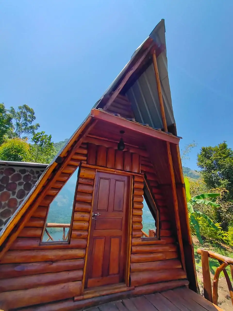
Booking: Select Mathikettan Shola Trekking in the Forest Department ecotourism catalogue. Chundal A Frame Log House is a separate overnight product, so confirm its own entrance and arrangements when booking a stay.

Parking: Use the space assigned at the confirmed entrance. The approach and check-post road also serve forest management; do not block a barrier or assume roadside estate land is public parking.

Getting here

How to reach Mathikettan Shola National Park

  • ✈︎ By air Cochin International Airport and Madurai Airport serve different sides of the wider journey. Arrange the complete road transfer to the confirmed Pethotty or Choondal meeting point, allowing for the programme’s arrival time.
  • 🚆︎ By train Theni is the Tamil Nadu-side rail gateway named by the park’s management plan; Aluva serves the Kerala-side journey. Select the station according to the wider itinerary and onward road route, rather than treating either as a local station beside the park.
  • 🚗︎ By road For the southern approach, arrange travel through Santhanpara towards Pethotty. For Choondal, use the northern approach confirmed from NH85. These are different routes; obtain the meeting point before choosing the last turn.
  • 🚌︎ By bus Santhanpara and Pooppara are useful road-transport connections on the approach. Confirm the final vehicle to the booked entrance and its return pickup; a through-bus on the Munnar–Kumily corridor is not a forest sightseeing service.
Getting around

Getting around Mathikettan Shola National Park

Choose the Pethotty or Choondal approach before hiring the final vehicle. Arrange a return pickup and follow the forest staff’s route instructions instead of navigating across the park.

Getting back

Confirm the finish and collection point for the actual guided route. A Pethotty office meeting and a Choondal stay should not be treated as the same pickup.

Do

Things to do

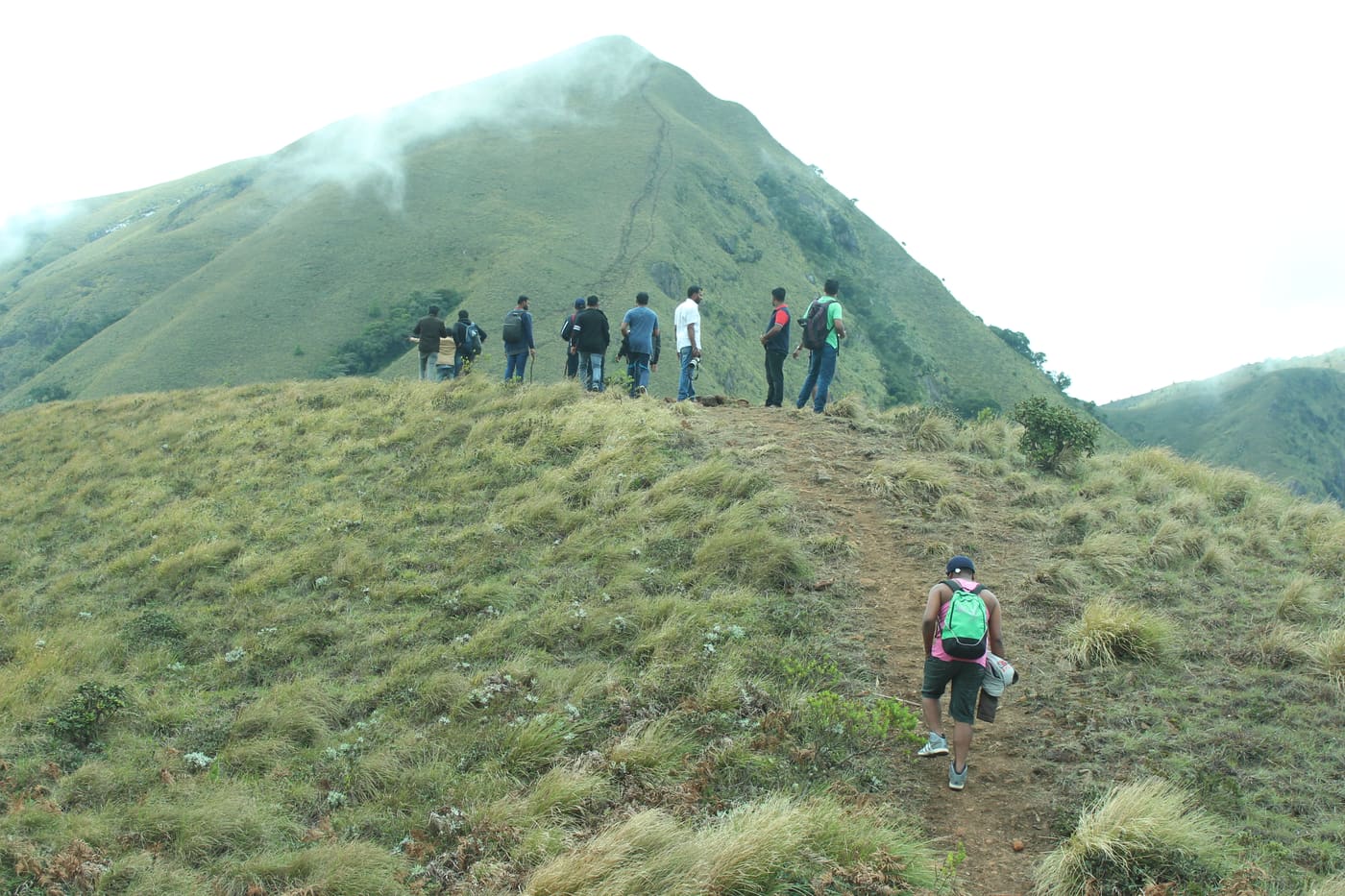
  • Join the authorised guided route and observe changes between moist forest, montane canopy and higher open patches.

  • Learn how the three headwater streams feed the Panniyar system without entering or disturbing their small channels.

  • Ask about the galaxy frog and recent botanical discoveries as examples of the park’s scientific importance.
  • Use an approved viewpoint on the Choondal programme to read the reservoir-and-forest landscape as distinct adjoining systems.
Included

What’s included

  • The confirmed permit or programme determines the opened route and guiding arrangement.
  • Reservoir visits, boating and travel between entrances are separate from a forest programme unless explicitly included by the operator.
Plan

Good to know

  • State the entrance name when arranging transport, because the two sides have different road approaches.
  • Keep the galaxy frog as a conservation story rather than a sighting target.
  • A forest and a plantation can look equally green from afar; ask the guide what changes in structure and species distinguish them here.
Facilities

On site

  • The management plan records information, education and accommodation facilities on the Pethotty side and a stay at Choondal. Confirm the exact facility attached to the reservation.
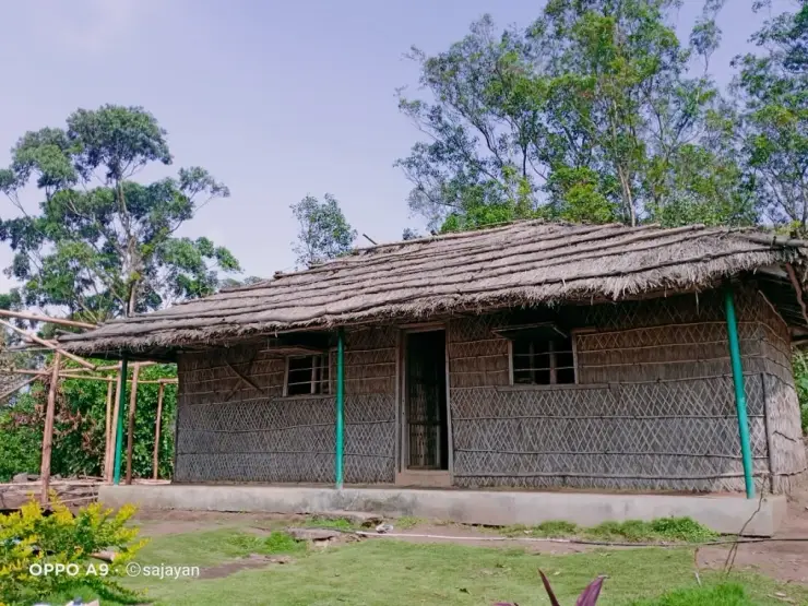
  • The Wildlife Division describes forest accommodation as simple, with limited connectivity.
  • Arrange food with the booked stay or use an established facility in the approach settlement; do not assume a restaurant along the guided route.
Stay safe

Safety

  • Stay with forest staff or the assigned guide; elephants use this landscape for movement.
  • Do not enter a closed track, cross a barrier or assume a patrol route is a public trekking route.
  • Leave streambeds, decaying wood and plants undisturbed; small habitats are vulnerable to concentrated visitor attention.
Getting around Mathikettan Shola National Park
From the entrance
Mathikettan Forest Office at Pethotty, a named reporting reference outside the park interior. Choondal programmes and accommodation use a separate approach.
Step-free access
The described guided route crosses forest terrain and should not be assumed step-free. Ask about slope, path condition, the distance from vehicle to building and the toilet at the exact booked facility. A road-accessible entrance does not make the interior accessible to every visitor.

Checked 6 September 2026 against source 1. Conditions change and surfaces vary with weather — if step-free access is essential, confirm with the site before you travel.

Eat nearby

What to eat in Munnar

Plan meals at Santhanpara or Pooppara on the appropriate approach, or through the specifically booked forest stay. The guided forest route is not a restaurant corridor.

Explore food in Munnar →
01

Santhanpara-side meal

For a Pethotty visit, use an established town stop before the final approach and keep the agreed reporting time.

02

NH85 approach

For Choondal, arrange the meal stop on the Pooppara-side journey rather than crossing to the other entrance for food.

03

Forest accommodation

Confirm meals and serving times for the exact log house or hut; do not assume that two accommodation names share one dining facility.

Nearby

What’s near Mathikettan Shola National Park

damAnayirankal Dam

Anayirankal is a KSEB earth-and-rockfill dam and reservoir in the Panniyar hydel system near Chinnakanal and Santhanpara. The map identifies the published hydel visitor-centre marker; boating is not currently assured.

5.2 km · straight line
viewpointKolukkumalai

High tea-estate sunrise viewpoint reached by jeep from the Munnar side.

7.2 km · straight line
viewpointChathurangapara Viewpoint

A wind-turbine ridge in Chathurangappara, Udumbanchola taluk, with views towards Theni’s cultivated plains; reached from the Munnar–Kumily road, with an exposed final hill approach.

8.8 km · straight line
viewpointLockhart Gap

The pass itself on the Munnar–Bodimettu highway, where the ridge drops away east — and the lay-by the Chokramudi Peak trek reports from, 51 m from the forest counter. A second, busier viewpoint signed "Lockhart Gap Road View Point" sits 1.7 km east.

14.2 km · straight line
trekChokramudi Peak trek

Forest Department peak trek from the counter at Gap Road, 13.2 km from Munnar: a mapped 2.09 km path climbing about 460 m of grassland and shola to a summit whose altitude four sources disagree about.

14.2 km · straight line
viewpointEcho Point

Popular Munnar lakeside viewpoint on the Mattupetty-Kundala route, useful for short stops, photos and family sightseeing.

16.5 km · straight line
viewpointTop Station

A border-highland viewpoint in Theni, Tamil Nadu, normally approached through Munnar, Mattupetty and Kundala; named for the former tea-transport terminus, with a separate stepped viewpoint walk.

16.6 km · straight line
wildlifePambadum Shola National Park

Pampadum Shola National Park protects high-elevation forest beside the Top Station–Vattavada road. The Top Station forest check post is the reporting anchor here; forest stays and guided walks require their own confirmed arrangements.

17.3 km · straight line
hill stationDevikulam / Sita Devi Lake

Hill-station and lake landscape near Munnar associated with Devikulam and Sita Devi, best planned as a quieter high-range side trip.

17.4 km · straight line
viewpointAamai Para

Tortoise-shaped rock outcrop above Thovalappady on the Kerala–Tamil Nadu border ridge, reached by jeep track from the Thookkupalam–Ramakkalmedu road, with a two-mouthed passage under the rock and DTPC’s Jaalakam eco-tourism centre on top.

37.2 km · 57 min drive
viewpointRamakkalmedu viewpoint

Open ridge viewpoint above the Tamil Nadu plains near Nedumkandam, useful for sunset, wind-farm and high-range road planning.

38.0 km · 54 min drive
heritageKuravan Kurathi statue

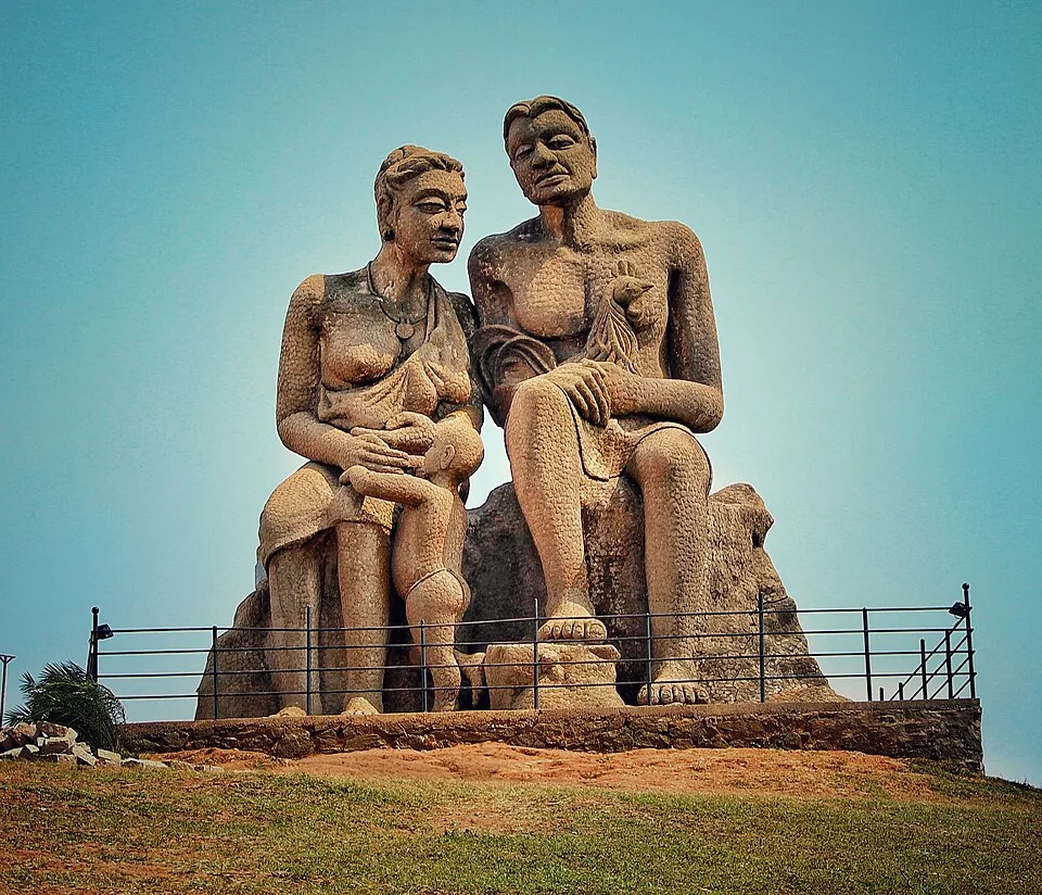
The seated concrete group of a Kuravan, a Kurathi and their child on the open mound at Ramakkalmedu, sculpted by C. B. Jinan and put up in 2005, inside DTPC Idukki’s ticketed viewpoint compound. It commemorates Kuravanmala and Kurathimala, the two hills the Idukki arch dam is wedged between — 30 km away in a straight line, 44 km by road.

38.0 km · 54 min drive

27 detailed place guides in Munnar →

Road and walking figures are route estimates, with travel times dependent on access, traffic and conditions. Figures marked “straight line” show direct separation and do not describe a road or walking route. Fare estimates use Kerala’s 26 April 2022 auto/taxi notification and exclude waiting, night and applicable one-way surcharges. Confirm the current meter or operator quote before travelling. Routing: © openrouteservice.org by HeiGIT | Map data © OpenStreetMap contributors

On the map

Where Mathikettan Shola National Park is

Good to know

Mathikettan Shola National Park — frequently asked

Is Mathikettan Shola in Munnar town?

No. It is near Santhanpara and Pooppara in Udumbanchola taluk, Idukki. Munnar is a wider travel hub; the final approach must be planned around the entrance confirmed for the visit.

Should I go to Pethotty or Choondal?

They are different visitor approaches. Pethotty is associated with the park headquarters and Santhanpara side; Choondal is nearer NH85. Use the exact reporting point supplied for the guided programme or accommodation.

When was Mathikettan declared a national park?

The notification reproduced by the Forest Department is dated 10 October 2003. It covers 1,281.74 hectares. A later date in general tourism descriptions should not replace that documented notification.

Can I see the galaxy frog during a visit?

A sighting is not promised. The park’s records come from scientific surveys, and the frog depends on specialised small habitats. Do not move logs or disturb wet ground to search for it.

Does a Mathikettan trek include Anayirankal boating?

No. The reservoir view and the forest programme are separate experiences. Dam access and any boating availability belong to the hydel-tourism operator’s current arrangements.

Can I enter Mathikettan without a guide?

Plan an authorised Forest Department visit. A visible track, an accommodation listing or a route on an outdoor map does not establish independent public entry to the national park.

How do I reach Mathikettan Shola National Park?

Mathikettan Forest Office at Pethotty, a named reporting reference outside the park interior. Choondal programmes and accommodation use a separate approach.

How much time do I need for Mathikettan Shola National Park?

Allow half a day for a confirmed guided visit and its road approach. A five-kilometre forest route needs a different allowance from a short look near an entrance; use the duration assigned to the actual programme.

What should I know before visiting Mathikettan Shola National Park?

Mathikettan has two visitor sides. A stay at Choondal and a meeting at Pethotty should never be treated as the same address.

When is the best time to visit Mathikettan Shola National Park?

The management plan identifies October–February as peak season. A Choondal booking also needs its own reporting window; the Pethotty office is a different arrival point.

What are the entry fee and timings at Mathikettan Shola National Park?

The guided trek and Chundal forest accommodation are separate products. Use the selected Forest Department programme’s conditions, including its participant category and reporting point.

What else is near Mathikettan Shola National Park?

Nearby you can pair Anayirankal Dam (5.2 km, approximate straight-line separation), Kolukkumalai (7.2 km, approximate straight-line separation), Chathurangapara Viewpoint (8.8 km, approximate straight-line separation), Lockhart Gap (14.2 km, approximate straight-line separation).

Read before you go

Mathikettan Shola National Park guides, stories & itineraries

Stories & history of Mathikettan Shola National Park

Written about Mathikettan Shola National Park itself — its history, its legends and the arguments about them.

Around Munnar

These reads cover nearby destinations, each with its own arrival point and visit arrangements.

In-depth guides to Munnar

Written about Munnar as a whole rather than about Mathikettan Shola National Park — its history, its streets, and how to spend a day in it.

Kerala-wide guides & itineraries

Route-level itineraries and practical guides for the rest of Kerala.

See all 153 Idukki guides & stories →

Image credits

Photographs: Kerala Forest and Wildlife Department (© Kerala Forest and Wildlife Department), Niyas8001 (CC BY-SA 4.0), Athulvis (CC BY-SA 4.0), Jan J George (CC BY-SA 4.0), Sarathgks92 (CC BY-SA 4.0), Jiths (CC BY 2.0), Jaseem Hamza (CC BY 3.0), Fotokannan (CC BY-SA 3.0). Wikimedia Commons.