India·Kerala·Idukki·Munnar·viewpoint

Chathurangapara Viewpoint

Chathurangapara Viewpoint is an exposed wind-turbine ridge in the Udumbanchola part of Idukki, near the Kerala–Tamil Nadu boundary. From the high ground, steep green-and-rock slopes frame the much flatter cultivated country below. Lattice towers and turbine blades make the skyline recognisable, while the final uphill approach gives the stop a different character from a roadside Munnar lookout.

Chathurangapara Viewpoint, Munnar
Practical guide

Plan Chathurangapara Viewpoint

Who's going?Tailor Chathurangapara Viewpoint to your trip
Typeviewpoint
AreaMunnar
DistrictIdukki
Best timeChoose clear daylight without a…
Time neededAllow around one to one and a half hours…
Places to visit27Listed businesses120

Use Chathurangappara on the Munnar–Kumily road as the local approach and establish the current ridge access before climbing. The viewpoint is well beyond Munnar town itself. Strong gusts, rough surfaces and cliff edges should determine how far the group proceeds, even when the road below feels calm.

The story

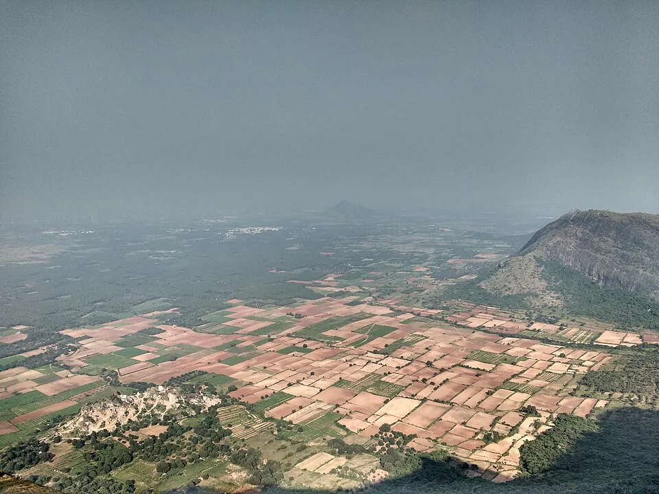
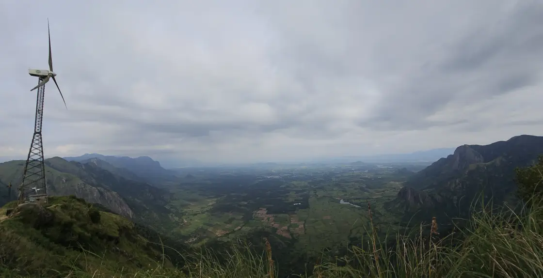
At Chathurangapara, the turbines give the eye a scale before the valley does. Their narrow lattice towers rise from the ridge, while far below, fields spread into a patchwork that looks almost flat between the walls of the Ghats.

The story of Chathurangapara Viewpoint

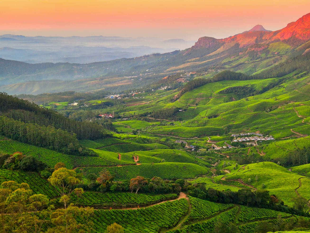
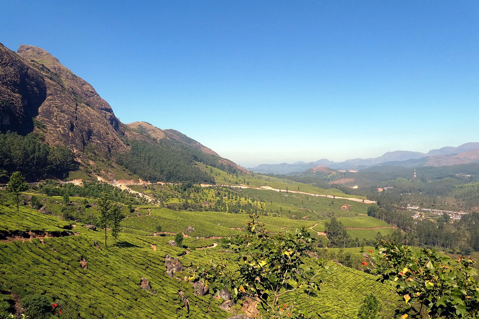
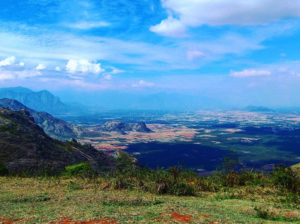
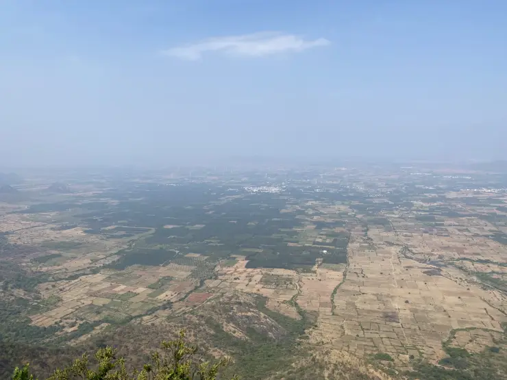
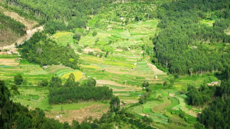
The lower landscape is one of the viewpoint’s distinguishing features. Rectangular plots, darker blocks of trees, pale dry fields and clusters of buildings extend towards the horizon. From this height, a cultivated plain becomes a pattern of land use. It is quite different from a panorama made only of successive hill ridges.

The village’s official geography places its eastern boundary against Thevaram and Pannaippuram in Theni district. That relationship helps explain the view without assigning a name to every distant building. The ridge stands at the meeting of high ground and lower agricultural country, with the state boundary running through this wider border landscape.

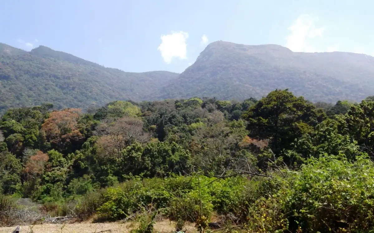
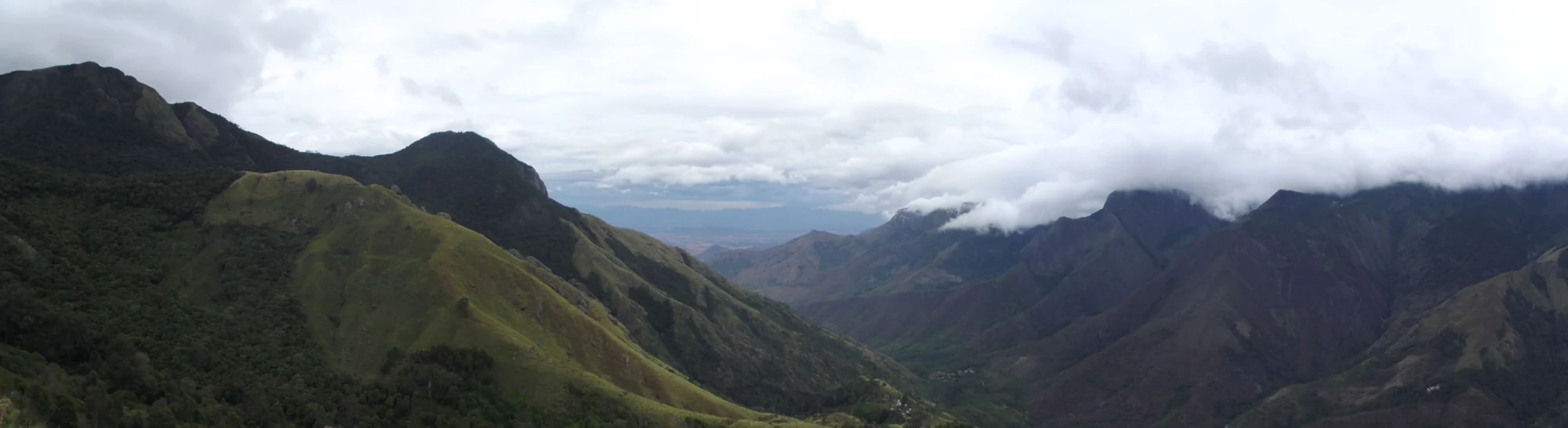
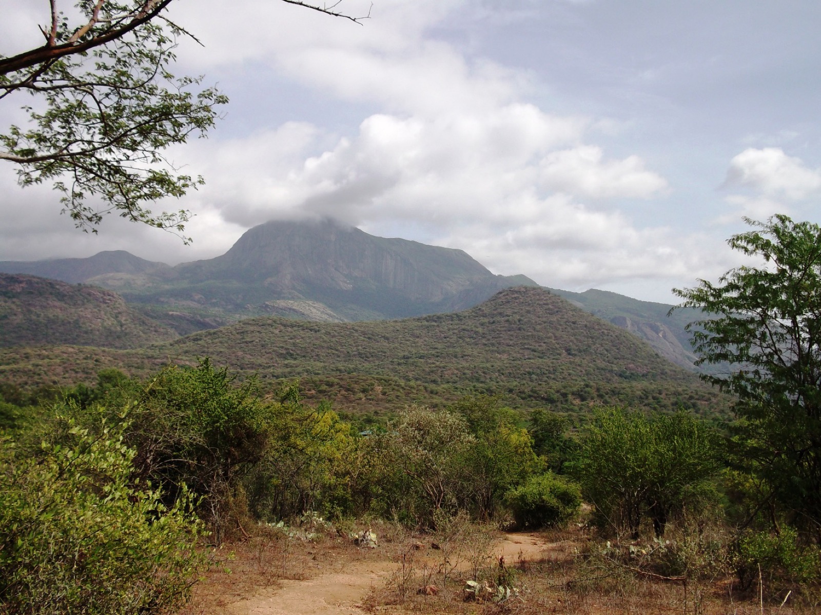
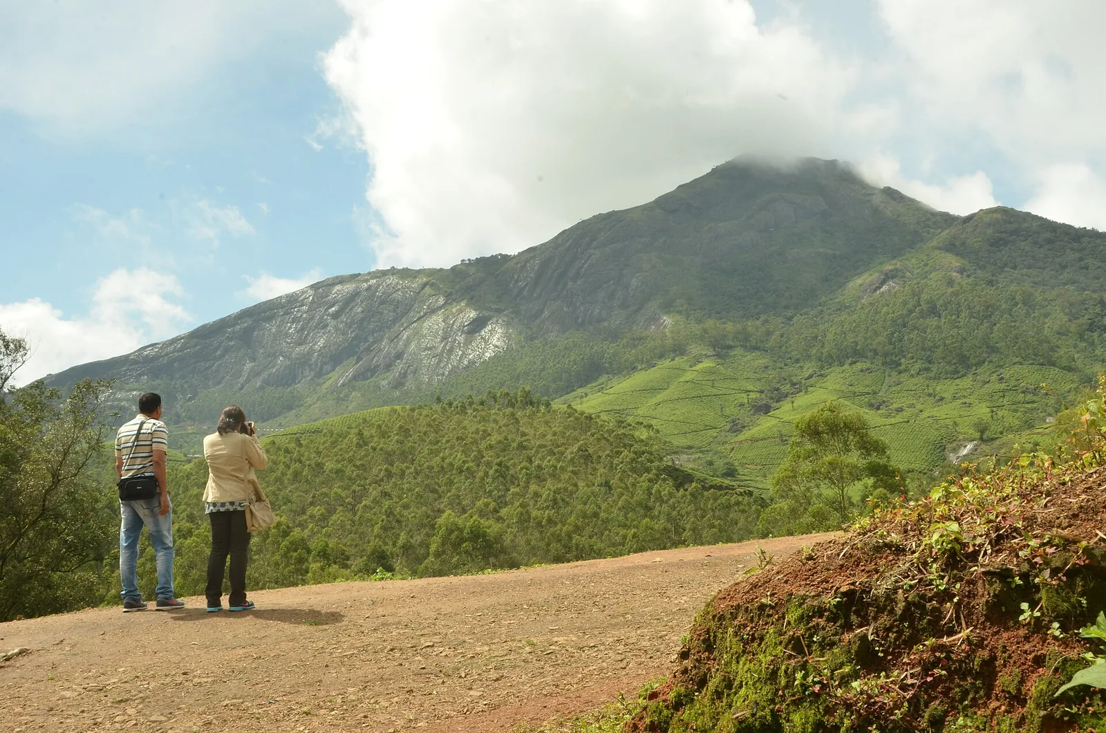
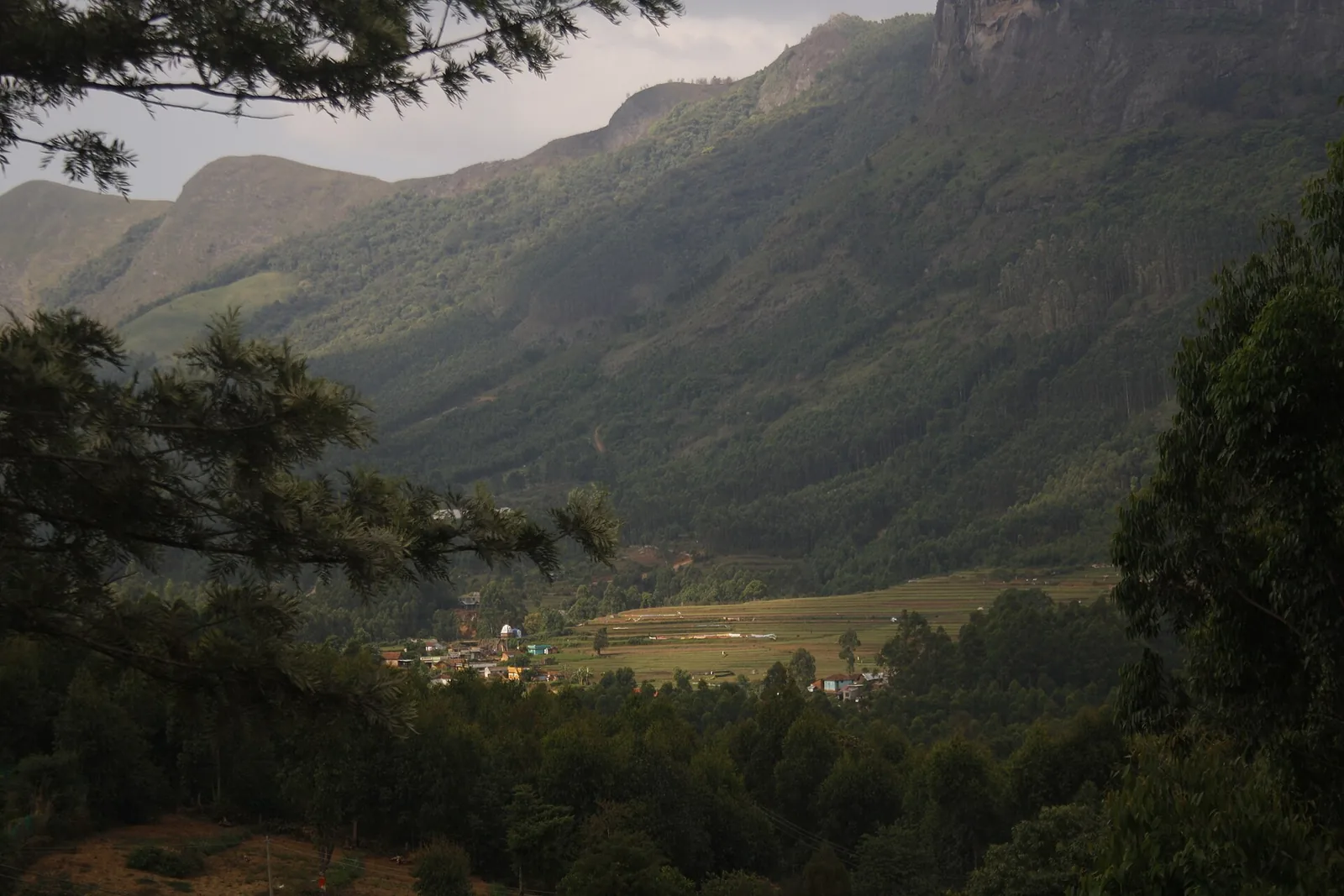
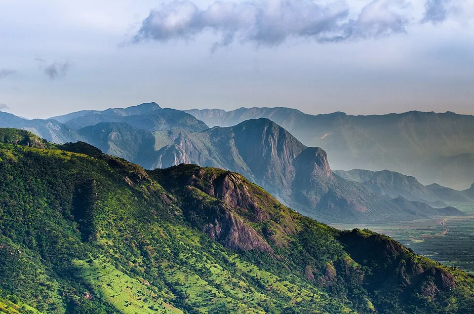
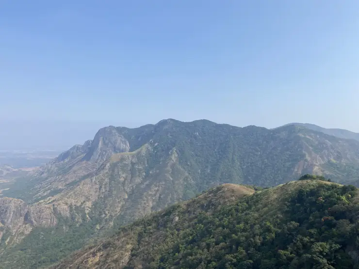
The slopes immediately below are much steeper than the plain. Broad grey rock faces interrupt the vegetation, and folds of denser green follow the hollows. Grass covers some upper surfaces while trees occupy others. Looking across rather than straight down makes the change in relief easier to understand and gives a better sense of why the apparent edge deserves distance.

Turbines add a repeated vertical form to this irregular terrain. In the photographic record, lattice towers stand at intervals along the crest, linked by tracks and small cleared spaces. Their bases, access routes and associated poles are part of an energy installation. The ridge is therefore both a landscape destination and a place with a working infrastructure purpose.

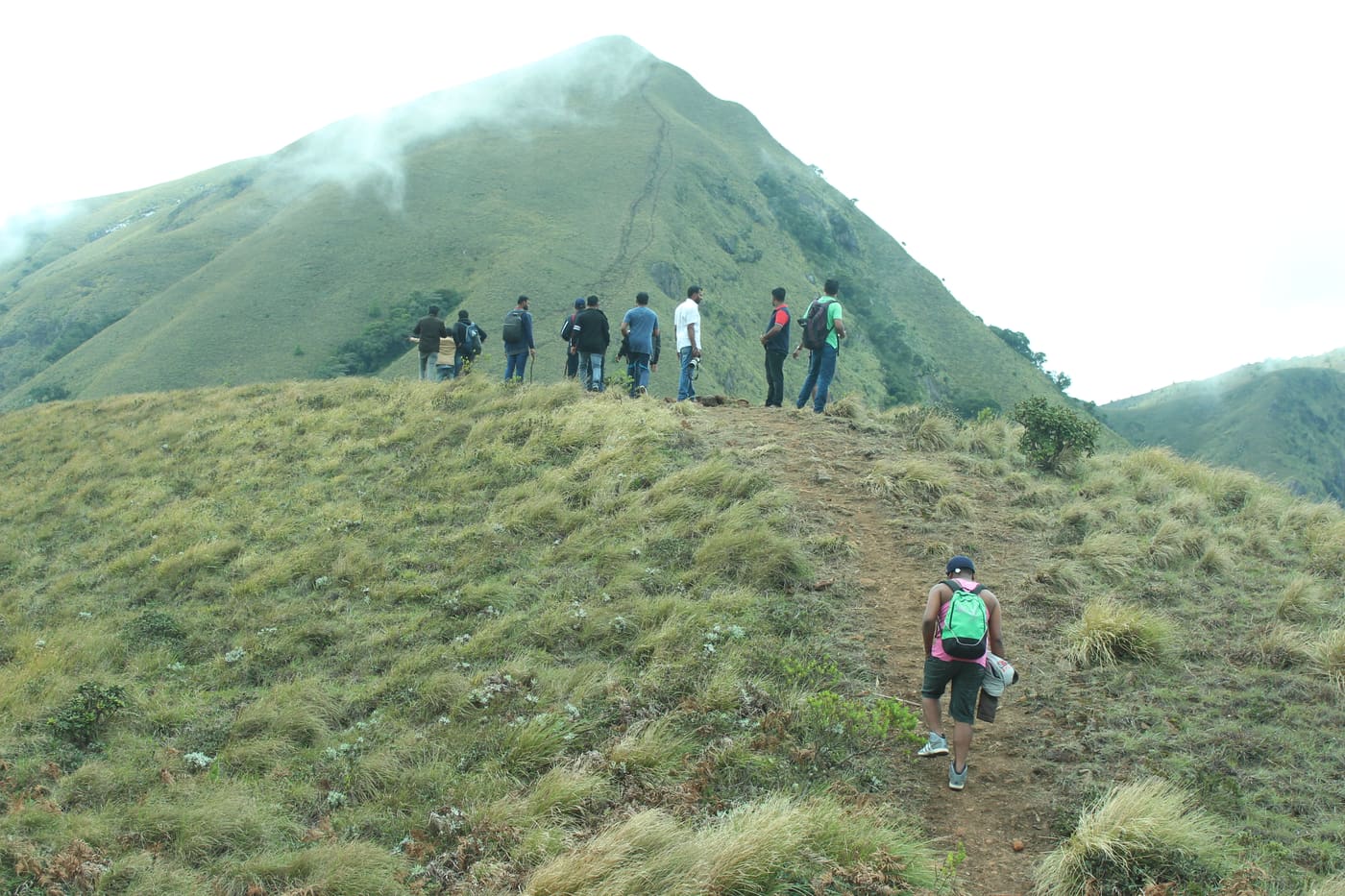
The towers also make distance legible. A nearby machine dominates the frame, while others shrink along the ridge. People and vehicles on the track give another measure of scale. The long view can feel immense, but these small details show that the visitor route occupies only a narrow part of the hilltop.

Wind is not merely an atmospheric description here. Kerala Tourism warns that its force can increase quickly at the viewpoint. The same exposed setting that makes the turbines prominent also leaves visitors without the shelter available farther down the approach. Conditions on the main road are not a dependable measure of conditions on the crest.

The final ascent changes the experience of arrival. The approach begins within a settled high-range area and climbs towards more open ground, where the vegetation lowers and the view widens. The rougher ridge tracks belong to this final stage. Reaching the locality by bus is not the same as reaching the hilltop, and a vehicle photograph does not establish that every car should attempt the climb.

Chathurangappara is also a village name, not only a viewpoint label. The Revenue Department describes a hilly, largely cardamom-plantation setting and identifies several named hilltops within the village. The open turbine crest is one part of that larger inhabited landscape. A visit becomes more grounded when the road and settlements below remain part of the picture.

The name has a story of its own. The village account connects Chathurangappara with chathurangam, a board game, and traditions of play on the hilltop involving Pandya rulers. This is a local explanation of the name. It does not establish a surviving board, a dated royal event or an archaeological site that a visitor can expect to find on the ridge.

Weather changes which part of the place is most visible. Clear conditions favour the fields and distant settlements; haze softens their outlines; mist can leave only the nearest tower and track. In poor visibility, the close details remain interesting, but the safe limit of the visit becomes smaller. The return route matters more than waiting for a perfect panorama.

Read the full history of Chathurangapara Viewpoint 173 more words

History

The Revenue Department’s village history records Chathurangappara’s formation as a separate village after the division of Udumbanchola village on 1 October 1956. This administrative history concerns the settlement and its land, rather than the date when the viewpoint became a tourism stop.

The same account places the area within the older Cardamom Hills administrative divisions and describes its association with Udumbanchola. The plantation setting helps explain why the road network and inhabited slopes belong in the story alongside the exposed crest.


The chathurangam name explanation is retained as local tradition. The modern wind turbines are a separate layer of the landscape; no foundation date or generating capacity is assigned here without a site-specific operator record.

Why visit

Read the contrast between the high ridge and the field patterns of the lower country.

See wind turbines within their actual hilltop setting, rather than as distant objects on a horizon.

Observe the cliff faces and wooded folds across the valley from secure viewing ground.

Include a distinct Udumbanchola-side landscape stop in a broader Munnar or high-range journey.

What to expect

Highlights

  • A wide view from the high-range ridge towards the field patterns and settlements on the Theni side.
  • Wind turbines standing above exposed grass, rock and service tracks.
  • Contrasting slopes: abrupt cliffs towards the lower country and more rounded green uplands along the ridge.
Getting there

How to visit

  • Reach Chathurangappara locality on the Munnar–Kumily corridor, then identify the hill approach and current transport arrangement. The main-road bus stop and ridge viewpoint are separate arrival stages.
  • Use only the accepted access track and viewing ground. A service road leading towards another turbine does not automatically extend the visitor route.
  • Make the return decision before wind or mist becomes difficult. A shorter stop on secure ground is preferable to continuing towards a more exposed projection merely for a wider photograph.

Distance by road

  • Kochi107 km
  • Madurai172 km
  • Thiruvananthapuram226 km
  • Coimbatore252 km
  • Kozhikode276 km

Road km to Idukki; ghat roads and traffic vary — allow extra.

Timing

Best time

Choose clear daylight without a strong-wind, thunderstorm or heavy-rain warning. Sunrise light can reveal the lower plains gradually, but a dawn trip requires an arranged approach in darkness. For a first visit, a daylight arrival makes the track and drop-offs easier to assess. Mist and haze can conceal much of the long view.

Weather in Chathurangapara ViewpointSeasonal guide

Live forecast loads in your browser.

Today at Chathurangapara Viewpoint
Sunrise6:09 am
Sunset6:06 pm
Golden hour best light5:06 pm–6:06 pm
Blue hour after sunset6:06 pm–6:31 pm
Sun sets toward compass bearingW · 263°
Moon tonight🌑 New moon · 0%
Retreating monsoon. October and November still see spells of rain from the retreating monsoon, though it is usually lighter than mid-year. Conditions are generally good but worth checking.

Sun and moon are calculated for this location and shown in IST. Photography windows are the hour around sunrise and sunset; the sunset bearing is degrees clockwise from true north. Moon phase is accurate to about half a day.

Visitor notes

  • Chathurangapara, Chathurangappara and Chathurangappara Mettu are spellings or forms used for this locality and hilltop. Include Udumbanchola or Idukki when arranging the journey.
  • The ridge is a landscape viewpoint alongside energy infrastructure. It is not a visitor tour inside a turbine.
  • A published current jeep tariff, parking tariff and guaranteed ridge-entry schedule are not verified. Agree the complete return arrangement at the approach before taking a local vehicle.
Safety

Good to know

  • Kerala Tourism specifically warns of sudden increases in wind speed here. Stay well back from cliff edges and return if gusts affect balance.
  • Keep away from turbine equipment, fenced compounds and service installations. Do not shelter against or climb the towers.
  • The open crest combines grass, loose soil and rock. Mist can obscure the break in slope; do not use another visitor’s position near an edge as a guide to safe ground.
Official eco & forest programmes

Experiences around Chathurangapara Viewpoint

These are official or public-sector eco offerings that match this place, town or forest destination. Confirm availability, permits, tariffs and reporting times with the official operator before travel.

Meesapulimala, Chathurangapara Viewpoint
trekforest staycamping

Meesapulimala trek through Rhodo Valley

Hard high-altitude trek from the Munnar side via Rhodo Valley, run through KFDC eco-tourism with guide, food and stay options.

KFDC Ecotourism MunnarOvernight with next-day trek
Official source →
Meesapulimala Base Camp, Chathurangapara Viewpoint
campingforest staytrek

Munnar Base Camp tent stay

KFDC tent stay near Meesapulimala base camp, with campfire, food and optional trek towards Meesapulimala or Rhodo Valley.

KFDC Ecotourism MunnartentOvernight
Official source →
Meesapulimala Base Camp, Chathurangapara Viewpoint
forest staytrekviewpoint

Munnar Sky Cottage

Lonely cliff-side KFDC cottage facing a waterfall and Anamudi views, paired with Meesapulimala trekking.

KFDC Ecotourism Munnarforest cottageOvernight
Official source →
Rhodo Valley, Chathurangapara Viewpoint
forest staytrekviewpoint

Munnar Rhodo Mansion

KFDC Rhodo Valley night stay with elephant-trench protection, campfire, food and next-day Meesapulimala climb.

KFDC Ecotourism Munnarforest cottageOvernight
Official source →
Eravikulam National Park, Chathurangapara Viewpoint
wildlifeviewpoint

Eravikulam National Park visit

High-altitude grassland national park and Nilgiri tahr habitat near Munnar.

Kerala Forest Department
Official source →
Chinnar Wildlife Sanctuary, Chathurangapara Viewpoint
trekwildlifeforest stay

Chinnar Wildlife Sanctuary eco visit

Dry-forest wildlife sanctuary east of Munnar, listed in Kerala Tourism’s ecotourism inventory.

Kerala Forest Department
Official source →
Pambadum Shola National Park, Chathurangapara Viewpoint
trekwildlifeforest stay

Pambadum Shola National Park eco visit

Shola forest national park near the Munnar/Vattavada side, listed as an ecotourism destination and programme.

Kerala Forest Department
Official source →
Anamudi Shola, Chathurangapara Viewpoint
trekwildlife

Anamudi Shola eco visit

Shola-grassland forest landscape in Idukki, included in Kerala Tourism’s official ecotourism destination list.

Kerala Forest Department
Official source →
Marayoor, Chathurangapara Viewpoint
wildlifeinterpretationtrek

Marayoor sandalwood forest eco visit

Sandalwood and dry-forest landscape on the Munnar-Chinnar side, listed by Kerala Tourism as an ecotourism destination.

Kerala Forest Department
Official source →
Stay · eat · do · rent · see · shop

Stays, food & things to do near Chathurangapara Viewpoint

Browse listed stays, food, activities, sights, shops and rentals around Chathurangapara Viewpoint. Check each listing’s locality and contact the business directly for current arrangements.

92 places to stay near Chathurangapara Viewpoint

Tea-estate bungalows · Munnar
KDHP Tea Sanctuary Bungalows

KDHP offers separate tea-estate bungalows around Munnar, including Kalaar, Lake View and Viriparai. Choose the named bungalow before comparing bedrooms and access. KDHP House is the reservations office; obtain arrival directions for the bungalow you book.

Commission-freeView details
Luxury hotel and spa · Munnar
Amber Dale Luxury Hotel & Spa Munnar

Amber Dale Luxury Hotel & Spa sits on KSEB Tunnel Road at Pallivasal, Munnar. It pairs a restaurant and Ayurveda spa with a conference hall and activities such as cycling, trekking and camp fires.

Directions Commission-freeView details
Luxury hotel and spa · Munnar
The Panoramic Getaway Munnar

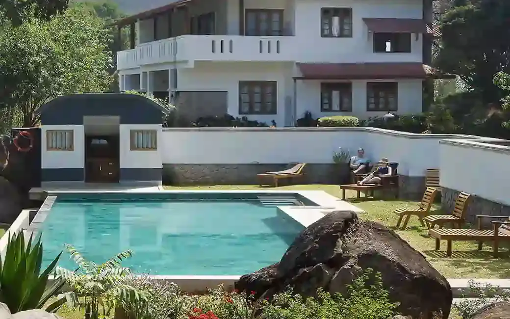
The Panoramic Getaway is at Chithirapuram, with separate family and adults’ pool areas and room choices including family suites. Compare the room layout and pool access you need, then confirm meals and the current total booking price.

Directions Commission-freeView details
Official budget forest stay · Munnar
Pampadum Shola Forest Stays, Munnar Wildlife

Official budget forest stay in Munnar. Pampadum Shola National Park, booked through Forest Information Centre, Wildlife Warden's Office, Munnar PO, Idukki District, Kerala 685612 · Budget official forest stay · Forest stay, Pampadum Shola, Official booking.

Directions Commission-freeView details
Luxury boutique spa resort · Munnar
SpiceTree Munnar

SpiceTree Munnar is on Muttukad–Periakanal Road at Nadukkurissu, in the Chinnakkanal area. Its pool villas, cottages with a Jacuzzi and honeymoon suites with a plunge pool are different room choices. Specify the category and inclusions when requesting a quote.

Directions Commission-freeView details
Mid-range town hotel · Munnar
Grand Plaza Munnar

Eco boutique hotel with 39 rooms overlooking tea plantations. Set on M.S.A Road close to the heart of Munnar.

Directions Commission-freeView details
Premium nature resort · Munnar
Rivulet Resort Munnar

Premium Chithirapuram-side nature resort with restaurant, activities and direct booking evidence. Rivulet Resort, Chithirapuram P O, Munnar, Kerala 685565 · Premium nature resort · Resort, Chithirapuram, Nature stay.

Directions Commission-freeView details
Hotel · Munnar
Windermere Estate

Windermere Estate is a Pothamedu plantation retreat with Garden, Estate and Planters room categories. Its operator describes meals served in courses rather than a fixed buffet. Compare room position, hillside access and meal preferences before reserving.

Directions Commission-freeView details
Hotel · Munnar
Tea County (KTDC)

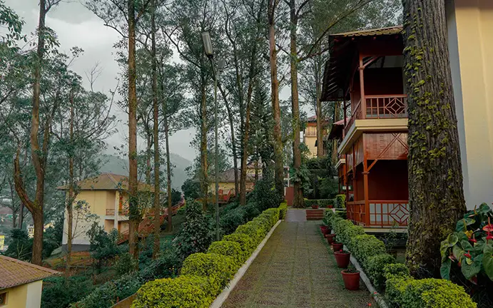
Tea County is KTDC’s Premium Hill Resort in Munnar, with garden paths between its accommodation buildings. Compare the room category and meal plan, and use KTDC’s current tariff and booking terms for your travel dates.

Directions Commission-freeView details
Hotel · Munnar
Blackberry Hills Munnar Nature Resort & Spa

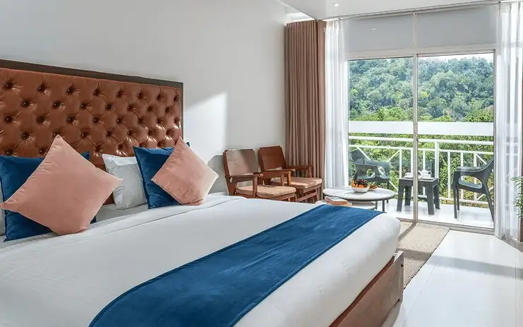
Blackberry Hills is on Bison Valley Road at Pothamedu, with accommodation, Hornbill Restaurant and Sisal Spa. Compare the room layout and balcony; the operator says a swing is available only in selected rooms.

Directions Commission-freeView details
Hotel and resort · Munnar
Parakkat Nature Hotel & Resorts

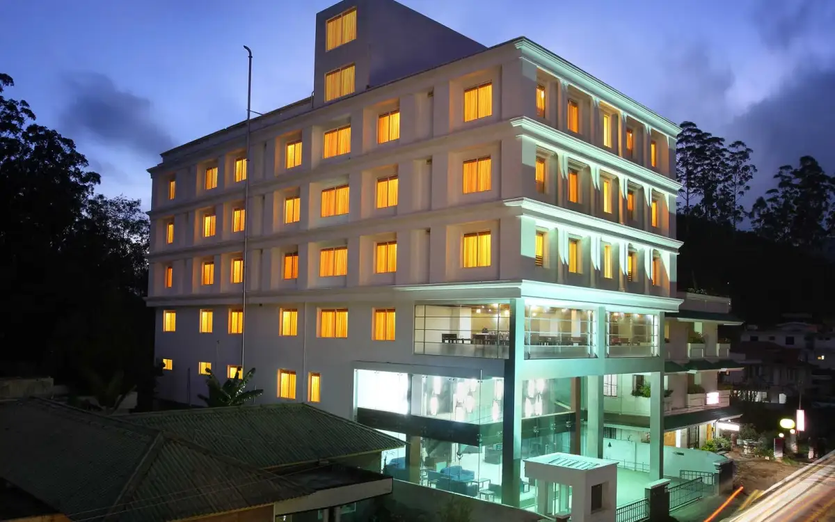
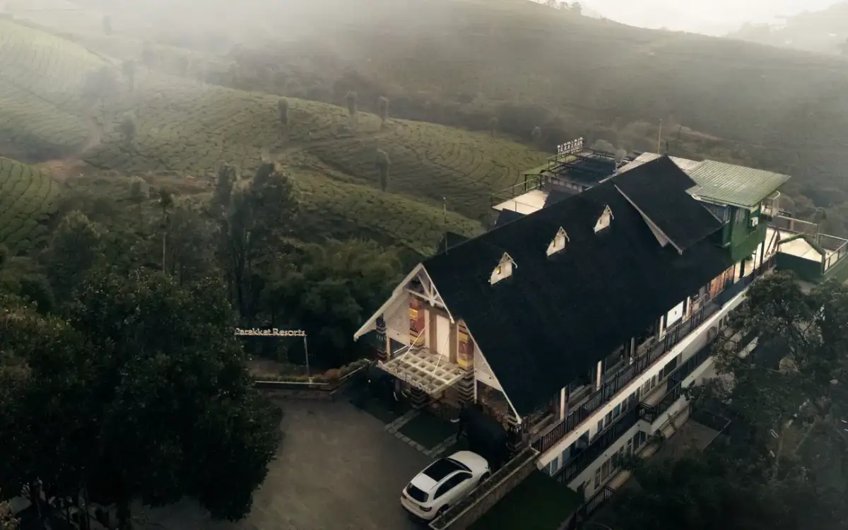
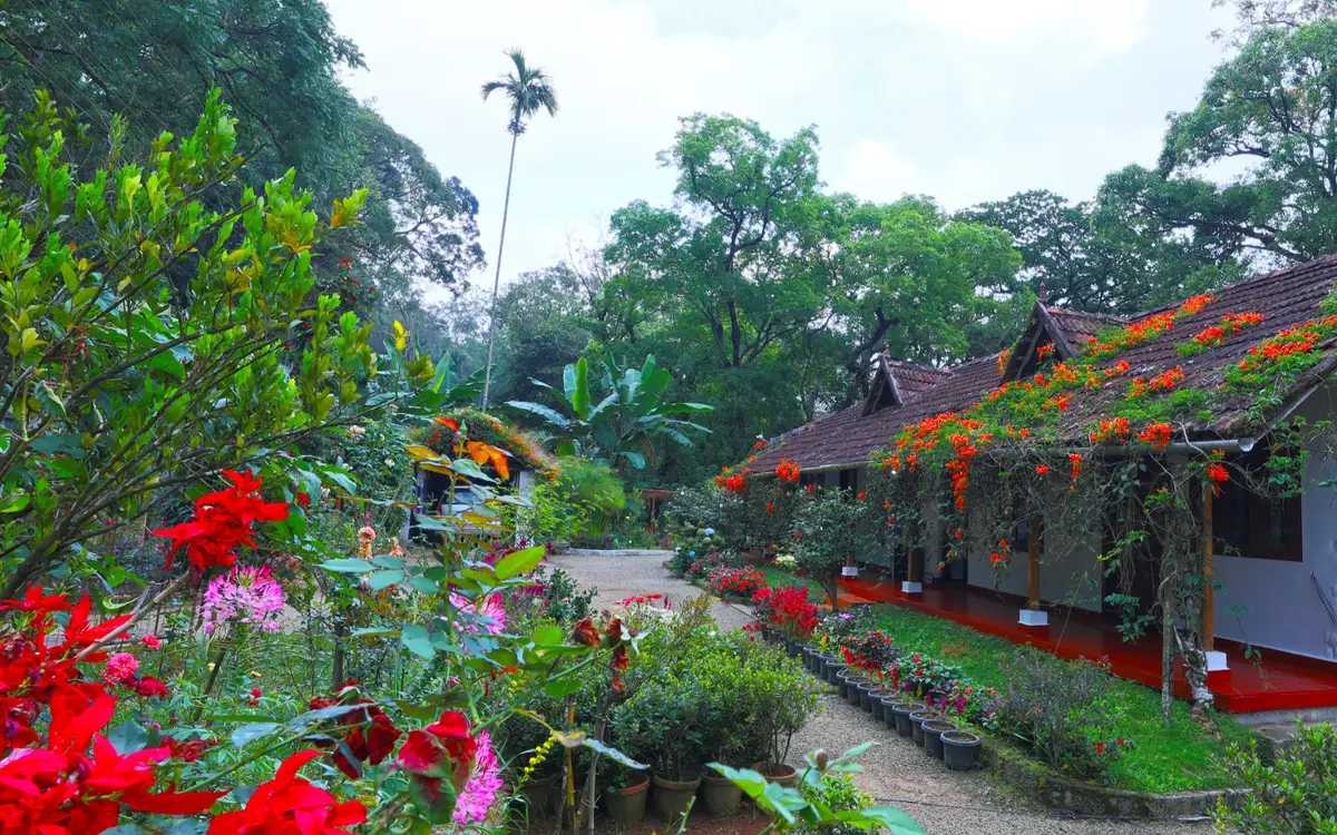
A Chithirapuram hotel and resort with standard rooms, interconnected family suites, pool villas and a separately named Tree House AC Room. Choose the category and confirm occupancy, pool arrangement and meal inclusions. The building photograph does not depict the treehouse room.

Directions Commission-freeView details
Hotel · Munnar
Chandy's Windy Woods

Chandy’s Windy Woods is a resort on terraced hill slopes near Munnar. Its hillside setting is a different choice from a town hotel. Compare the room category and view, and check the road transfer before combining your stay with early sightseeing departures.

Directions Commission-freeView details
Hotel · Munnar
Fragrant Nature Munnar

Five-star classified resort about 4 km from town at Pothamedu. Dining spans the Black Truffle and Glass House restaurants.

Directions Commission-freeView details
Resort · Munnar
Tall Trees Munnar

A forest-setting resort with Cinnamon Cottage, Saffron Suite, Saffron Grand and Mint Villa categories. Compare bedrooms, balconies and the walk to dining. Request the actual entrance pin; the published P.B. No. 40 address is a postal contact.

Directions Commission-freeView details
Resort · Munnar
Mountain Club Resort

A Chinnakanal resort with Family Villas arranged across upper and lower levels, a living room and two bathrooms. Compare that layout with the Honeymoon Villa category. Discuss stairs, occupants and meals with reservations before choosing.

Directions Commission-freeView details
Hotel · Munnar
Clouds Valley Munnar

Four-star hotel in the heart of Munnar town with 52 rooms. A handy base for reaching most nearby attractions.

Directions Commission-freeView details
Resort · Munnar
Aranyaka Resort

A Pullivasal Estate stay on Attukad Waterfalls Road with cottages and executive rooms described by the operator. Compare the actual accommodation layout and approach. Ask for a current quote rather than relying on the older tariffs displayed on parts of its website.

Directions Commission-freeView details
Homestay · Munnar
Rose Gardens Munnar

A family-run homestay at Karadippara with home-cooked Kerala food and spice-garden activities described by the hosts. Ask about the room balcony, meal arrangements and cooking sessions. The operator flags limited mobile reception and monsoon power interruptions.

Directions Commission-freeView details
Hotel · Munnar
Bougainvillea Homestay Munnar

Five-room boutique homestay in Anachal near the Munnar bypass. Home-cooked meals, tea-plantation tours and 24-hour room service.

Directions Commission-freeView details
Hotel
Abad Copper castle
2-star

Clifftop Abad resort perched around 1,600 m near Pothamedu. Its 40 rooms overlook the Kannan Devan hills and river valley.

Directions Commission-freeView details
Serviced villa · Munnar
T. Cherry Villa Munnar

Ottamaram/Pothamedu serviced-villa stay. Specify the room or holiday-home unit, then confirm bedrooms, shared spaces, meals and arrival access.

Directions Commission-freeView details
Serviced villa · Munnar
Greenspaces Serviced Villa Munnar

Ottamaram serviced villa on the Pothamedu side. Compare studio floors and balcony arrangements, then ask about shared spaces and meals.

Directions Commission-freeView details
Homestay · Munnar
Munnar Dreams Serviced Villa

Chinnakanal homestay on Periyakanal Road. Compare the room layout and meal arrangements; this is a different base from Munnar town centre.

Directions Commission-freeView details
Silver House homestay · Munnar
The Sanctuary Munnar

Kerala Tourism Silver-classified Munnar homestay at Thokkupara, with Wi-Fi, car hire and coffee-maker rooms for a quiet host-led stay.

Directions Commission-freeView details

Book with the place itself. India’s cyber-crime coordination centre warned in April 2025 that convincing copies of hotel and pilgrimage booking sites are being pushed through sponsored search and social ads, taking payment for rooms the property never hears about. Use the contact and source details on each profile to confirm the exact business and booking channel. A directory entry or map pin alone does not establish an operator’s identity or current availability. Roampedia takes no commission and does not collect booking payments. If a booking page reached you through an ad, check the address bar against the property’s own site before you pay. Fraud can be reported on cybercrime.gov.in or on 1930.

Nearby guides

Top experiences around Chathurangapara Viewpoint

32 more places around Munnar. Open a guide to plan the visit and onward journey.

hill stationMunnar

Kerala’s most famous hill station, known for tea estates, viewpoints and cool weather.

wildlifeEravikulam National Park

High-altitude grassland park, Nilgiri tahr habitat and access point for Anamudi views.

viewpointAnamudi Peak

The highest peak in South India, viewed through Eravikulam/Rajamala access contexts near Munnar.

wildlifeRajamala

Rajamala is the designated tourism and awareness zone of Eravikulam National Park near Munnar. It is not a separate unrestricted summit trek or the whole national park.

museumTea Museum

Tea-history museum in Munnar linked with the plantation story of the high ranges.

damMattupetty Dam

Reservoir, boating and lake-view stop on the Munnar-Mattupetty sightseeing circuit, usually paired with Echo Point and Kundala.

viewpointEcho Point

Popular Munnar lakeside viewpoint on the Mattupetty-Kundala route, useful for short stops, photos and family sightseeing.

damKundala Lake

High-range lake and dam stop beyond Mattupetty on the Top Station route.

viewpointTop Station

A border-highland viewpoint in Theni, Tamil Nadu, normally approached through Munnar, Mattupetty and Kundala; named for the former tea-transport terminus, with a separate stepped viewpoint walk.

trekMeesapulimala trek

Popular high-altitude Western Ghats trek, usually booked through official eco-tourism channels.

viewpointKolukkumalai

High tea-estate sunrise viewpoint reached by jeep from the Munnar side.

wildlifeChinnar Wildlife Sanctuary

Dry-forest wildlife sanctuary on the Marayoor-Udumalpet side of Idukki.

heritageMarayoor

High-range village known for natural sandalwood forests, dolmens and sugarcane jaggery.

wildlifePambadum Shola National Park

Pampadum Shola National Park protects high-elevation forest beside the Top Station–Vattavada road. The Top Station forest check post is the reporting anchor here; forest stays and guided walks require their own confirmed arrangements.

wildlifeAnamudi Shola

Anamudi Shola National Park protects Mannavan, Pullaradi and Idivara shola forests in the Kanthalloor–Vattavada high ranges. Methappu is the visitor anchor on this page; this is not Anamudi Peak or the Rajamala visitor area.

waterfallLakkam Waterfalls

Waterfall stop on the Munnar-Marayoor route, usually paired with Eravikulam and Marayoor days.

waterfallAttukad Waterfalls

Waterfall area near Munnar commonly used for short scenic drives and monsoon views.

viewpointLockhart Gap

The pass itself on the Munnar–Bodimettu highway, where the ridge drops away east — and the lay-by the Chokramudi Peak trek reports from, 51 m from the forest counter. A second, busier viewpoint signed "Lockhart Gap Road View Point" sits 1.7 km east.

damAnayirankal Dam

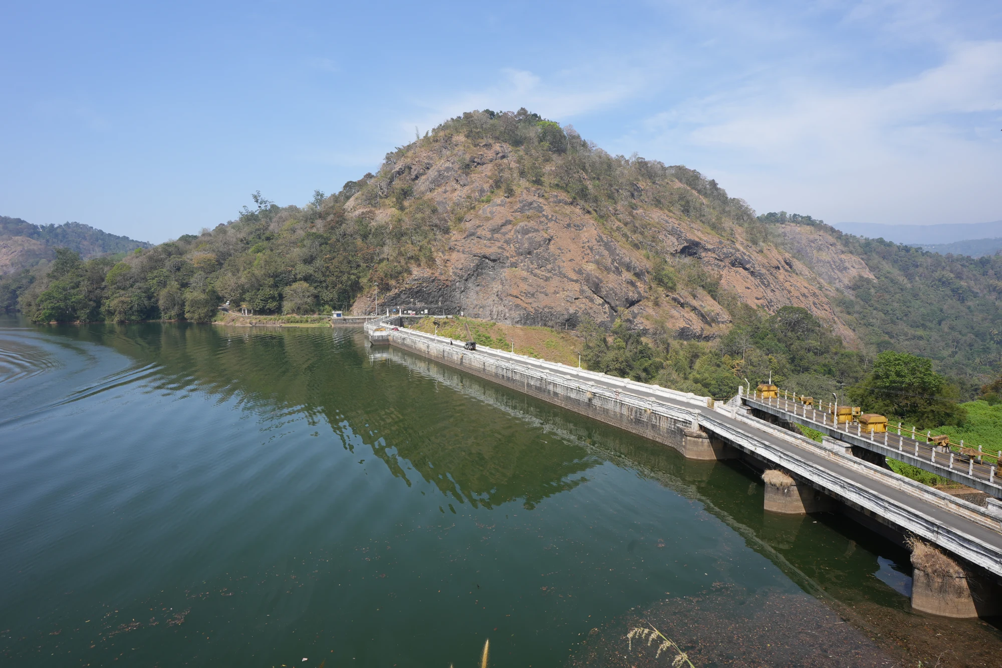
Anayirankal is a KSEB earth-and-rockfill dam and reservoir in the Panniyar hydel system near Chinnakanal and Santhanpara. The map identifies the published hydel visitor-centre marker; boating is not currently assured.

waterfallPower House Waterfalls

The Muthirapuzha spread sideways over bare rock at 796 m, below the tailrace of Pallivasal — the first hydroelectric station Kerala built. Free, unmanaged and very quiet, down about a kilometre of steep narrow lane. ⚠ Not the Chinnakanal falls that Kerala Tourism describes under this name, 21 km east.

viewpointBlossom Hydel Park

The Kerala State Electricity Board’s riverside flower park on the Munnar–Aluva road, 3.3 km below Munnar town and 1.2 km from the KSRTC stand at Old Munnar. It runs along the east bank of the Muthirapuzha immediately above the 1944 R. A. Headworks weir that feeds Pallivasal, Kerala’s first hydroelectric station — which is what the "hydel" in the name means. Open daily 09:15 to 20:15 with tickets sold online by Kerala Hydel Tourism Centre.

hill stationDevikulam / Sita Devi Lake

Hill-station and lake landscape near Munnar associated with Devikulam and Sita Devi, best planned as a quieter high-range side trip.

waterfallNayamakad Waterfalls

Nyayamakad, also called Nayamakad, is the waterfall and tea-estate landscape on the Munnar–Rajamala approach. The map uses the identifiable Nyamakad roadside stream-view base, not a waterfall lip, pool entrance or estate walking permit.

trekChokramudi Peak trek

Forest Department peak trek from the counter at Gap Road, 13.2 km from Munnar: a mapped 2.09 km path climbing about 460 m of grassland and shola to a summit whose altitude four sources disagree about.

trekKurinjimala Sanctuary trek

The 32 km² sanctuary above Kottakamboor and Vattavada, notified in 2006 for one plant — Strobilanthes kunthiana — with two walks and two stays in the Forest Department's own brochure and nothing bookable online.

trekThoovanam Falls trek

Forest Department guided walk in Chinnar Wildlife Sanctuary, from the Alampetty counter on SH17 down the river to the Thoovanam waterfall. Kerala Tourism contradicts itself on which river it follows: its own destination article says the Pambar, and the page selling this programme says the Chinnar.

trekChinnar Dolmen Culture trek

Forest Department culture trek in Chinnar Wildlife Sanctuary to prehistoric dolmen (muniyara) sites, run with local tribal Eco-Development Committees. Report at the Alampetty guide stand on the Marayoor–Udumalpet road (SH17), 6.4 km beyond Marayoor.

trekVasyappara Trekking and Camping

Forest Department trekking-and-camping programme at Vasyappara in Chinnar Wildlife Sanctuary — an overnight stay in a mud hut on a hill crest, published by the department as the Chinnar Valley Safari Trail. Report at 3 pm at the Chinnar check post on the Marayoor–Udumalpet road, not at the Alampetty counter 10.2 km back.

hill stationKanthalloor

High-range village near Marayoor often called the “Kashmir of Kerala”, known for terraced farms of apples, oranges, strawberries and vegetables at around 1,800 m.

hill stationVattavada

Cool high-altitude farming village beyond Munnar near the Tamil Nadu border, known for terraced vegetable and fruit cultivation, Kurinji slopes and quiet valley views.

viewpointPothamedu Viewpoint

A road-accessible viewpoint in Pothamedu south of Munnar, looking across planted hills and wooded valleys. The viewpoint marker is separate from the wider village and from private plantation walking routes.

wildlifeMathikettan Shola National Park

Mathikettan Shola protects a remnant of native Cardamom Hills forest in Idukki. Visits are arranged through the Forest Department, with distinct Pethotty and Choondal approaches; a reservoir viewpoint is not a park-entry permit.

Roampedia is commission-free — own or know a stay, eatery, guide or shop near Chathurangapara Viewpoint? Submit public business details for review.

Add a nearby business
Before you go

Chathurangapara Viewpoint — at a glance

Photography: A wide frame from secure ground can include turbine, ridge and lower plain together. Avoid backing towards the drop while fitting a whole tower into a photograph, and do not let a tripod obstruct the track.

Parking: Use the vehicle space accepted at the local approach or instructed hill roadhead. Keep turbine service tracks and turning areas clear. A marked public parking capacity and current tariff are not verified.

Getting here

How to reach Chathurangapara Viewpoint

  • ✈︎ By air Cochin International Airport is the air gateway listed by Kerala Tourism. Book the onward journey using the full viewpoint name and Udumbanchola locality.
  • 🚆︎ By train Aluva is the rail gateway identified by Kerala Tourism. The journey continues by road into Idukki, with the local hill approach after reaching Chathurangappara.
  • 🚗︎ By road Use the Munnar–Kumily corridor through the Pooppara/Udumbanchola side, then take the local Chathurangappara viewpoint approach. The final uphill section is a separate stage with surfaces and access that need assessment on arrival.
  • 🚌︎ By bus The mapped Chathurangappara stop is on the through-road network, including the Munnar–Nedumkandam route via Pooppara and Udumbanchola. Confirm the current service and return with the bus operator; the ridge itself requires a separate local approach.
Getting back

Arrange the return to the same main-road approach before climbing. Do not rely on finding an onward vehicle along a turbine service track or a descent towards the Tamil Nadu plain.

Do

Things to do

  • Observe the turbine line from the permitted ridge route.
  • Compare the field patterns below with the irregular wooded slopes above them.
  • Look across the valley at the exposed rock faces.
  • Read the changing visibility from near tower to distant plain, keeping the return route clear.
Facilities

On site

  • The approach locality provides the point for arranging any local hill transport. Do not treat turbine compounds as staffed visitor shelters.
  • Plan meals and essential town services on the through-road journey. A permanent ridge toilet, drinking-water point or café is not established by the tourism descriptions.
Getting around Chathurangapara Viewpoint
From the entrance
Chathurangappara local hill-transport approach off the Munnar–Kumily road
Step-free access
The ridge includes gradients, rough track, loose soil and open rock-and-grass surfaces. There is no verified continuous wheelchair route or protected step-free viewing platform. A vehicle reaching part of the hill does not establish access to the final outlook.

Checked 7 September 2026 against source 1source 2. Conditions change and surfaces vary with weather — if step-free access is essential, confirm with the site before you travel.

Eat nearby

What to eat in Munnar

Keep meals on the Chathurangappara approach or the larger town route. The exposed ridge is a viewpoint stop, not the place to depend on a permanent food court.

Explore food in Munnar →
01

Local road tea stop

Use an established shop in the approach locality before arranging the final hill leg.

02

Udumbanchola meal

A town restaurant suits an itinerary continuing south along the high-range corridor.

03

Pooppara return stop

If travelling back towards Munnar, place the meal on that return route rather than adding a separate ridge-side search.

Nearby

What’s near Chathurangapara Viewpoint

wildlifeMathikettan Shola National Park

Mathikettan Shola protects a remnant of native Cardamom Hills forest in Idukki. Visits are arranged through the Forest Department, with distinct Pethotty and Choondal approaches; a reservoir viewpoint is not a park-entry permit.

viewpointAamai Para

Tortoise-shaped rock outcrop above Thovalappady on the Kerala–Tamil Nadu border ridge, reached by jeep track from the Thookkupalam–Ramakkalmedu road, with a two-mouthed passage under the rock and DTPC’s Jaalakam eco-tourism centre on top.

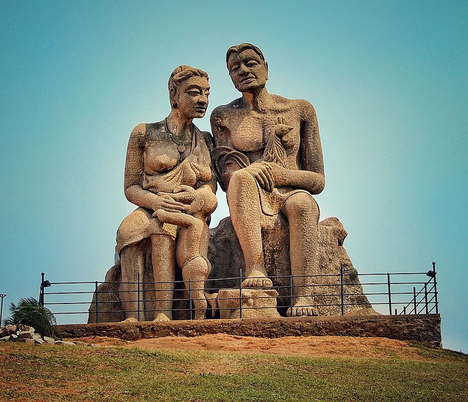
heritageKuravan Kurathi statue

The seated concrete group of a Kuravan, a Kurathi and their child on the open mound at Ramakkalmedu, sculpted by C. B. Jinan and put up in 2005, inside DTPC Idukki’s ticketed viewpoint compound. It commemorates Kuravanmala and Kurathimala, the two hills the Idukki arch dam is wedged between — 30 km away in a straight line, 44 km by road.

viewpointRamakkalmedu viewpoint

Open ridge viewpoint above the Tamil Nadu plains near Nedumkandam, useful for sunset, wind-farm and high-range road planning.

viewpointRamakkalmedu

Windy Idukki ridge and viewpoint area above the Tamil Nadu plains, often planned with wind farms and Nedumkandam-side routes.

damAnayirankal Dam

Anayirankal is a KSEB earth-and-rockfill dam and reservoir in the Panniyar hydel system near Chinnakanal and Santhanpara. The map identifies the published hydel visitor-centre marker; boating is not currently assured.

viewpointKolukkumalai

High tea-estate sunrise viewpoint reached by jeep from the Munnar side.

damPonmudi Dam

KSEB’s Panniyar-project dam at Konnathadi near Rajakkadu and Vellathooval in Idukki; a reservoir-and-engineering visit, distinct from Ponmudi hill station in Thiruvananthapuram.

trekChokramudi Peak trek

Forest Department peak trek from the counter at Gap Road, 13.2 km from Munnar: a mapped 2.09 km path climbing about 460 m of grassland and shola to a summit whose altitude four sources disagree about.

viewpointLockhart Gap

The pass itself on the Munnar–Bodimettu highway, where the ridge drops away east — and the lay-by the Chokramudi Peak trek reports from, 51 m from the forest counter. A second, busier viewpoint signed "Lockhart Gap Road View Point" sits 1.7 km east.

viewpointAnchuruli

The Anchuruli reservoir-side landscape near Kattappana, where the Erattayar diversion tunnel discharges towards Idukki reservoir. Plan an exterior viewpoint visit; the water tunnel is working infrastructure.

viewpointKalvari Mount

Reservoir-view hill point near Idukki and Cheruthoni, useful for scenic drives, photos and central high-range itineraries.

27 detailed place guides in Munnar →

Road and walking figures are route estimates, with travel times dependent on access, traffic and conditions. Figures marked “straight line” show direct separation and do not describe a road or walking route. Fare estimates use Kerala’s 26 April 2022 auto/taxi notification and exclude waiting, night and applicable one-way surcharges. Confirm the current meter or operator quote before travelling. Routing: © openrouteservice.org by HeiGIT | Map data © OpenStreetMap contributors

On the map

Where Chathurangapara Viewpoint is

Good to know

Chathurangapara Viewpoint — frequently asked

Where is Chathurangapara Viewpoint?

It is in the Chathurangappara locality of Udumbanchola taluk, Idukki, near the Tamil Nadu boundary. The local approach leaves the Munnar–Kumily road; it is not within Munnar town.

Are Chathurangapara and Chathurangappara Mettu the same destination?

They are forms used for the locality and its hilltop viewpoint. Specify the wind-turbine ridge when arranging transport, because the village and road stop cover a wider area.

What can I see below the viewpoint?

In clear conditions, the view includes steep Ghats slopes and the cultivated lower country towards Theni. Fields, tree blocks and settlements become visible as patterns; haze may hide the distant detail.

Do I need a jeep for Chathurangapara?

The final hill approach is separate from the main road and includes rough ridge tracks. Confirm the present access and suitable vehicle at the approach; a permanent compulsory-jeep rule and official tariff are not established here.

Can I enter or climb the wind turbines?

No turbine-access tour is included in this visit. Keep clear of towers, machinery and service compounds and use only the accepted viewpoint route.

Why is Chathurangapara associated with a board game?

The village account connects the name with chathurangam played on the hilltop in a tradition involving Pandya rulers. This is a name tradition, not proof of a surviving ancient game board.

Is Chathurangapara the same as Ramakkalmedu?

No. Both are associated with wind and border-ridge views, but they are separate destinations with different approaches. Ramakkalmedu’s visitor facilities and wind-project figures should not be transferred here.

Is the viewpoint accessible without walking on rough ground?

The open ridge has uneven soil, rock and grass, and a continuous accessible viewing route is not verified. Assess the roadhead and final surface before committing to the ascent, especially for anyone with limited balance or mobility.

When is the best time to visit Chathurangapara Viewpoint?

Choose clear daylight without a strong-wind, thunderstorm or heavy-rain warning. Sunrise light can reveal the lower plains gradually, but a dawn trip requires an arranged approach in darkness. For a first visit, a daylight arrival makes the track and drop-offs easier to assess. Mist and haze can conceal much of the long view.

How do I reach Chathurangapara Viewpoint?

Reach Chathurangappara locality on the Munnar–Kumily corridor, then identify the hill approach and current transport arrangement. The main-road bus stop and ridge viewpoint are separate arrival stages. Use only the accepted access track and viewing ground. A service road leading towards another turbine does not automatically extend the visitor route. Make the return decision before wind or mist becomes difficult. A shorter stop on secure ground is preferable to continuing towards a more exposed projection merely for a wider photograph.

How much time do I need for Chathurangapara Viewpoint?

Allow around one to one and a half hours as a planning estimate for the final hill approach and a short viewpoint visit, once you have reached the locality. The journey from Munnar is additional. This is not an estimate for a through-trek along the entire wind-farm ridge.

What else is near Chathurangapara Viewpoint?

Nearby you can pair Mathikettan Shola National Park, Aamai Para, Kuravan Kurathi statue, Ramakkalmedu viewpoint.

What should I know before visiting Chathurangapara Viewpoint?

Kerala Tourism specifically warns of sudden increases in wind speed here. Stay well back from cliff edges and return if gusts affect balance. Keep away from turbine equipment, fenced compounds and service installations. Do not shelter against or climb the towers. The open crest combines grass, loose soil and rock. Mist can obscure the break in slope; do not use another visitor’s position near an edge as a guide to safe ground.

Read before you go

Chathurangapara Viewpoint guides, stories & itineraries

Stories & history of Chathurangapara Viewpoint

Written about Chathurangapara Viewpoint itself — its history, its legends and the arguments about them.

Around Munnar

These reads cover nearby destinations, each with its own arrival point and visit arrangements.

In-depth guides to Munnar

Written about Munnar as a whole rather than about Chathurangapara Viewpoint — its history, its streets, and how to spend a day in it.

Kerala-wide guides & itineraries

Route-level itineraries and practical guides for the rest of Kerala.

See all 153 Idukki guides & stories →

Image credits

Photographs: Vis M (CC BY-SA 4.0), Vinayaraj (CC BY-SA 4.0), Niyas8001 (CC BY-SA 4.0), Athulvis (CC BY-SA 4.0), Jan J George (CC BY-SA 4.0), Sarathgks92 (CC BY-SA 4.0), Jiths (CC BY 2.0), Jaseem Hamza (CC BY 3.0), Fotokannan (CC BY-SA 3.0), Ingo Mehling (CC BY-SA 4.0), DdraconiandevilL (CC BY-SA 3.0), Ruben Joseph (CC BY-SA 3.0), Aruna at Malayalam Wikipedia (CC BY-SA 3.0), Jbmarshal (CC BY 3.0), Musheer1999 (CC BY-SA 4.0), Sajith Erattupetta (CC BY-SA 4.0), Amal94nath (CC BY-SA 4.0), Kondephy (CC BY-SA 4.0), Kerala Tourism (Official tourism image), Kerala Hydel Tourism (Official website image), Ramkumar (CC BY-SA 2.0), Gnan.prabhakar (CC BY-SA 4.0), Suresh Krishna (CC BY-SA 2.0), Jbmarshal27 (CC BY-SA 3.0), Jeyadevcs (CC BY-SA 3.0), Sanojvs55 (CC BY-SA 4.0), Deepa Chandran2014 (CC BY-SA 3.0), Ahamedhjewadh (CC BY-SA 4.0), Vasant944 (CC BY-SA 4.0), Kerala Forest and Wildlife Department (© Kerala Forest and Wildlife Department), Emmanuel P.Loui (CC BY-SA 4.0), JVN5871 (CC BY-SA 4.0), \prinz\ (CC BY-SA 4.0), Arshad.ka5 (CC BY-SA 4.0), Alanjs (CC BY-SA 4.0), Vinayaraj / CC BY-SA 4.0 / Wikimedia Commons, Vis M / CC BY-SA 4.0 / Wikimedia Commons, Ingo Mehling / CC BY-SA 4.0 / Wikimedia Commons, Rainer Halama / CC BY-SA 4.0 / Wikimedia Commons, Ranjithsiji / CC BY-SA 4.0, DrPJGeorge / CC BY-SA 4.0, Kannan Devan Hills / CC0 / Wikimedia Commons, Mohammed Faris M A / CC BY-SA 4.0 / Wikimedia Commons, Jan J George / CC BY-SA 4.0 / Wikimedia Commons; resized WebP, Sangeey / CC BY-SA 4.0 / Wikimedia Commons, Jaseem Hamza / CC BY 3.0 / Wikimedia Commons; resized WebP, Hari K Patibanda / CC BY 2.0, Lip Kee from Singapore, Republic of Singapore / CC BY-SA 2.0, Windermere Estate (Official operator website image), KTDC Tea County (Official operator website image), Blackberry Hills Munnar (Official operator website image), Parakkat Nature Hotel & Resorts (Official operator photograph), Chandy's Windy Woods (Official source photograph; credit retained), Fragrant Nature Munnar (Official source photograph; credit retained), Tall Trees Munnar (Official operator photograph), Mountain Club Resort (Official operator photograph), Clouds Valley Munnar (Official source photograph; credit retained), Aranyaka Resort (Official operator photograph), Rose Gardens Munnar (Official operator photograph), Bougainvillea Homestay Munnar (Official source photograph; credit retained), Cliff Edge Restaurant - The Wind Munnar (Official source photograph; credit retained), Munnar Sandy Taxi Service (Official website image), Munnar Green Parrot Taxi (Official website image), Munnar Cabs (Official website image), Plantation Directorate, Govt. of Kerala (Government website image), The Panoramic Getaway (Official website image), Grand Plaza Munnar (Official website image), Rivulet Hospitality / Blanket Riverside Resort & Spa (© Rivulet Hospitality / Blanket Riverside Resort & Spa), Kalypso Adventures (Official website image), Misty Mountain Resort (Official website image), Blanket Hotel & Spa (Official website image), SpiceTree Munnar (Official website image), Amber Dale Luxury Hotel & Spa Munnar (Official website image), The Fog Munnar (Official website image), Green View Holiday Inn (Official operator photograph), Abad Copper castle (Official source photograph; credit retained), Jungle Jive Tree House Munnar (Official operator photograph), Soma Seven Springs Plantation Resort (Official operator photograph). Wikimedia Commons.